This page lets you read every post in a single long scroll.
-
Arrived in Kathmandu
-
Day 1 of Everest trip
-
Day 2: the easy hike to Namche
-
Day 3: a lovely hike above Namche to the Khunde ridge
-
Who am I going with?
-
Day 4: rest day in Namche
-
The Plan
-
Day 5: moving up to Phortse
-
Day 6: a day hike to Khonar ridge.
-
The Khumbu Climbing Center in Phortse
-
Day 7 + 8: up to Gokyo.
-
Day 9: sick day
-
Day 10: Gokyo Ri
-
Day 11: Getting really sick
-
Looking back on Everest…
-
Intro to Africa
-
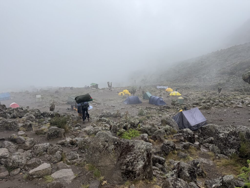
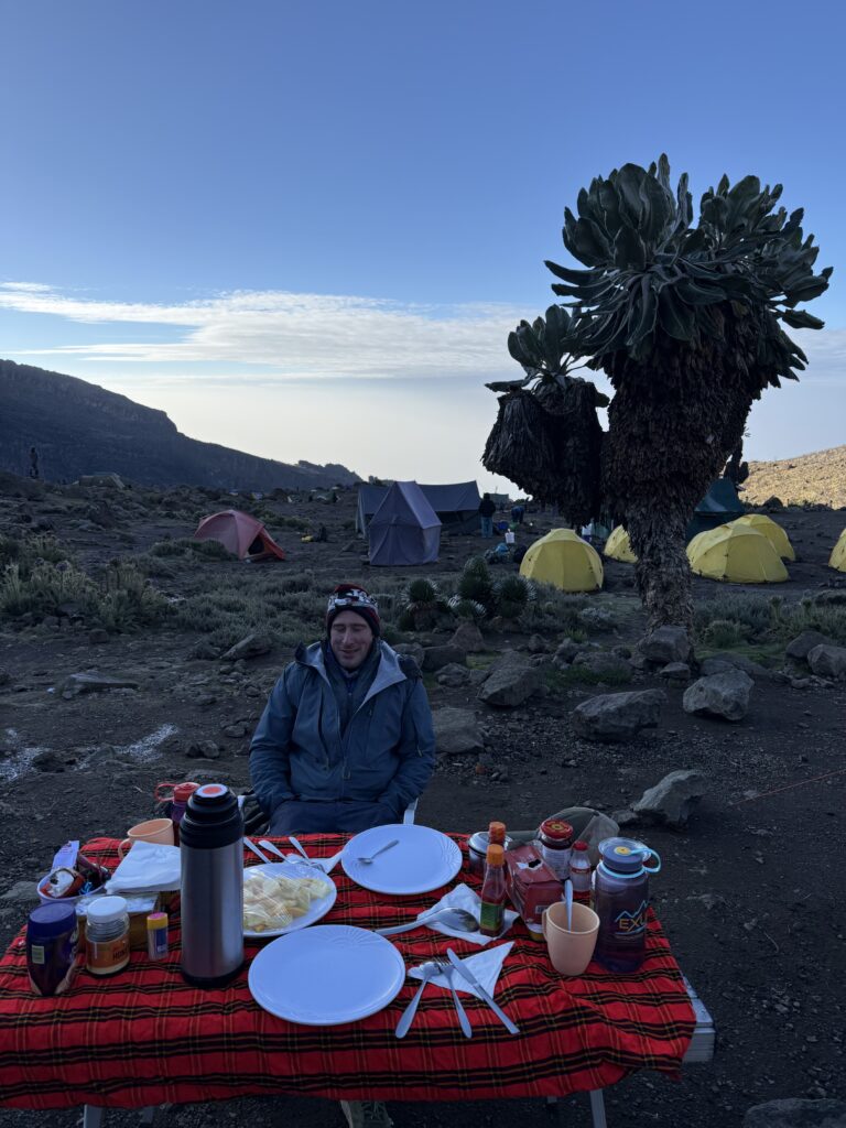
Day 2 on Kilimangaro
-
Day 3 on Kilimanjaro
-
Day 4 on Kilimanjaro
-
Day 5
-
Day 6 – Summit Day
-
Day 7
-
Day 8 – Transfer Day
-
Days 9 and 10 (Mt Kenya days 1 + 2)
-
Day 11
-
Day 12 + 13
-
Mt Kenya photo essay, part 1 of 2
-
Mt Kenya photo essay, part 2
-
Final thoughts on both Kilimanjaro and Mt Kenya
-
Arrived in Kathmandu
To expect much coherent thought after 28 hours of travel and an eleven and three quarters hour time change is unrealistic, but suffice it say I made it to the Yak and Yeti hotel without any drama, and I’ll leave it at that. If all goes well, I’ll be flying to Lukla tomorrow.
-
Day 1 of Everest trip
Forgive my slow start to this blog. I’m still adjusting to the 11 and 3/4 hour time change. Mercifully, my tour operator got me out of the city quickly allowing me to get on the trail. After 29 hours in Kathmandu, I boarded a helicopter and flew to Lukla. Regular fixed wing flights are still the norm, but those flights no longer start from Kathmandu, rather, they involve a 5 or 6 hour drive that starts in the wee hours of the morning. If I may go on a tangent here: there’s a certain allure to just starting where the road ends… my father started his trek to Everest base camp back in 1979 from the end of the road in Jiri. 15 years ago Dede and I took a 10 hour bus ride to the Rolwaling valley… but there’s a lesson to be learned that comes from these experiences: driving on Nepali roads sucks. This year I elected to just fly in a helicopter from Kathmandu.
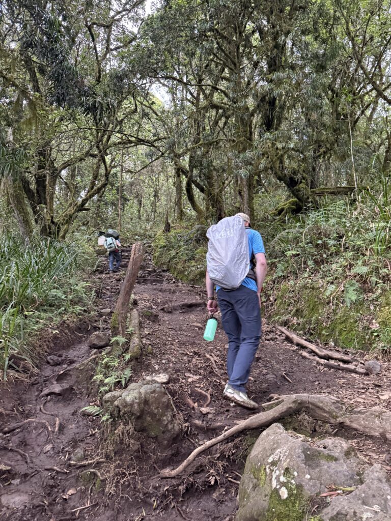
Lukla (9300’) has the famous runway that ends in a cliff, and is the normal starting and end point of treks and climbs in the Khumbu valley. After handing my 3 duffels to porters (2 duffels go straight to base camp, the third duffel goes with me for the next 2 weeks), we started a relatively easy 8 mile hike that ends at the same altitude that we started. This is walking up the main “road”… well, it is a road, only instead of cars, it’s people, yaks and donkeys. It’s most definitely not wilderness. There are people everywhere.If you look at the video, you will notice that it’s hazy. Farmers in India burn their fields in the spring, making the air toxic. When I pulled up a weather app in Kathmandu, the weather app starting giving me air quality alarms (AQI = 191). I had experienced this back in 2000 and knew it was coming. I should be climbing above most of the the haze tomorrow, but we’ll see. Today the clouds blended with the haze, and you couldn’t see any of the high peaks. The air smells foul. I hiked with a mask on.
Of course the advantage of being lower down in the valley is that this teahouse has relatively good internet, and power outlets. That should continue for the next three days, and then all bets are off. I’ll enjoy it while I have it.
That’s all I have for tonight. I’m still too jet lagged to even think about the fact that this is the first day of a two month journey… yikes. Time for bed. Goodnight.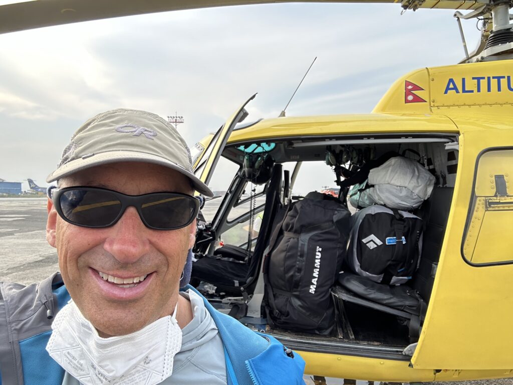
-
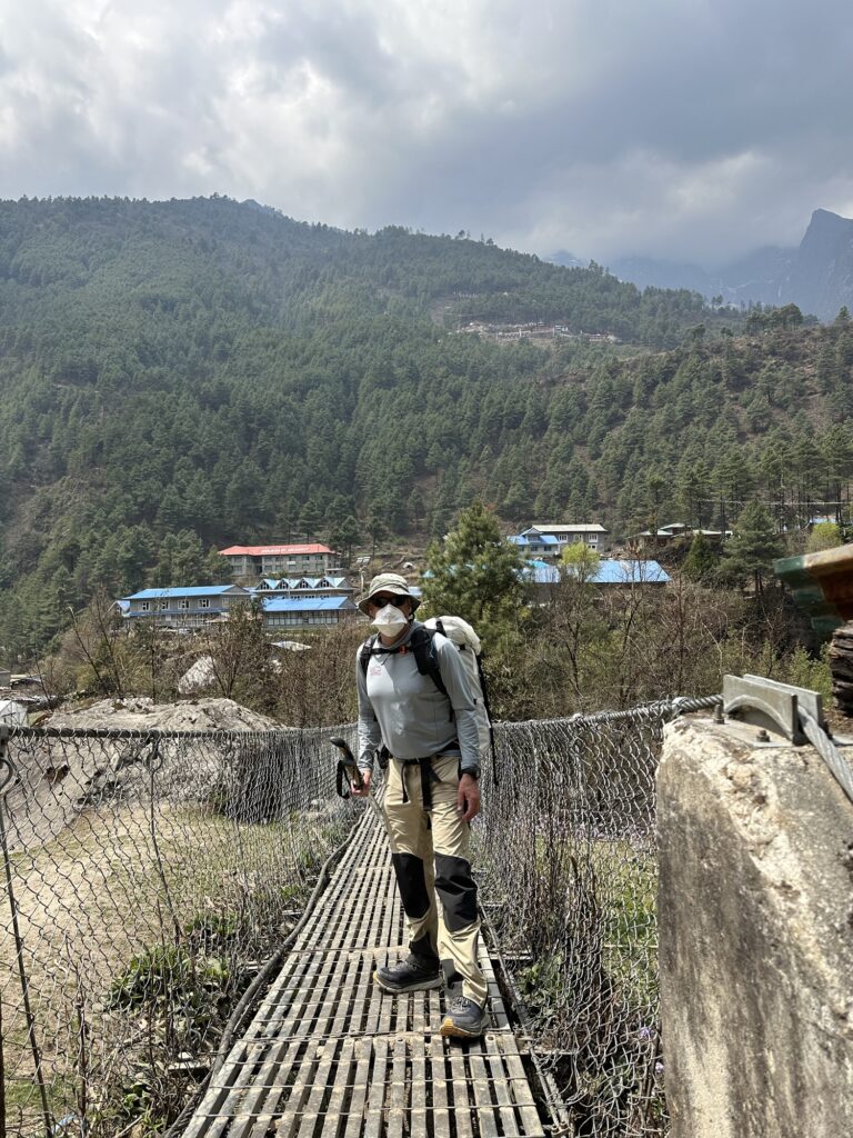
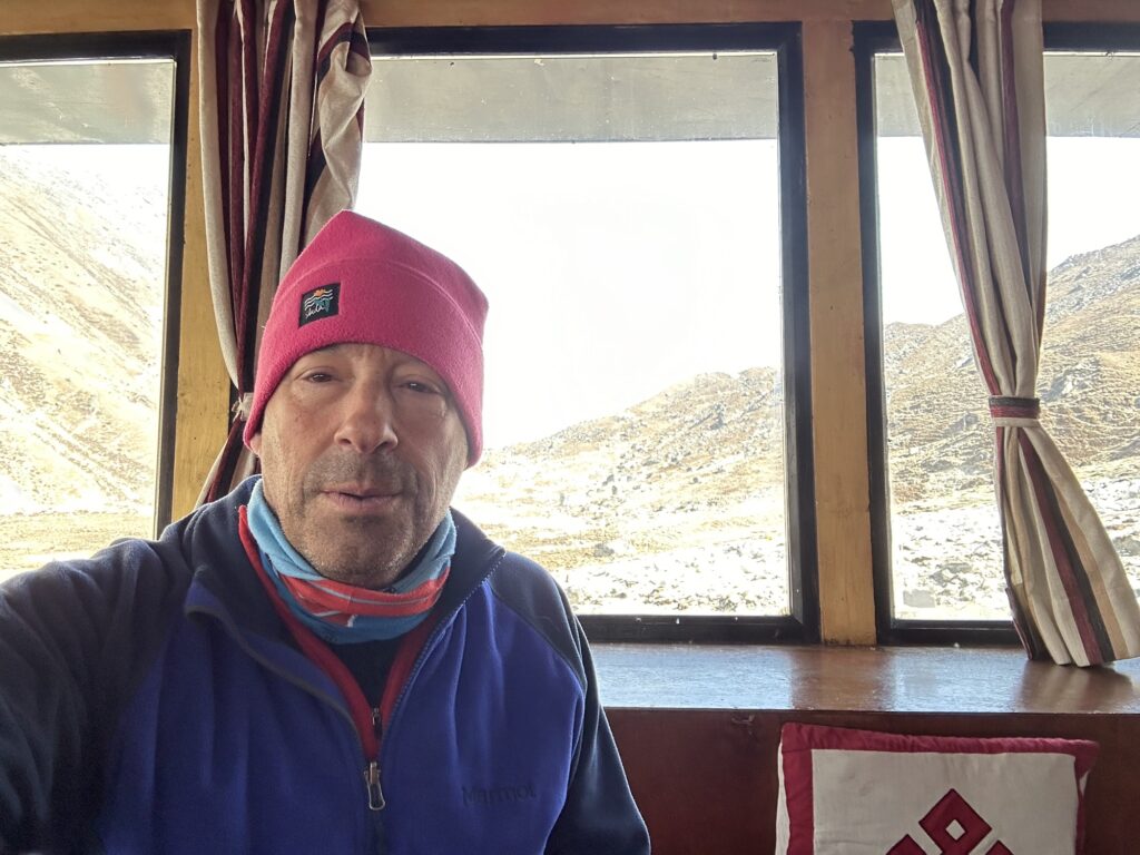
Day 2: the easy hike to Namche

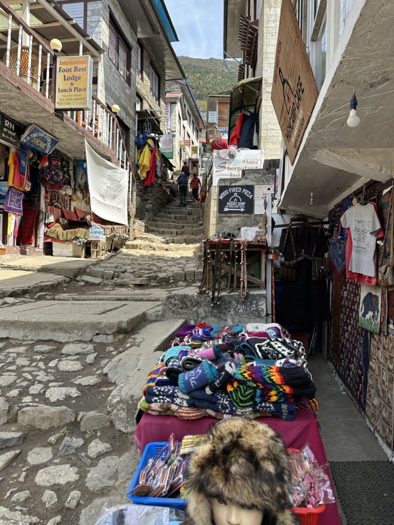
Namche Bazaar is the largest town, and in most respects is the centerpiece of the Khumbu valley. My memory is that it hosts a weekly market for Tibetan goods on Saturdays, hence the “Bazaar”, but I saw no sign of that as we walked in around lunchtime (did Amazon put them out of business?). Anyway, today was an easy 3.5 miles and 2100’ of ascent. It only took 2.5 hours, and at least 20 minutes of that was spent doing paperwork at the two government checkpoints. The final hill up to Namche is a dusty trail through the woods, and a very good friend of mine says that this hill seems to be a common source of the Khumbu cough, so I wore a mask and tried not to breath too deeply. Since we’re still in the elevation range of the mountains I trained on in Jackson this winter, this wasn’t a problem.
Acclimatization is a slow process. At this point, there’s nothing to do except to let the body adapt, and that takes time. Thus the days are short. Here I am attempting the highest mountain in the world, and I’m walking slowly up an easy hill, and then calling it a day. It’s all very counterintuitive.
Galzen on the trail. Namche is tucked behind the ridge below the mountain 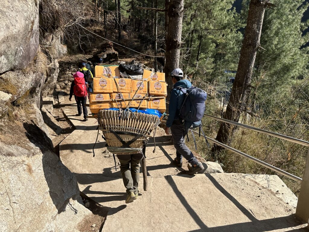
A truck on the road 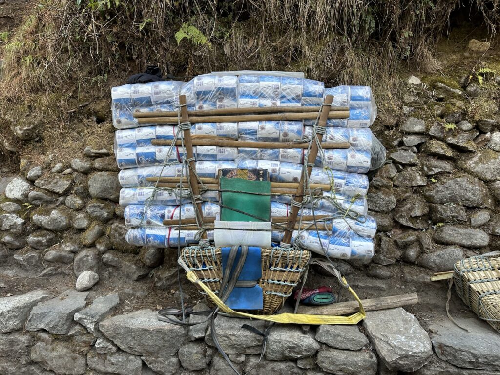
Would you rather be carrying beer or TP? 
Arriving in Namche Namche exists where it is because it has a large and reliable spring. When I was here 8 years ago, this fountain was under construction.
My hotel room is at about 11,300’. We’ll stay here for 3 nights to acclimatize before moving on. This is the calm before the storm. My hotel room comes with an electric blanket, unlimited power and relatively good internet. Once I leave here, it will become much more primitive, but only for the next 7 weeks or so.
A lot of you have been emailing me questions, and I will attempt to answer all of them over the next few days in these posts. Email is the best way to reach me. Tetonclimber@gmail.com.
It’s tea time.
-
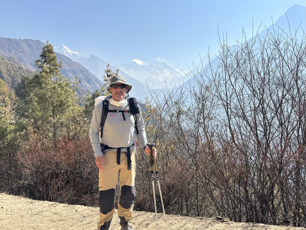
Day 3: a lovely hike above Namche to the Khunde ridge
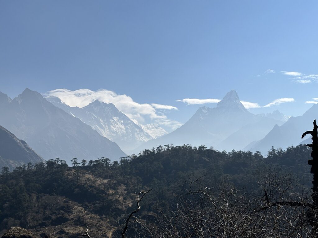
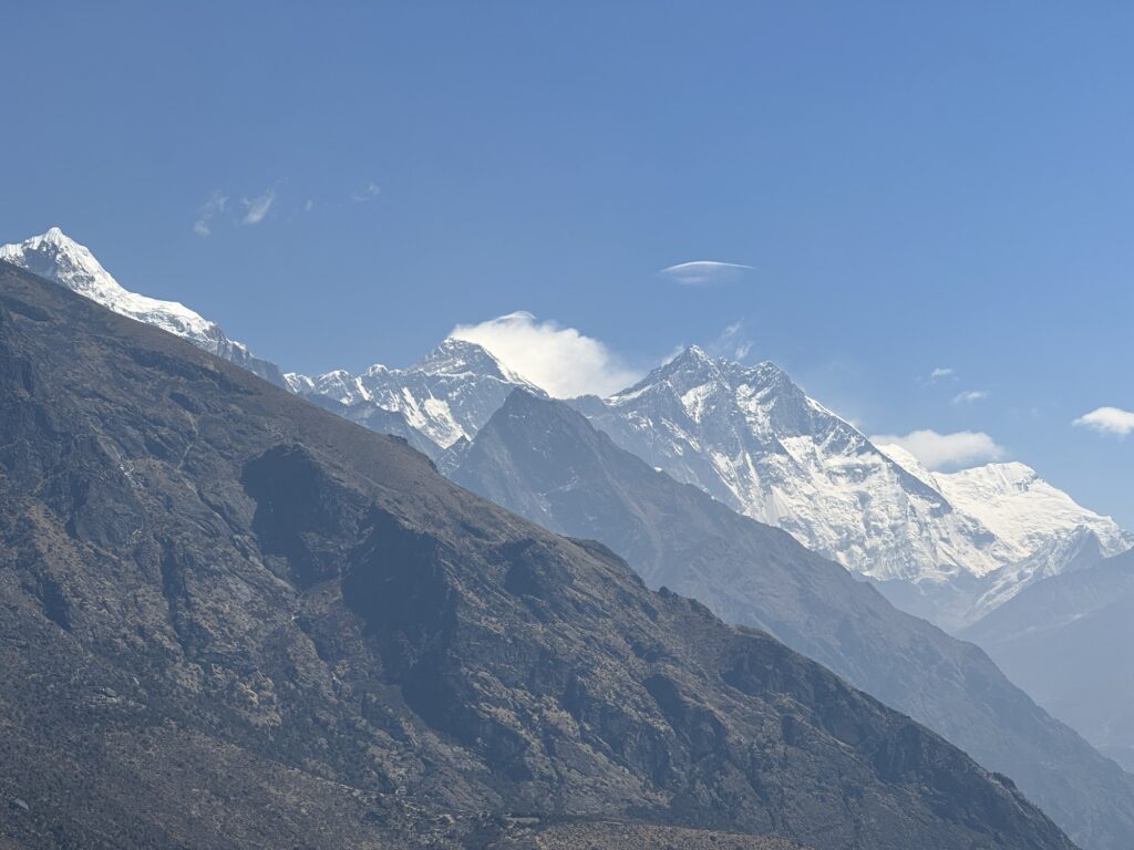
This is my fourth trip to the Khumbu, and I still do a double take when I first see Ama Dablam. Oh, and this is also my first glimpse of Everest (poking up being Nuptse on the left)… still 20 miles away. I haven’t talked about Galzn, my Sherpa guide yet. That will come. For now, suffice it to say that we’re still feeling each other out. I think he envisioned today as a 2 hour stroll to the Everest View Hotel and back, and showed up this morning with nothing but a jacket. I, on the other hand, had other ideas. I wanted to hike up a ridge above the hamlet of Khunde. We had talked about it the night before, and I even pulled out a map to show him, but I don’t think it really sunk in. On the trail, he seemed annoyed that I kept wanting to go farther, and I had to coax him forward on several occasions. When we reached the summit he confessed to me that he had never been there before, and at some point I noticed that his body language had changed: he was having a good time.
Just to be truthful, it’s not really a summit. It’s just one of a dozen bumps on a longer ridge… you could go as far as you want, but this bump seemed to have more prayer flags on it than any of the others, so we declared victory.
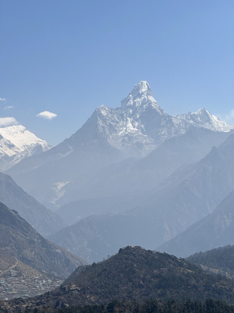
It takes great restraint to not take a picture of this mountain every 5 minutes 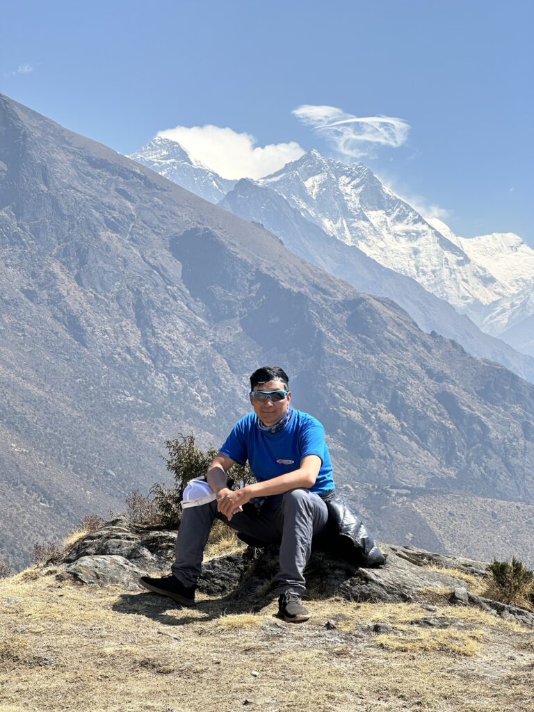
Galzn on the way up with Everest behind.
The obligatory summit video
On the way up, we had ascended a very easy but indirect trail. To mix it up I wanted to descend a slightly steeper ridge but one that didn’t really have a trail on it. Galzn was very skeptical of the idea, and I got the impression that he was starting to dig in his heels. I think we were about 15 seconds away from our first argument when a young woman in running tights ran right past us and down the ridge. We never spoke a word to her, nor did Galzn and I say anything, but without further ado, Galzn just started walking down the ridge. The decision was made. Trekking in Nepal can be a journey into the past… and I’ll leave it at that.
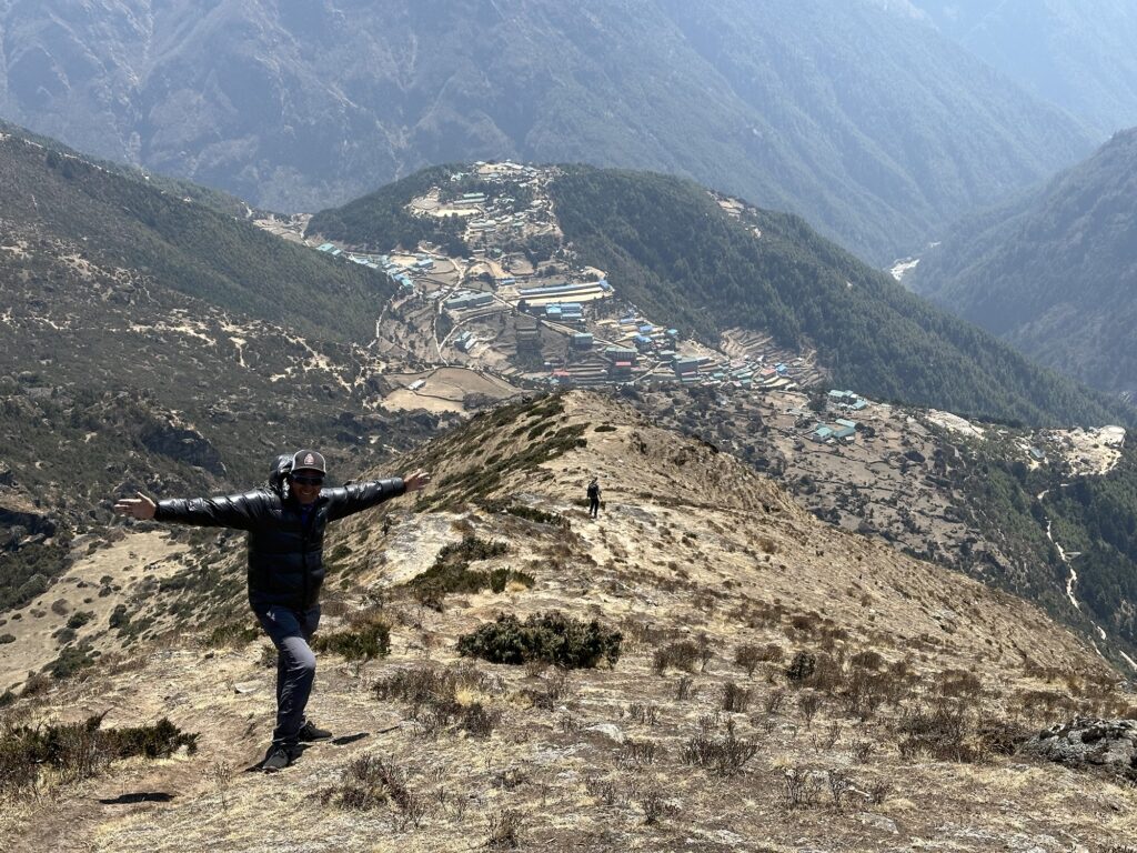
Galzn on our descent ridge with Namche below. You can see the aforementioned woman heading down. Descending the ridge Our “summit” today was about the same altitude as the Grand Teton (Gaia had me 30 feet higher). So far I seem to be acclimatizing well. It takes discipline to resist just putting it in gear and sprinting uphill, but I’m trying not to irritate my lungs. Most people around me are coughing, including Galzn. I don’t think it’s an illness… I think it’s just irritation. The trail is really dusty, and the wind blows the dust everywhere. Plus, the haze from the brush burning in India is acrid and feels toxic to me. Many if not most people hike with a buff over their mouth. I’ve worn a buff in the past, but I’m a little skeptical that it actually does anything. This year I’m trying to wear an N95 mask. We’ll see if it makes any difference. It’s only day 3.
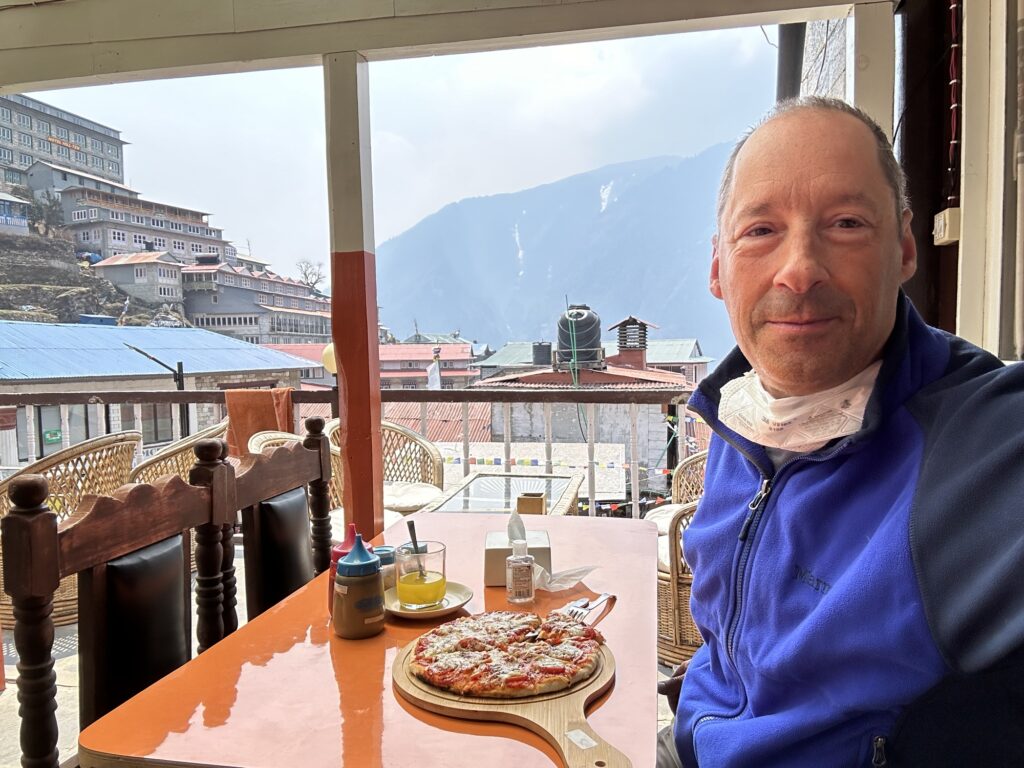
Tomorrow is a rest day. That means walking around town for an hour, eating a pizza for lunch and then reading a book. I will leave you with a panorama video from the start of our hike. The internet isn’t working very well this morning (nor was it last night) so this might just be a link. Cheers.
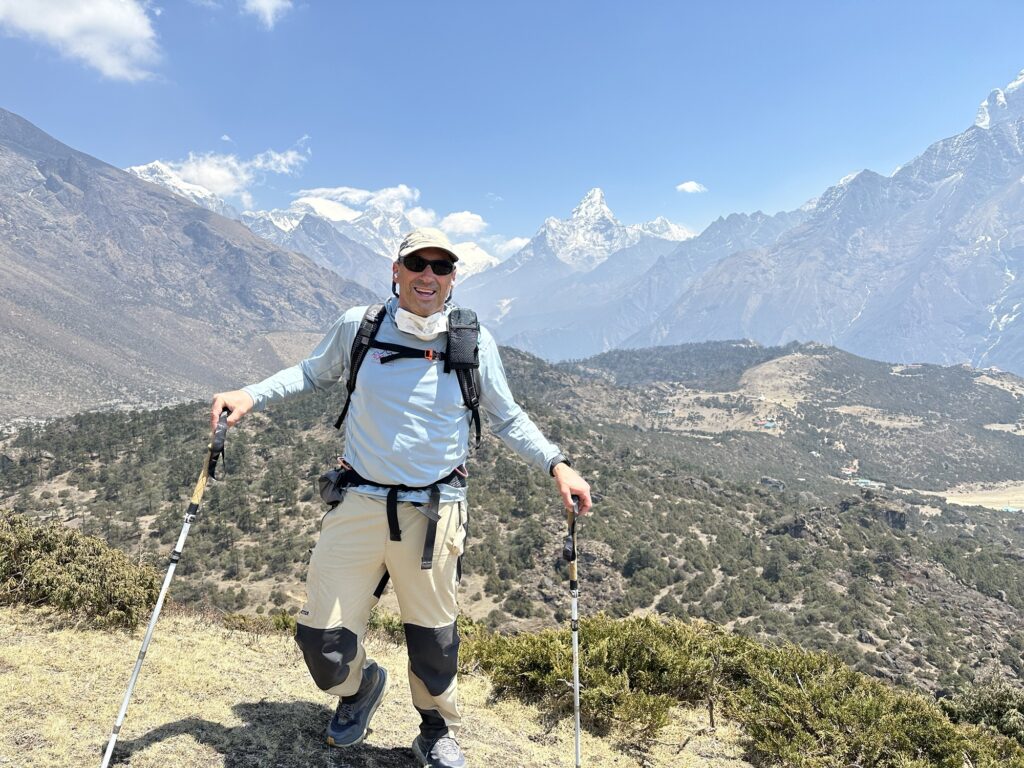
In front of Everest and Ama Dablam
-
Who am I going with?
Everybody has been asking me: who am I going with? Well, it’s not easy finding a partner to climb Mt Everest. I have a lot of friends who would love to go, and are certainly qualified and would make great partners. The stumbling block is the price. I don’t have many friends who have $50k to throw at the mountain (and when you add airfare, tips, rescue insurance and specialized gear that you’ll never use anywhere else such as a down suit and 8000 meter boots, you can probably add $15k to that). I thought that I had lucked out: I went to Pumori in 2000 with a friend who has the experience and a lucrative job… And he wanted to go. Because his daughter was graduating last year, he asked me to wait a year, which I did, but this February, after I had wired the money to Kathmandu, he decided to cancel. I have to admit that it threw me for a loop. Everybody I tell this story to justifiably has questions, but I’m just going to say that I don’t have the answers, and that it’s time to move on. Please let this one go.
So, this winter I had the choice to wait another year or two in the hope that I could find another partner, or just go solo. I had already paid in full, and I wasn’t getting my money back. Obviously, I’m here. The fact of the matter is that I’m 61… waiting has its downsides.
I’m not really going alone. I will have two Sherpas with me. One of them, Galzn, met me at the Lukla airport and will be with me for the whole expedition. The other is already at Everest Base Camp. I’ve been told his name but it went in one ear and out the other (did I mention the 11 and 3/4 hour time change?). I’ve not met him yet. Presumably he’ll be shuttling loads up to the higher camps while we trek around.
There are a select few western climbers who succeed in the Himalayas without Sherpa support, but it’s remarkably rare. Most western climbers hire sherpas, and dare I say it: ALL western climbers hire Sherpas on the easy routes of famous peaks (more on that in a future post). I personally have never stood on top of a Himalayan peak without a Sherpa. I tried once. I didn’t make it. Dede and I got to the top of Baruntse (along with a 3rd American) accompanied by 4 Sherpas, and a few years later I climbed Ama Dablam 1 on 1 with a Sherpa. Even with an American partner, my expectation all along is that we would each be climbing with a Sherpa. It’s just easier and safer that way. Remember that Sir Edmond Hillary made the first ascent of Everest with Sherpa Tenzing Norgay.
So who are these Sherpas? Wikipedia says that “the Sherpas are one of the Tibetan ethnic groups native to the most mountainous regions of Nepal and Tibetan Autonomous Region. The term sherpa or sherwa derives from the Tibetan-language words ཤར shar (‘east’) and པ pa (‘people’), which refer to their geographical origin in eastern Tibet.” Perhaps a more simplistic answer is that they are the people that live in the mountains of eastern Nepal. They are very well adapted to altitude, and, from my point of view, their lives aren’t easy. These two attributes translate well to mountaineering. Their strength and work ethic are amazing to me. 15 years ago I remember trying to keep up with a Sherpa (Nima Tashi) at 22,000’ on Baruntse. He was 10 years my senior and had a fused ankle but I wasn’t even close to keeping up with him. He was in a different league.
Galzn (full name Fur Galzn Sherpa) was born and raised downstream of Lukla. He’s 37, has a wife and two teenage kids in Kathmandu, and makes his living supporting and guiding westerners like me in the mountains. He’s summitted Everest 5 times, and has also climbed Makalu, Lohtse, Daulagiri and Manaslu. I seem to be in good hands. The only downside is that his English is only fair. We can communicate the basic stuff. I can ask him if I should drink the orange juice that was just put in front of me (the answer was no) and talking about what gear to bring seems easy, but asking him what is a “Sherpa” got me nowhere. On the plus side, he laughs easily and if I keep my jokes simple, he seems to genuinely laugh with me. It’ll be interesting to see how our relationship evolves in the next two months.
4 responses to “Who am I going with?”
-
I’m undeniably your biggest groupie/fan in the Sonoran desert of Arizona. With fond memories of climbing Pumori with you, I know that if anyone can do this “alone” it would be you! Sending all of my best vibes and prayers!
-
I’m glad your Dad jokes translate well!
-
Following you on this adventure! Have a great climb!
-
I’m excited to following you on this adventure!
-
-
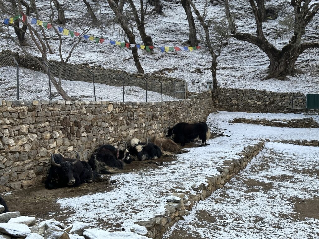
Day 4: rest day in Namche
The streets of Namche Since I might not have internet this reliable for the next 7 weeks, I thought I would do a photo dump this afternoon. I’ll start with the teahouses. Generally speaking, the lower in the valley you are, the nicer the lodgings. That has certainly proved the case so far.
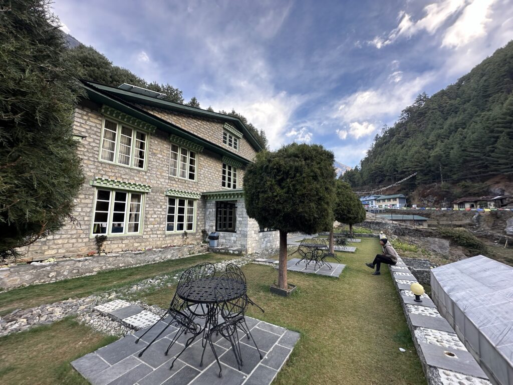
The Yeti Mountain Home, in Monjo. Our first teahouse of the trip. 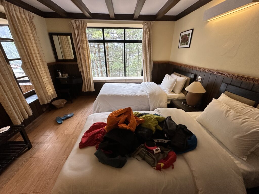
The room These rooms look very western. They have a private bathroom with a shower, but you have to be careful… There is no heat or ventilation (except for opening the windows) and you have to assume that the room will cool off into the 40s at night. I know from past experiences that steaming up the room in the evening by taking a shower has its consequences. In this case I tried to game the system by taking a shower in the morning, but alas, the water is heated by the Sun… so close…
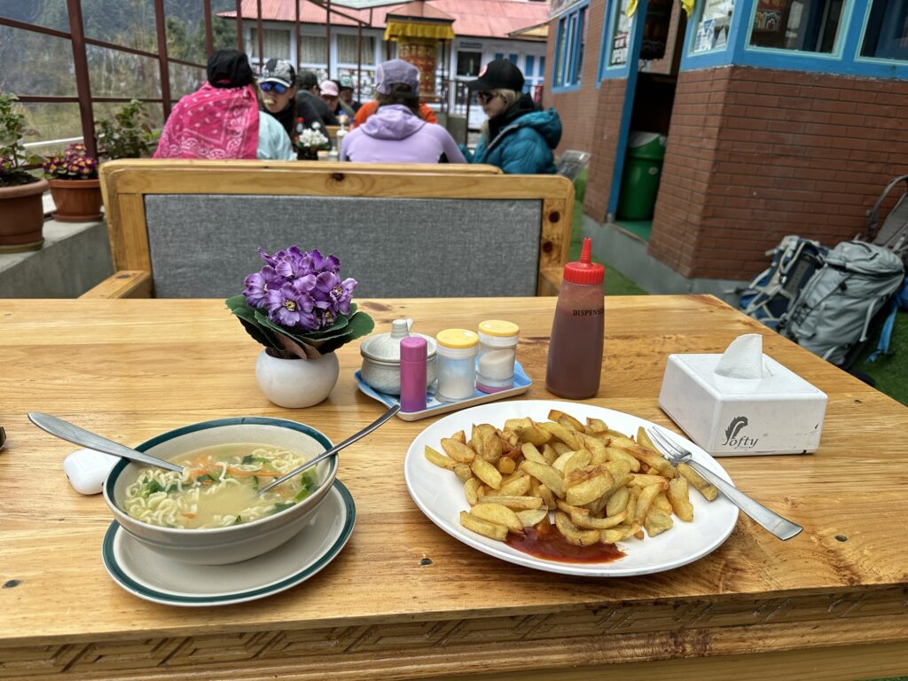
There is good food on the trail down this low. In this case, fried potatoes and ramen noodles (they call them rara noodles) According to Galzn, all the potatoes are grown locally. Technically, I guess, they are organic, and there are many signs advertising this at the restaurants. The cynic in me wonders if these potatoes would pass organic certification in the US knowing that it was grown with human poop as fertilizer… best not to think too hard about that.
In case you’re wondering, no, you won’t see even the tiniest potato skin anywhere. Not even a speck. And we pretty much eat potatoes 3 meals a day.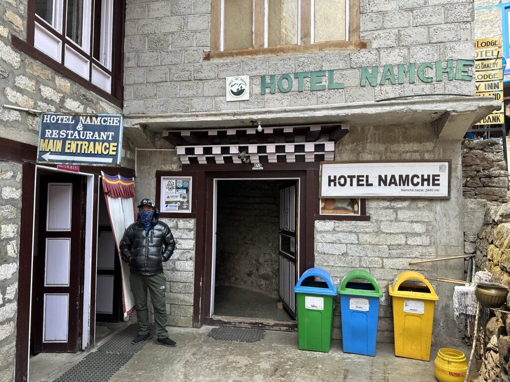
Galzn and the Hotel Namche. I had never stayed here before but Galzn’s friend runs it. As to where the garbage goes, my guess is “somewhere the westerners won’t see it”… which is about the same as in the US, so I shouldn’t be too critical. 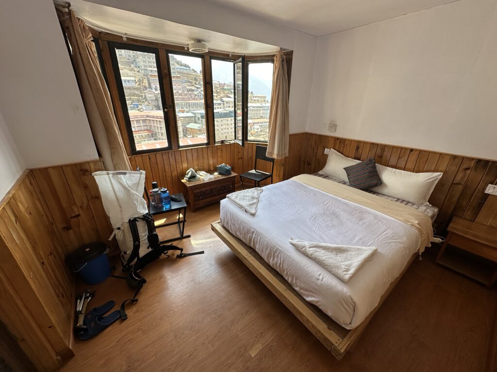
My room in Namche 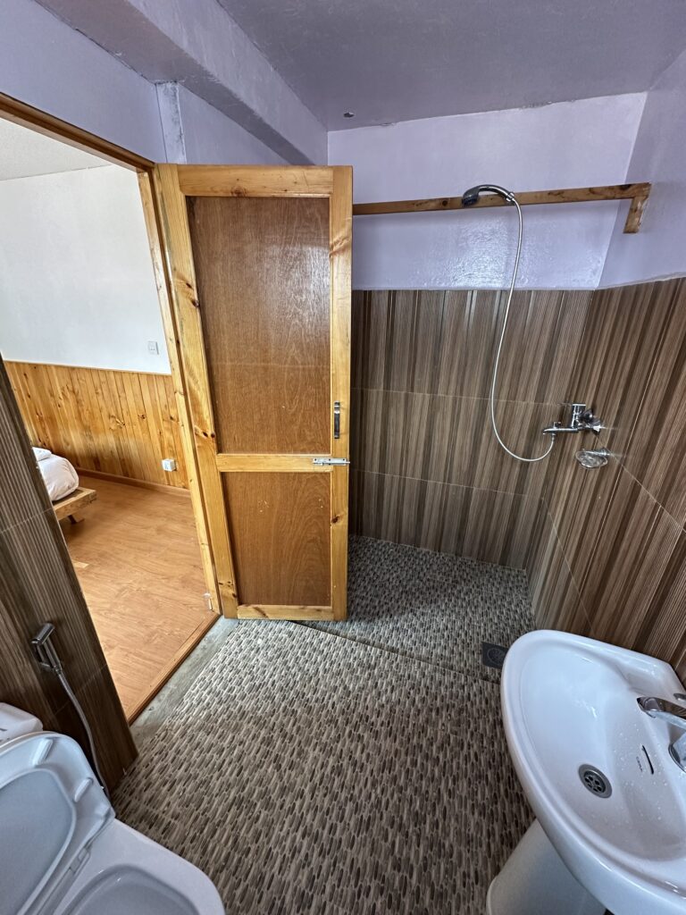
The bathroom 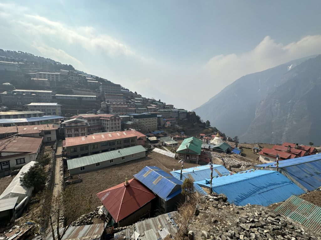
Namche from my room, looking down valley into the haze. 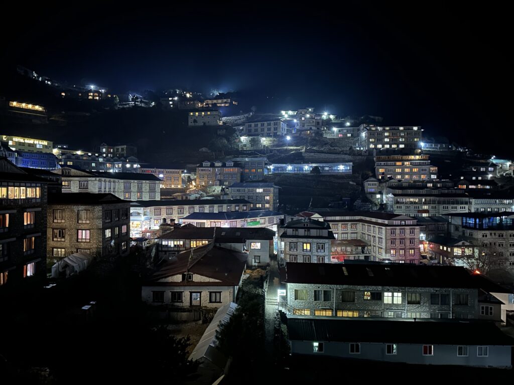
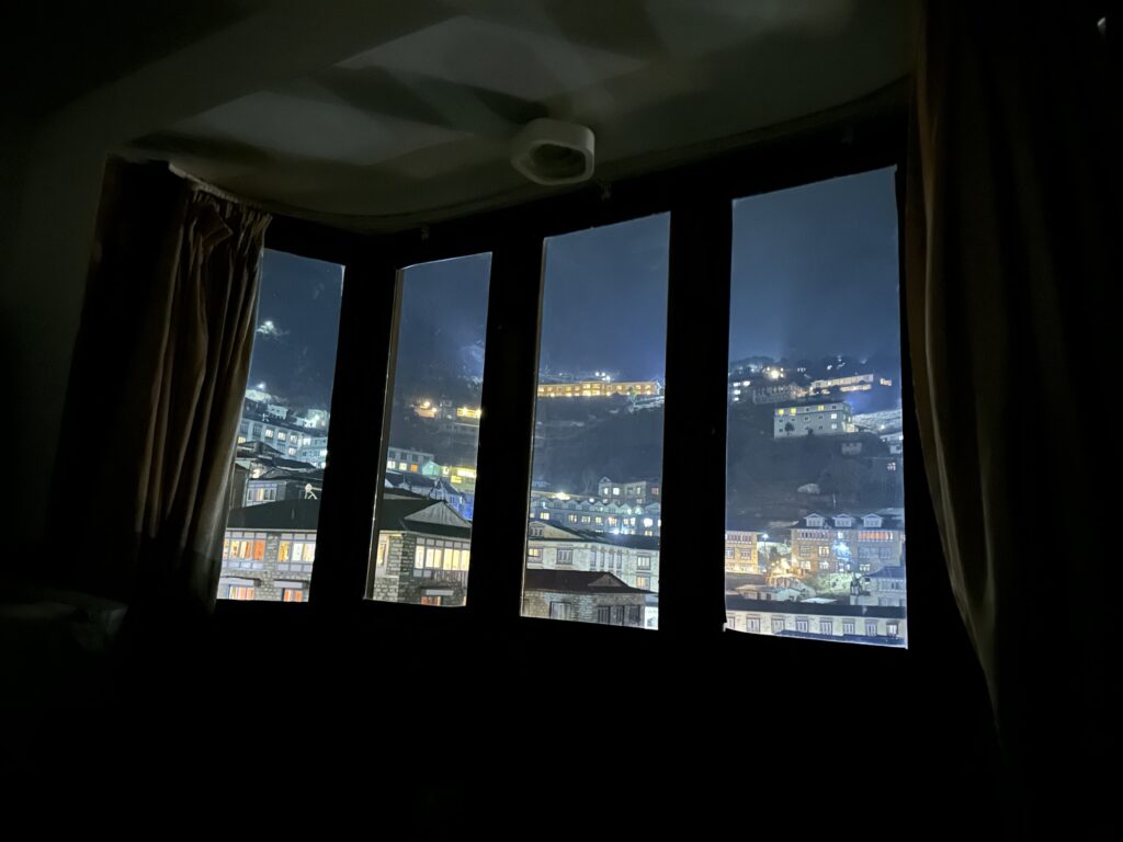
Namche from my room at night. It’s hydroelectric power, and probably the best in the mountains of Nepal (for a small town at least) 
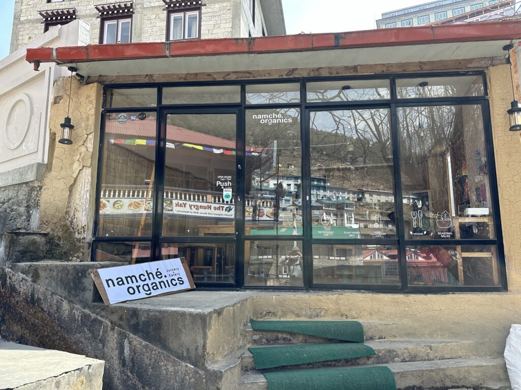
“Juicery”… only for the brave. At least it’s organic. 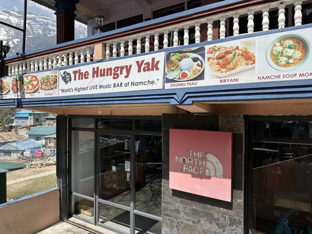
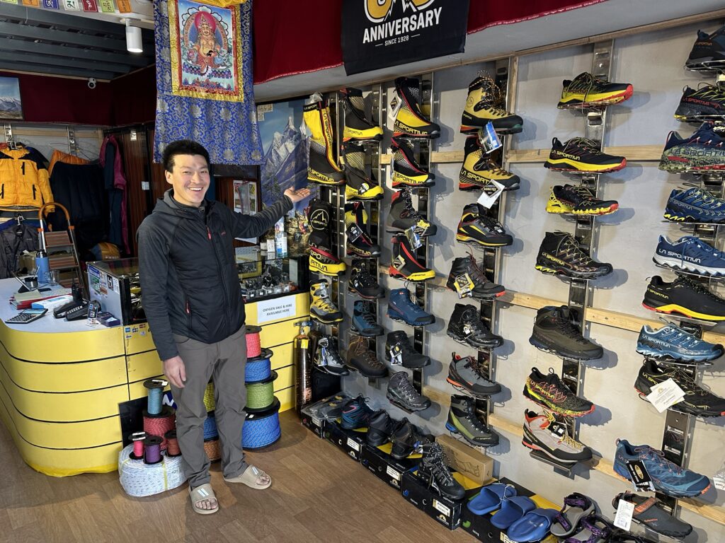
Yes, they sell real north face products. Interestingly enough, you can buy brand new western goods here. I would go so far to say that if the airlines lost all you gear, you might be able to completely restock for Everest here in Namche. And the gear is actually cheaper than in the US. They had all kinds of Black Diamond packs and ice axes and slings. The La Sportiva Everest boots were 96000 rupees, which is about $740. Now the question would be do they have the right size…
The view from my pillow at night Tomorrow, we continue up valley to Portse.
One response to “Day 4: rest day in Namche”
-
Nice work documenting the adventure. Thanks for keeping the blob! Catching up on your travels while lounging in the van outside Bears Ears. Man oh man, The Kumbu sure looks a LOT different than 1987!! HA!
Keep’m coming!
Hugs from Carolyn, Jenny, and gk
-
-
The Plan
Today is day 4 and is a complete rest day. No hiking, just organizing gear and perhaps reading a book. Tomorrow we continue moving up valley.
So, what’s the plan? Typically, people summit Everest the last two weeks of May. The goal is to go as late into the spring as possible for warmer temperatures, but also to get off the mountain before the Monsoon arrives in the beginning of June (“Monsoon” means a change in weather pattern. In this case the NE winds switch to southerly winds, bringing heavy moisture up from the Indian Ocean. Although every year is different – after all, this is weather that we’re talking about – typically, the Monsoon lasts from June through mid-September).
So the goal is to be ready to climb Mt Everest during the last two weeks of May. To get ready for the ascent, I have to acclimatize. That’s why I’m here so early. It takes a solid month, if not more. I’m writing you from an elevation of 11,300’. Tomorrow I’ll go higher and likely won’t breathe such thick air again until after my summit attempt.
I have chosen to take a meandering trek to basecamp. I’m not in a hurry and this place is stunning. So tomorrow I will veer off the main 33 mile path to Everest Base Camp (EBC) and head up a different valley. Eventually I’ll go over a 17000’ pass and reunite with the main drag to EBC. If the weather allows, and health allows, I’ll arrive at EBC on the 19th of April (which I think is day 12 or 13).
EBC is at about 17,000’. The standard way of acclimatizing above EBC is to do three rotations up through the Khumbu Icefall. Rotation one is to go up to Camp 1, tag Camp 2 at 20,000’, and then descend to basecamp. Rotation two is to go up to Camp 2, tag camp 3 at 23000’, and then descend back to basecamp. Rotation three is the summit attempt and is 5 days: you sleep at camp 2, camp 3 and camp 4, go for the summit and descend to camp 2, and then out. I will be using supplemental Oxygen at camp 3 and above.
The Khumbu Icefall is the famous bottleneck on this side of the mountain. It’s basically a waterfall of frozen ice. Climbers don’t normally go through such an icefall, but there’s no reasonable way to avoid it on the Nepal side. It’s not realistic for climbers to just shoulder a weeks worth of food and gear and climb through it. It’s just too difficult, tedious and dangerous. Instead, from the very beginning, expeditions have fixed ropes and ladders through the icefall. This process can take weeks, but once the route is in, then climbers can move up and down through the icefall in only a matter of hours. In the old days, individual expeditions fixed the route themselves. Nowadays, all the expeditions collectively hire a company called “The Icefall Doctors”, and this company of Sherpas creates and maintains the route. As I write this the Icefall Doctors have not yet reached camp 1, but that’s not a concern. My understanding is that they normally have the route open to camp 1 by around mid April.
Incidentally, I only know this from Alan Annette’s YouTube blog. Nobody down here has any inside information.
https://youtu.be/nBOxqvGMZ7Y?si=ZpXpgJoNqinL2kZN
If you watch his weekly blog, you’ll probably know more about what’s happening on Everest than I will.
I’m choosing to skip the first rotation through the Icefall. Instead, I’ll attempt at least one and perhaps 2 trekking peaks that are both about the same elevation as Camp 2 (20,000’). The peaks are Lobuche East and Pokalde. I’ve not climbed either. In the last week of April the plan is to walk down valley to their base, and give it a go. I love to explore and this is just a way to mix it up. Interestingly enough, a good friend of mine says that I’m making a mistake. He rightly says that I’ll never see anything like the Khumbu Icefall ever again, and that it’s interesting to see how much it changes over the course of a month. He might be right. Ask me when the expedition is over. However, I’ll still get to go up and down through it twice.
So, that’s the plan. We’ll see if we pull it off. My return flight is May 31st. Conceivably I could be back a few days earlier or later, but no need to worry about that now.
Cheers
-
Day 5: moving up to Phortse
This morning’s sunrise from my room Day 5. Today we’re moving up the valley to Phortse. Once again, it’s not a particularly hard day. That’s the rule around here… going up the days are short. Tonight we’ll be sleeping a mere 1200’ higher than Namche, although admittedly to get there we have to hike up 2700’, and down 1500’… trails around here tend to go up and down a lot.
The first mile or two out of Namche is utterly spectacular, and has the rare attribute of being mostly level and not too rocky.

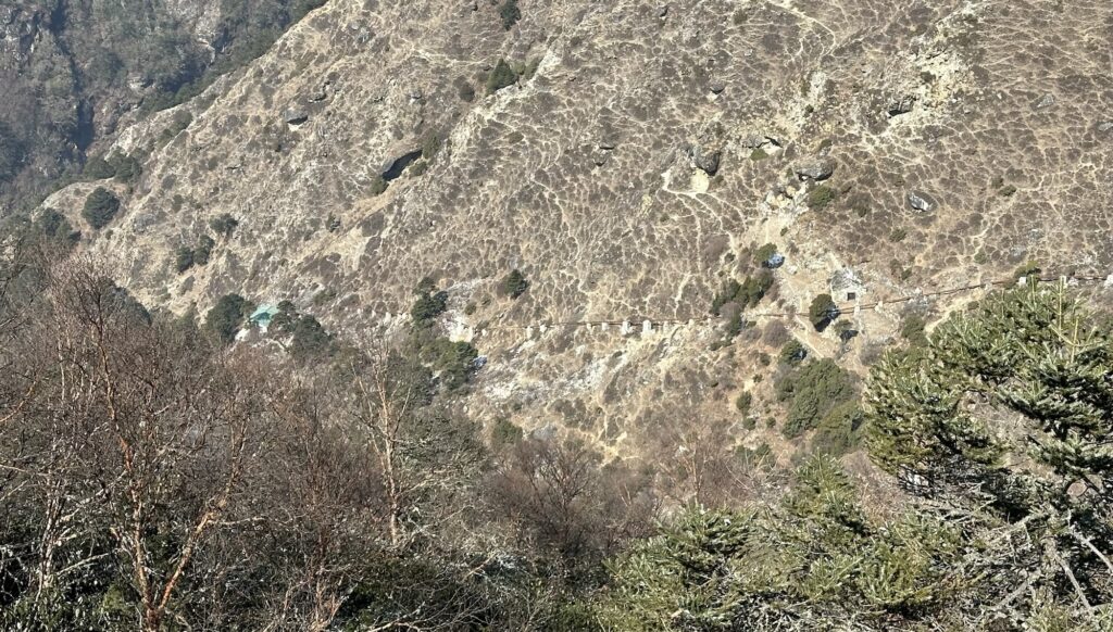
Looking down valley you can see the wire bridge that I filmed on day 2 It is, however, very crowded. This is not wilderness. That’s why I call it the main drag to EBC.
You might wonder why my pack is so big… after all, I have a porter. Conceivably I could be carrying only water and a rain jacket. Well, this isn’t that kind of vacation. I’m intentionally keeping 25 – 30 pounds on my back. This strategy worked well for me on Ama Dablam. Hopefully it works again. Galzn has told me that most people that he has guided have carried lighter packs than me.
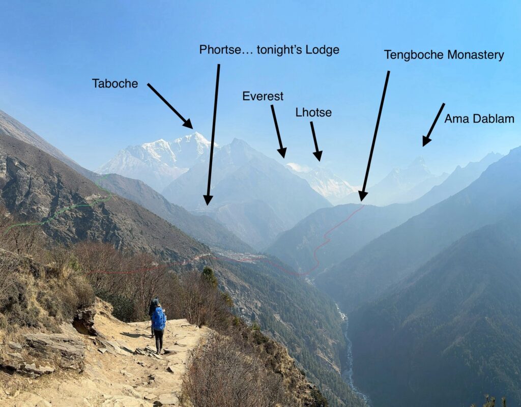
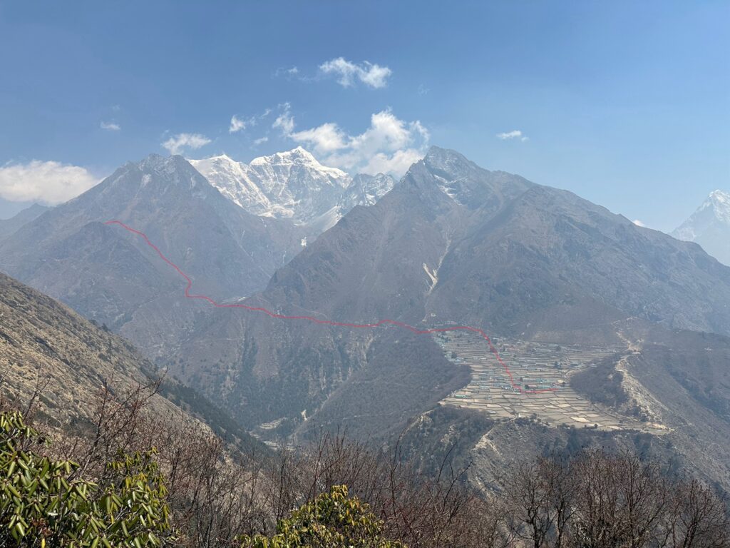
About 2 miles past Namche, my route finally diverges from the main path to EBC. The red line is the main path. We’re going up the green line. Where the green line disappears over the ridge (at a hamlet called Mong-La), the trail drops down 1500’ and then climbs back up 800’ to Phortse.

Here’s the original photo in case you didn’t like my graffiti 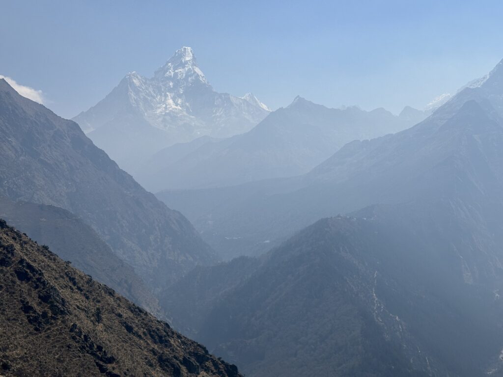
You can see the main path going up to the famous Tengboche Monastary in the lower right quadrant of the photo. 
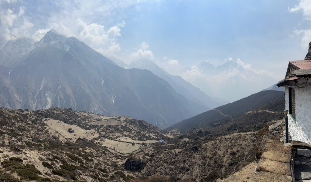
Mong-La, at 13,000’, is the high point of the day. The mountain behind is called Taboche. 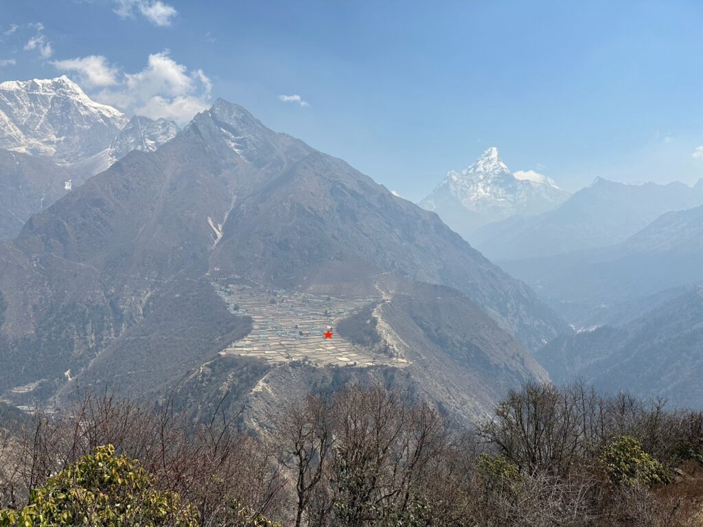
The view of Phortse from Mong-La. I’m writing this post from the teahouse at the red star. We’re going to spend two nights here, and then continue up the valley to the left. 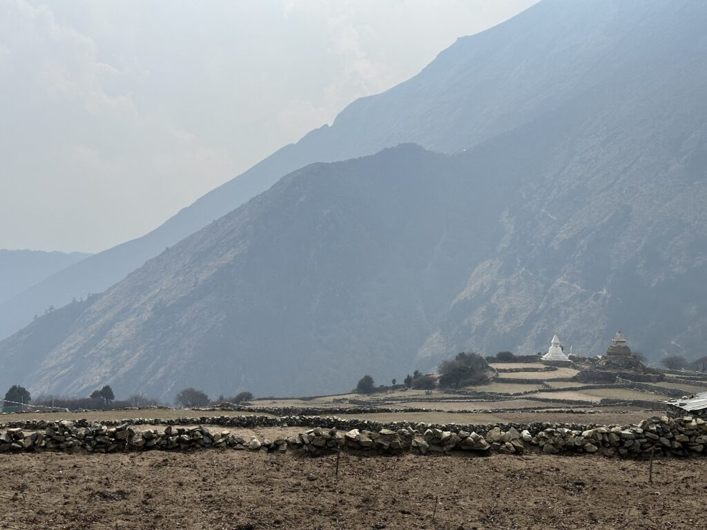
Looking back at Mong-La (the mini saddle on the shadowy ridge – not the skyline) from where I am now. You can see the path that we descended. 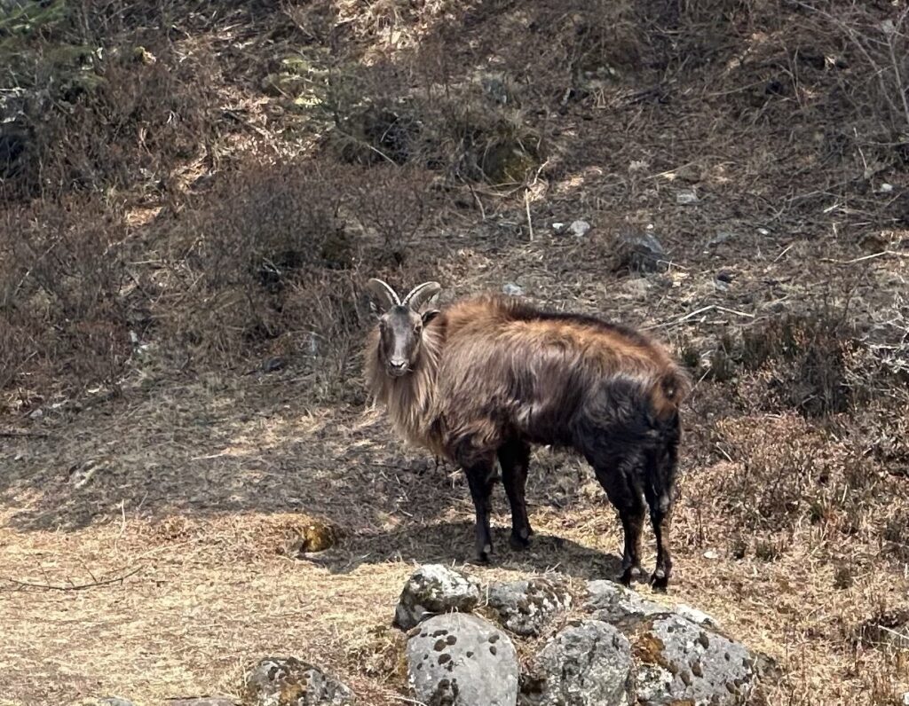
Our first wildlife sighting of the trip. Galzn was pretty excited to see this. It’s a Himalayan Tahr, which is basically their version of a mountain goat. 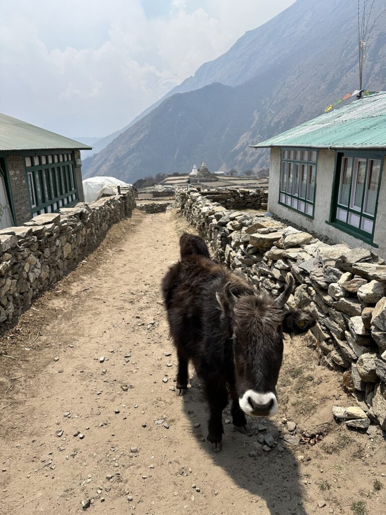
This is not wildlife. My iPad is running out of juice, so I’m going to stop for now. Overall, it was an uneventful day. 5 leisurely hours to cover 6 miles with 2700’ of ascent. We had to stop a lot… the view was just too good and you definitely don’t want to stumble off the trail around here. After the first two miles we left the main road, and I must admit it felt great to get away from the crowds. Our path isn’t empty, but at least you can get far enough away from other people to pee. Up until this point, that just hasn’t been a possibility… yes, it really is that crazy. I honestly thought that springtime would be less crowded than autumn, after all, there’s this horrible acrid smelling haze…the air in October/November is much cleaner, but maybe the word isn’t out yet. Or maybe it actually is more crowded in the autumn, after all, it’s been 8 years since I was last here. Hmmmm…
4 responses to “Day 5: moving up to Phortse”
-
I hope the crowds abate and it gets easier to pee. Amazing scenery and thanks for the pictures!
-
Thanks for sharing your adventures with us, so exciting! And that goat!
-
Love following your adventure, Tom!
-
Such incredible photos. Love hearing your “voice” in the text. Feel like I’m there! Xx margot
-
-
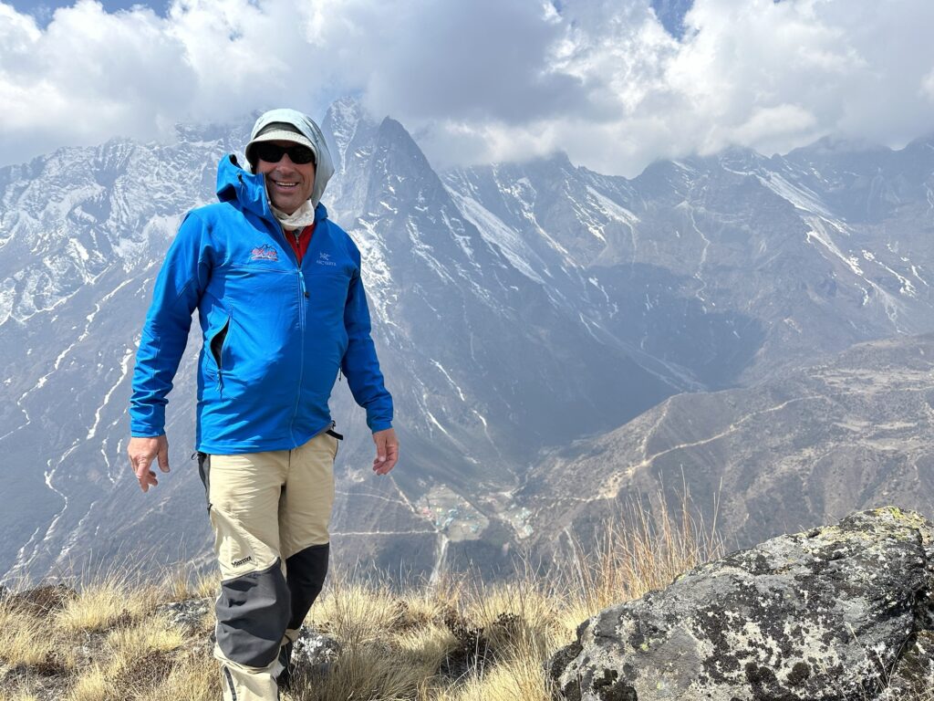
Day 6: a day hike to Khonar ridge.
A photo taken yesterday showing today’s hike It snowed a little last night… not much more than a dusting, but it was the first precip of the trip. Apparently the hill directly above Phortse can be scrambled, but it’s steep, and with the fresh snow, we decided on a mellower hiking objective. Remember, the goal is to acclimatize, not to beat ourselves up. So we aimed for the ridge above the hamlet of Khonar. It’s mostly grassy pastureland, but it still got us up to 14,950’… and no matter how you slice it, it’s a day hike in the Himalaya. It’s always spectacular. Overall, it took us 4 hours to go 5 miles round trip, with a tad over 2500’ of ascent. Galzn didn’t even bring a pack.
Good morning 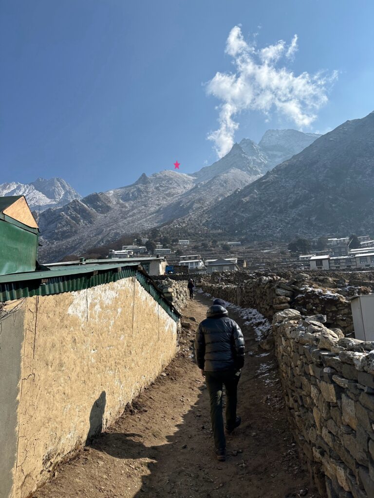

The easy walk up The obligatory summit video.
On the summit 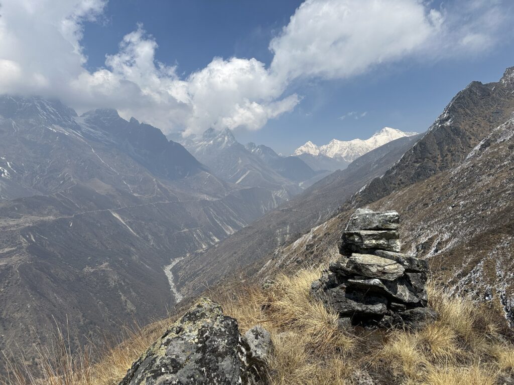
Looking up the valley. Tomorrow we’ll be walking up the trail on the other side. The high peak is Cho Oyu, which is the 6th highest mountain in the world. I don’t have a picture of it, but a hundred feet below the summit there was a few feet of exposed scrambling… steep enough to make you think, but not really hard. In descent, Galzn was going first, and after he down climbed the step, he turned around and asked to hold my trekking poles as I down climbed it. My initial reaction was: you have to be frickin kidding me! Here we are about to climb Mt Everest together – Mt Everest! – and you think I need help on a casual scramble, but…. …. …. I knew something like this was coming, and I had mentally prepared myself for this moment. You see, back in 2009, our Sherpas fixed about 100’ of rope up some easy 4th class rock on a pass called the Tashi Lapsa. Back then I was in my guiding prime, and it didn’t even occur to me to grab the rope… I just free soloed it because it was fun. Well, it turns out that the Sherpas took it personally. They thought I didn’t touch the rope because I didn’t trust them. It may seem trivial but it turned into a minor brouhaha and knowing that we had a lot of climbing ahead of us, I had to essentially grovel for their forgiveness. There’s no need to go through that again. I don’t know how Galzn would have reacted had I declined his help, but the fact of the matter is that I need him on Everest, and if this is what it takes, well, I’m not that proud. I handed him my poles. I don’t have a partner. I have a guide.
I wonder what Galzn would think if he ever read this blog?
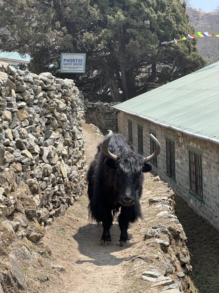
The end of the hike. Yes, I’m staying at the Phortse Guest House, and this is the path to get there. Hmmm…. The solution was to wait it out for a minute until the Yak decided to move on. It was interesting to me that Galzn had no interest in confronting that yak either. 3 responses to “Day 6: a day hike to Khonar ridge.”
-
Wise move on the trekking poles! Interesting.
Really enjoying your reports…thanks! Safe travels!
-
Loving the blog, writing and photos both! The evolving relationship with Galzn is so interesting to me.
-
-
I think the yak wanted your poles too! Not the prettiest of faces…
-
-
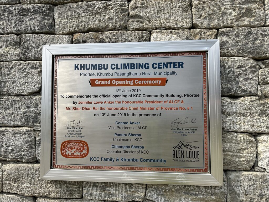
The Khumbu Climbing Center in Phortse
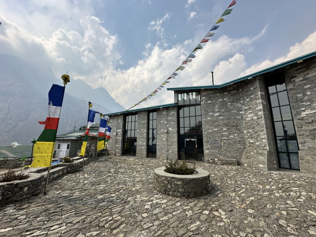
Phortse is home to the Khumbu Climbing School. This school was set up by western climbing guides – Conrad Anker being foremost among them – to train the Sherpas in western guiding techniques. The school generally takes place during the Khumbu off season: ie, January. I know several guides in Jackson who have come here to teach (I would imagine it’s a little chilly then). During the Sherpa guiding season, ie, now, it functions mostly as a museum, with a library and a study hall. It’s beautifully built.
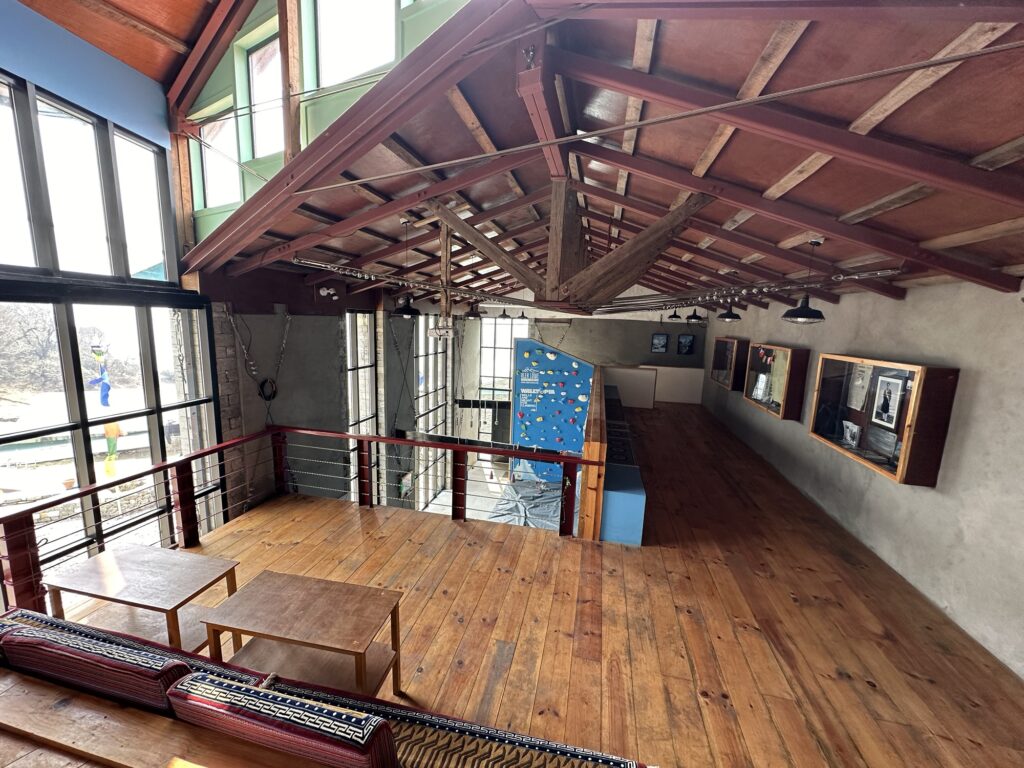
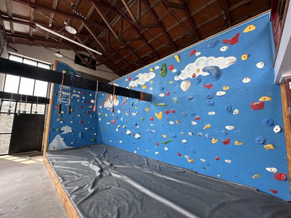
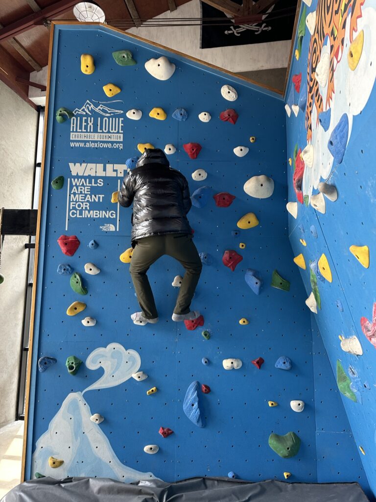
So, how did you get hurt in Nepal again? Well, funny story. See, I was climbing an artificial wall barefoot in the Khumbu Climbing Center in Phortse, and jumped off…. No, that didn’t happen, but I thought about it. I did one lap up and called it a day. 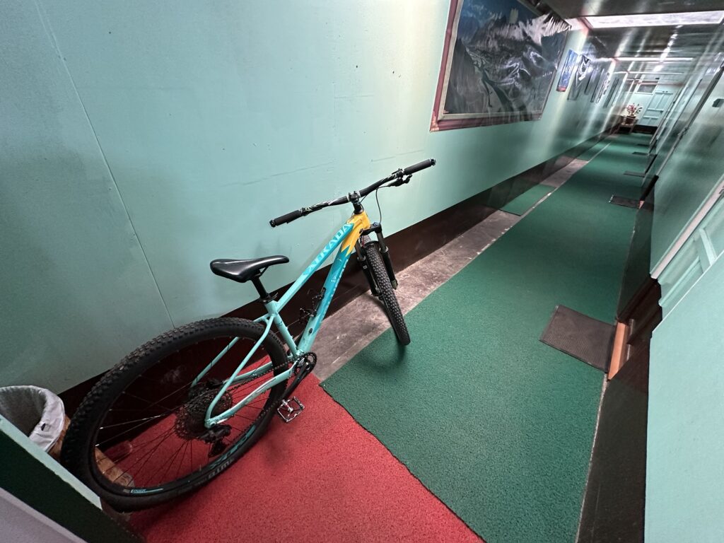
I know some of the guides who have worked here, and I can totally visualize them taking this mountain bike out for a spin. I get it. To an older rider such as myself, it looks suicidal… the side hilling is next level and the trails are rocky, but I get it, and seeing the bike here – in good condition – made me smile.
I’m staying at the teahouse adjacent to the center. Phortse is not inline with any of the main Khumbu canyons, so this place gets only a fraction of the traffic. Last night and tonight I have the place to myself. I’m the only one here. On our hike today, we only saw maybe a half dozen people. The solitude likely ends tomorrow, so I’ll just live in the moment.
Having the whole place to myself. The Sherpas eat in another room. 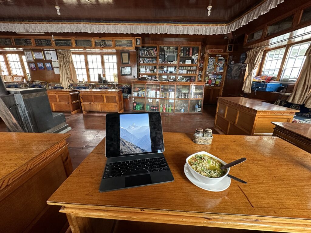
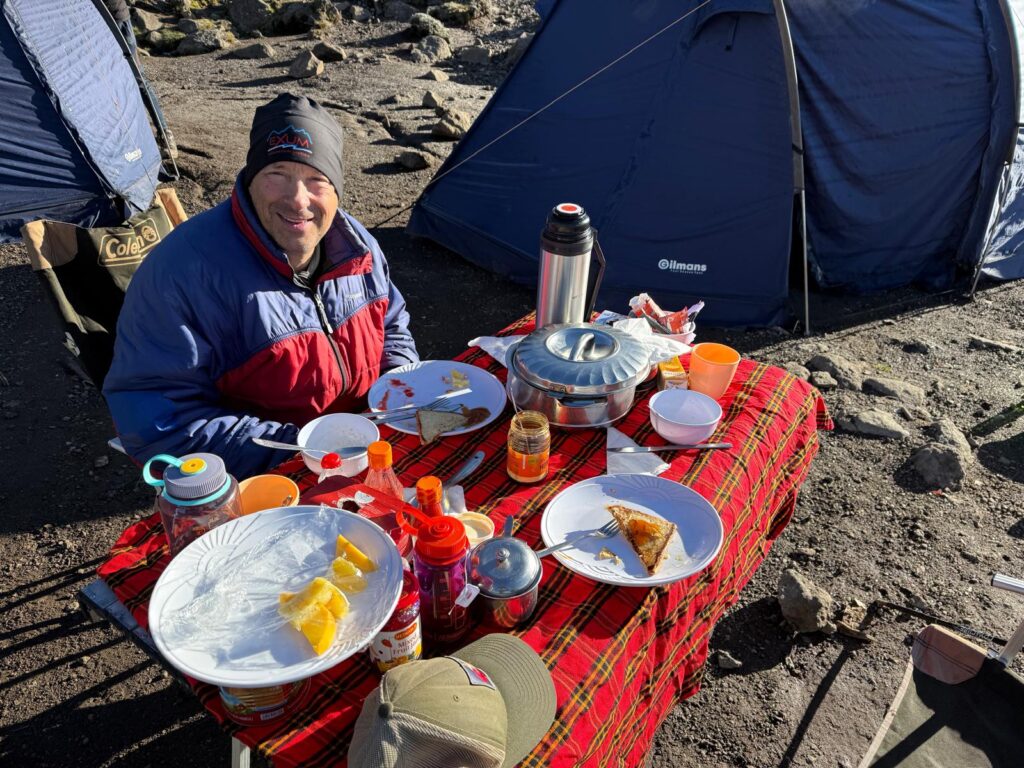
Lunch Alas, now that I’m moving up the valley, the rooms are getting more, well, you can see for yourself. I still have a private toilet, but you have to manually flush it by pouring water in it. There’s no hot water. There’s no heat. No more electric blankets. It was 38 degrees in the room when I woke up this morning.
Who picked the green paint?
This is how they get power in these small towns. A pipe with gravity pressurized water spins a turbine in the little shack. 
Sweet sweet electricity. I could be living off of battery packs for the next week. If so, then no more iPad. We’ll see. 4 responses to “The Khumbu Climbing Center in Phortse”
-
Wishing you all the best on your journey! Loved reading through your posts so far, as well as the picture of the yak!
-
Yay, Tom! Excited to see your updates. Xoxoxo
-
Tom, I have another friend at Everest Base camp that is waiting for permits for Lhotse I think? When will you arrive there? Keep an eye out for a dark haired American gal named Tracee!
-
Fun reading your blog, and I shared it with my students, since we are studying pilgrimage accounts of Tibetan mountains! Good luck.
-
-
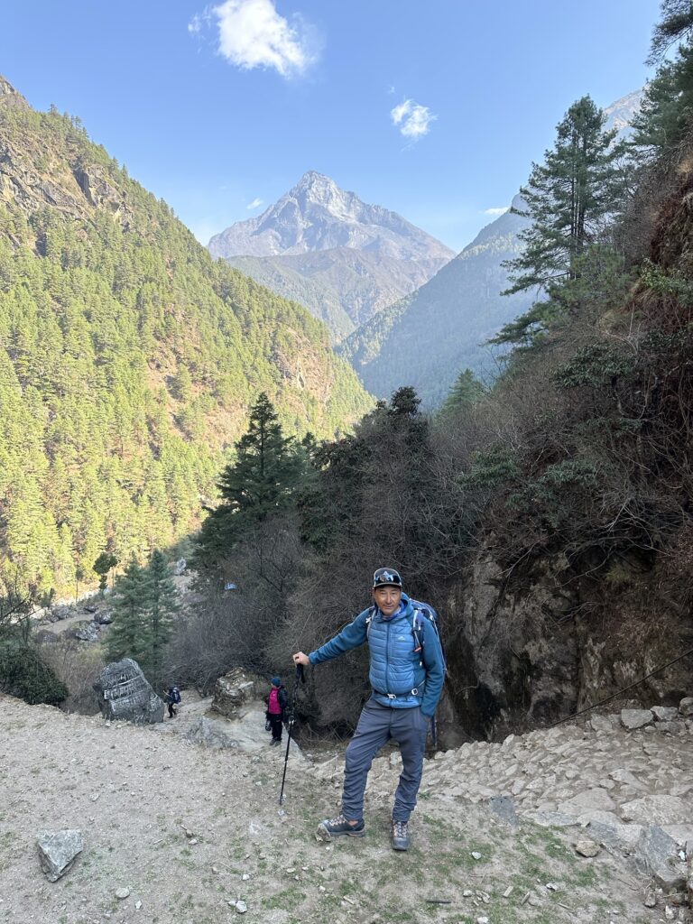
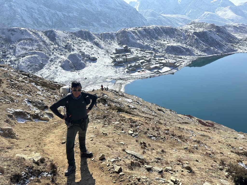
Day 7 + 8: up to Gokyo.
Saying goodbye to the Stupa at Phortse Gokyo is widely regarded as one of the more beautiful destinations in the Khumbu. I had been here back in 2009, but unfortunately we had bad weather. The views from a bump above the town (Gokyo Ri) are reportedly 5 star, so I intentionally planned my route through here in the hopes of getting to see it with blue sky.. Plus, this allowed me to spend two days hiking up a valley that I haven’t been to before, and I’m always up for exploring.
That’s Cho Oyu. The 6th highest mountain in the world. I’ll spend two days hiking towards it. 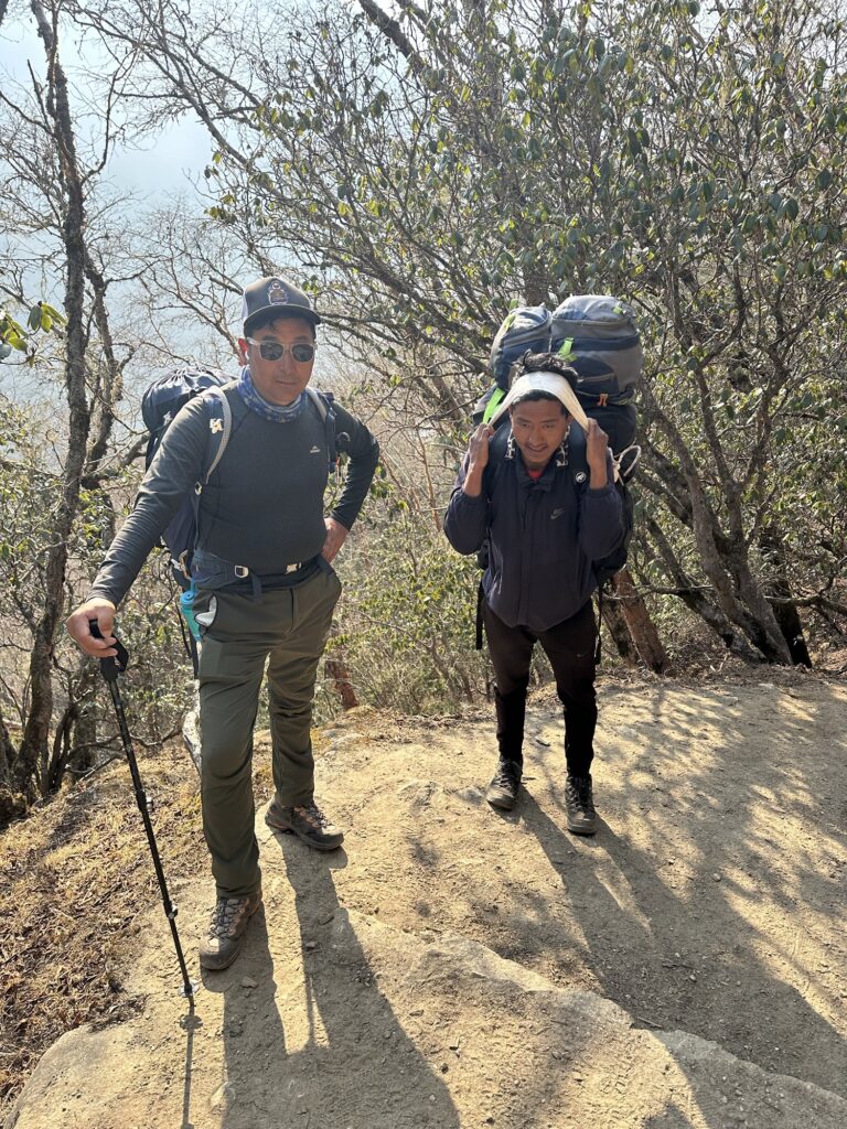
Galzn and my porter (who doesn’t speak any English) 
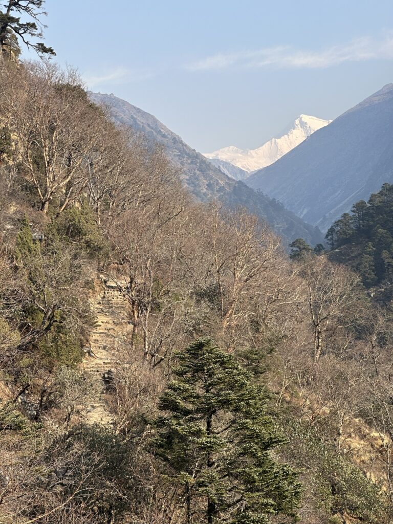
Looking down valley On this day we’re climbing up 14,000 feet. Timberline is around 13, so this is the day that we leave the trees behind… for the next 7 weeks.
The mostly level bump on the ridge not too far above us is the Khonar ridge that we hiked up from Phortse on Day 6. 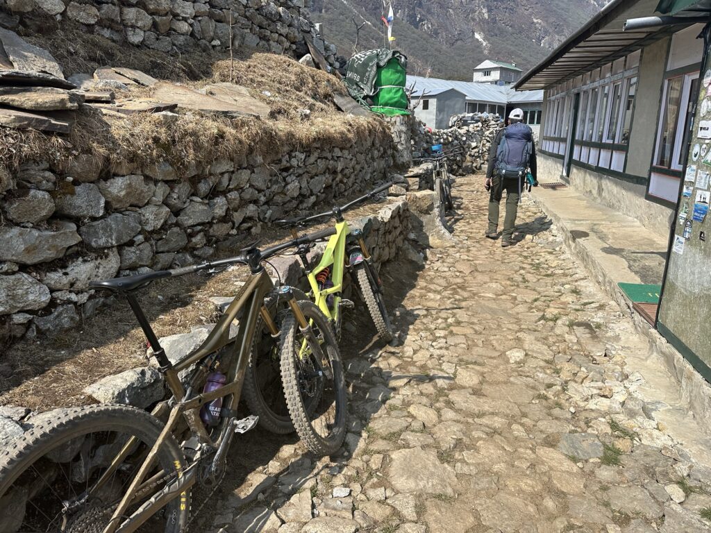
This is hardcore. 4 Frenchmen riding up to Gokyo… in other words, they are riding uphill on rocky trails sidehilling the whole way, up to 15,000’. Damn. I was keeping my eye out for them, but unfortunately they must have passed us when I was using the rest room.
OK, yes, there was some level trail. 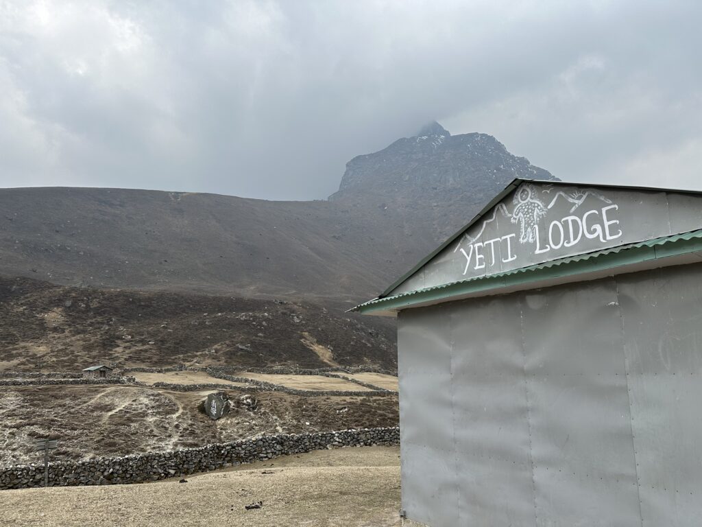
The Yeti Lodge at Manchermo. You can see Yaks grazing on the slopes above. This was probably the hardest day so far, although it wasn’t that hard. 5 hours, 6 miles and almost 3000’ of climbing. The lodge is at 14,400’, which is historically where I start feeling the altitude.
There was no internet here so I had the day off.
One of the joys of trekking in Nepal is the burning Yak dung. At least it warms the room. The smell is unique to Nepal (at least for me). Yes, it’s horrible, but I associate it with good memories, and I’ll take it any day over the brush fire smoke from India.
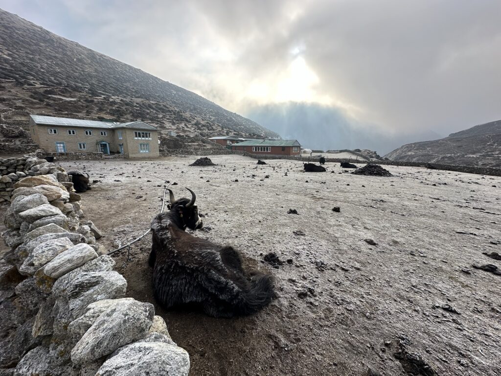
Those piles in the middle of the pasture… that’s firewood. 
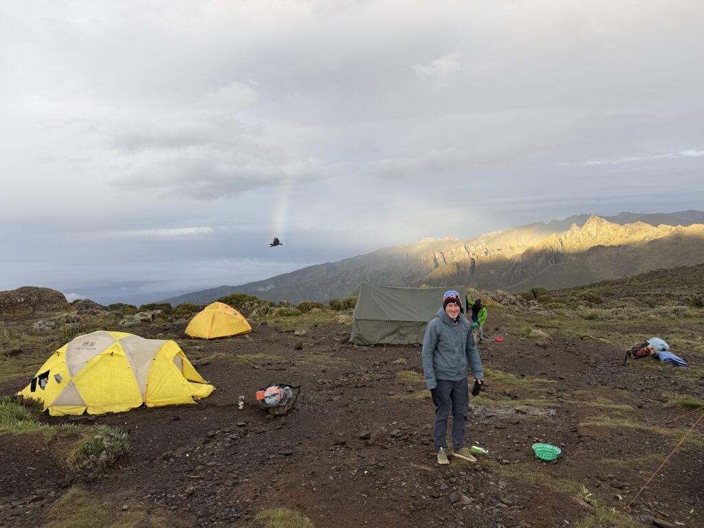
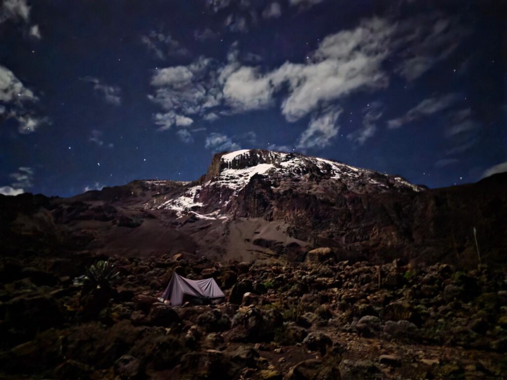
A sunny morning, and at almost 15,000 feet, I’m finally getting about the haze. Last night was the first night that I’ve seen a star. It took long enough. It’s been pretty cloudy except for a few hours each morning.
The hamlet of Gokyo Gokyo is at 15,600’. While I have been blissfully unaware of the altitude up until this point, I now have a headache, loss of appetite and I feel tired and achey. (whose idea was this anyway?) I’m just sleeping the afternoon away, and honestly, it’s a bit of a struggle to write this post. I’ll talk more about the altitude another day. For now, I’m going to sign off and lie down. The plan tomorrow is to hike up Gokyo Ri, which is over 17,000’, and then return to here. If we were going to leave right now, I would pass. We’ll see.
10 responses to “Day 7 + 8: up to Gokyo.”
-
Wow, I didn’t realize how dramatic the Gokyo scenery was without low clouds! Amazing. And yes, I’m still hoping that those pants accidentally fall into a yak dung stove and burn up.
-
As I recall, when Exum gave me these pants, you said “don’t ever wear them in my presence again.” I have kept my word. However they look, they are comfortable.
-
-
Tom, Fantastic,
Alex -
Way to go my friend!
-
Loving the videos and write ups! Thanks for the vicarious trip … sans the altitude headache. Feel well!
-
I hope the headaches dissipate like the smog did. The scenery is amazing!
-
Following your journey Tom. Thank you for pointing out details in your pictures, which I would have missed.
I’m with Dede- the pants are a fashion fauxpas. 🤪
-
Haha, thanks for the backup, Cathy!!!
-
-
Views stunning. What’s wrong with your pants?
-
Your eyes don’t hurt when you look at those pants?!
-
-
-
Day 9: sick day
Well, the weather is gorgeous this morning, but alas, we’re not hiking up Gokyo Ri. I came down with a cold yesterday. If this were at home, it would be unremarkable. At 15,600’, with my sinuses filled, it’s hard to breathe. It was a long night.
I made it to the night of day 8 before digging into my med kit. I’ve now started taking Diamox.
Does this mean that I don’t have to wear my n95 mask anymore? I thought I had a secret weapon… not.
Time to go back to bed. I knew that this was coming. I’m well prepared. It just sucks in the moment.
7 responses to “Day 9: sick day”
-
Nooooooooooooooo!
-
Feel better Tom. Maybe good to get it out of the way. 😘💪
-
Hope it passes quickly!
-
Get better!
-
Get some rest and fight it off! Hope it passes quickly.
I’m enjoying following you. We are cheering for you!
-
Get well soon Tom!
-
Hang in there, TB. Don’t get discouraged. Give it time and it’ll pass. You’re resilient beast and will bounce back. 🙏🏾
-
-
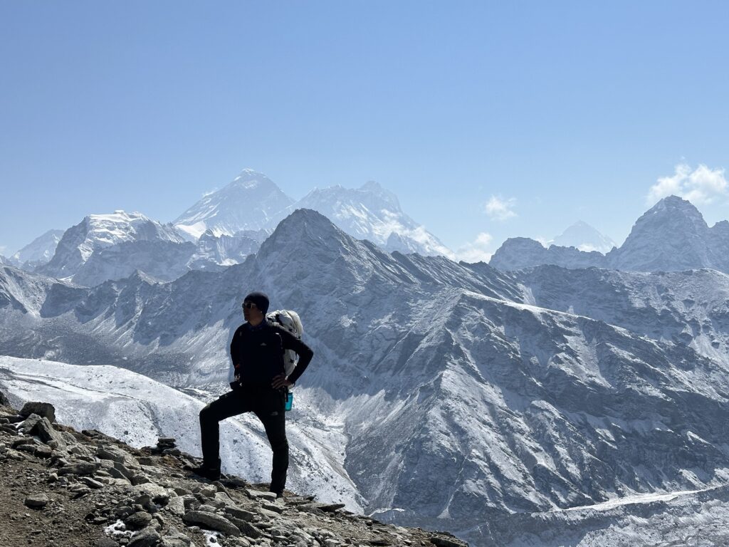
Day 10: Gokyo Ri
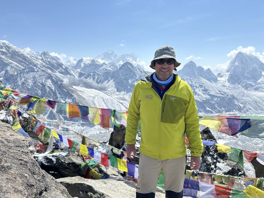
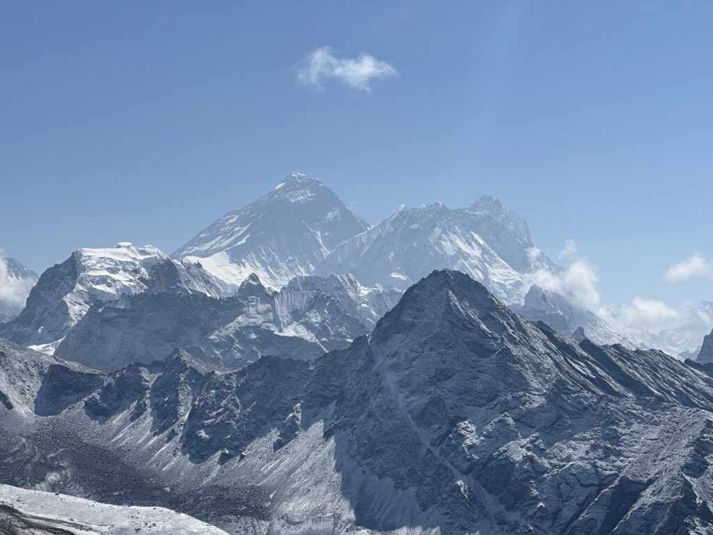
On top of Gokyo Ri with Everest behind me. At 17,600, I have roughly 11,500’ to go. This cold is still hitting me hard but I really wanted to go up Gokyo Ri. It’s a pretty easy hike… about a mile and 2000 vertical feet. Realistically, If I couldn’t do it, then I might have to reevaluate our plans to go over the Cho La, which is a pass of about the same altitude which we plan to go over in 2 days. In a way, this was a test. Turns out, it was pretty easy. It took 1.5 hours up, and the views were worth it. And keep in mind that I literally chose to go up this valley for this hike.
Getting started. The astute among you may notice that Gallzn is carrying my pack. I think he took pity on me due to my coughing. 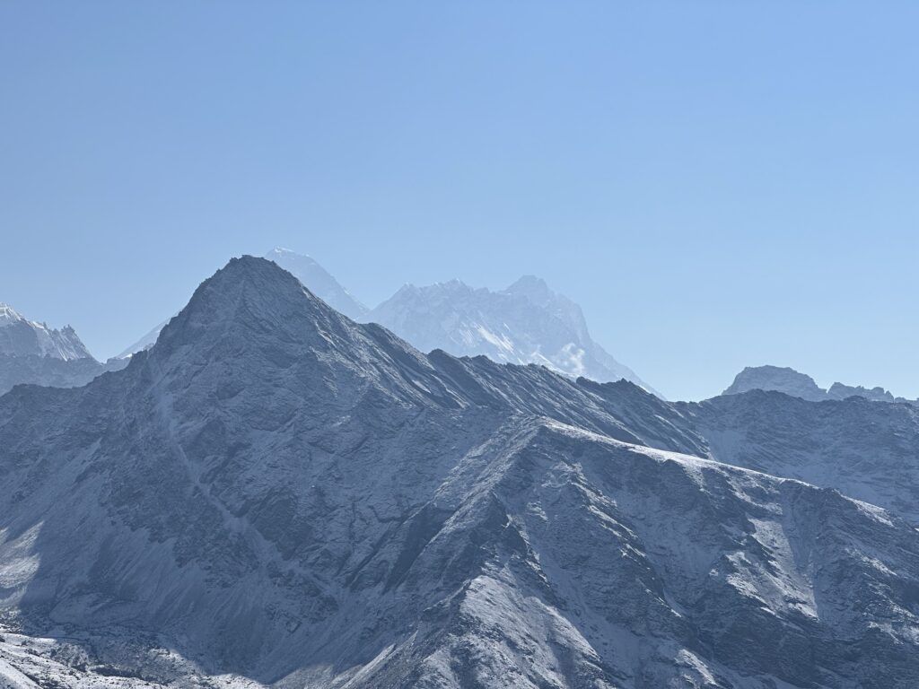
On the way up with Everest just poking up behind the foreground peak. 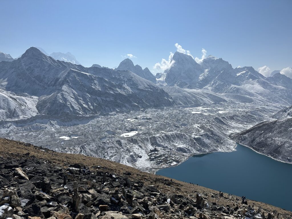
Only 11,500 vertical feet to go 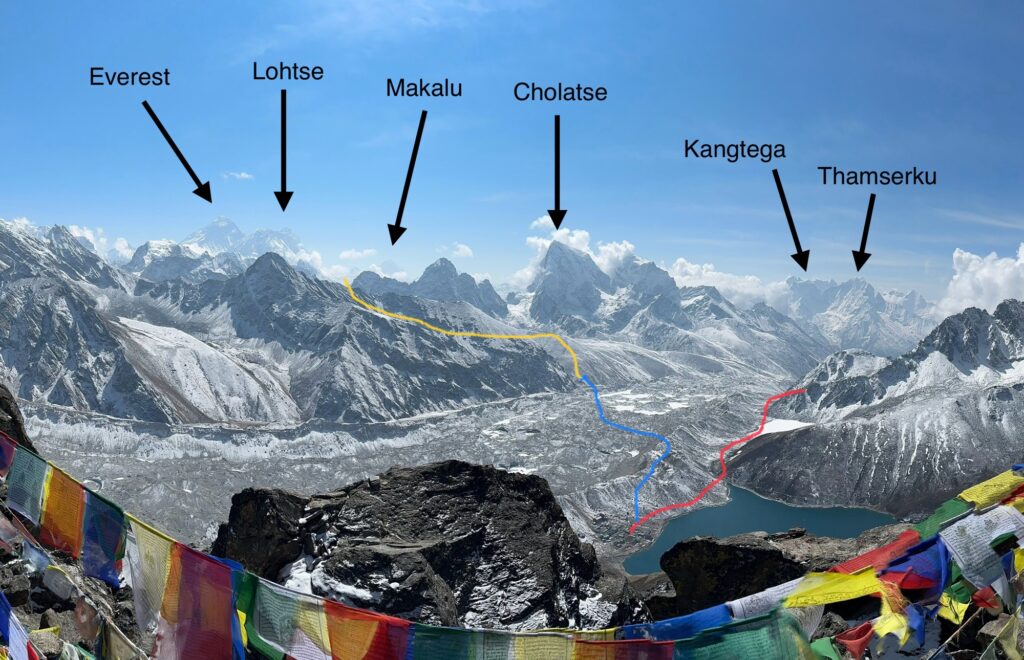
the red line is our approach to Gokyo 2 days ago. The blue line is tomorrow’s short crossing of the glacier to Dragnag, and the yellow line is our rough path to the Cho La, a 17,000’ pass that will return us to the main drag to EBC. Note that the our actual path to the Cho La is hidden behind a ridge. The yellow line just shows its general location. 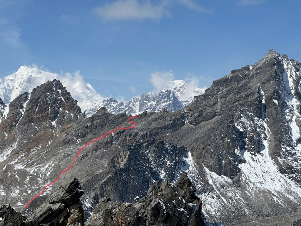
The Renjo La. I had descended the red line in cloudy weather back in 2009. 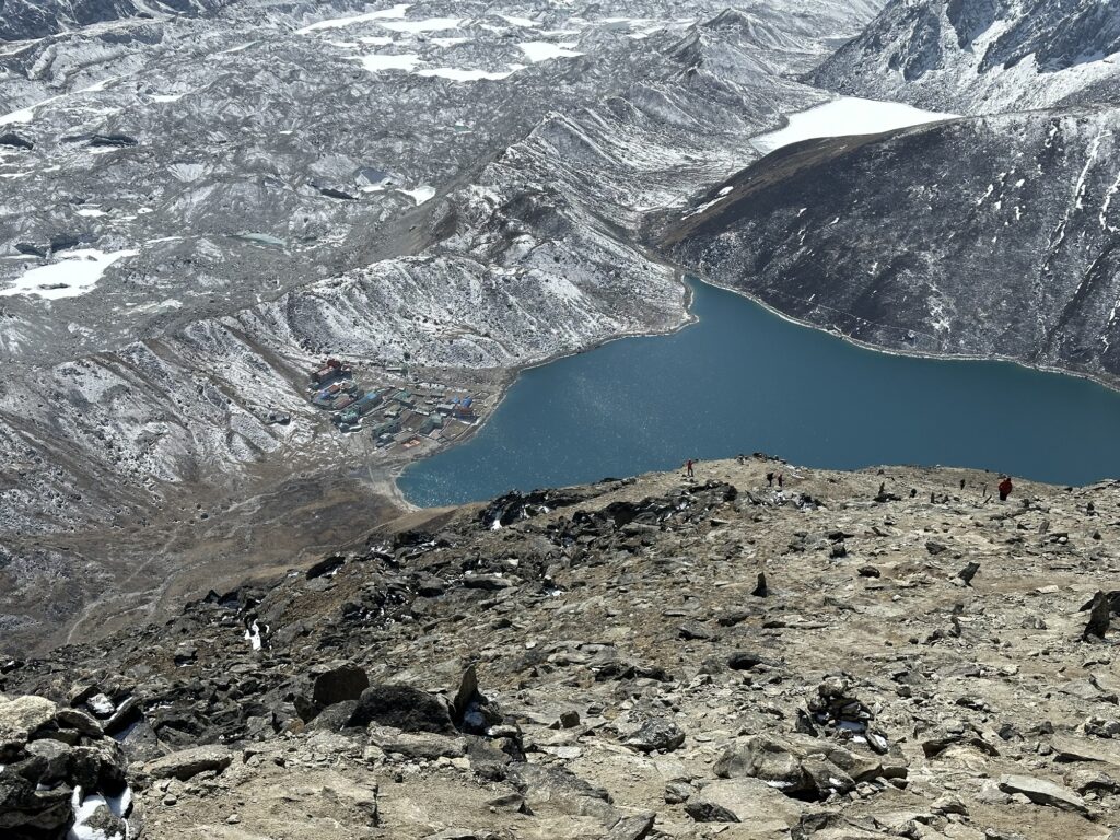
Climbing at altitude is all about deprivations. This cold just brought them on sooner than I was expecting. That first night was pretty miserable. As I’m writing this I just had Dal Bhat for dinner and it was the first food that I actually wanted to eat in 48 hours. Assuming that the worst is over, this only put me back one day… these kind of delays are built in to any Himalayan itinerary. No big deal really.
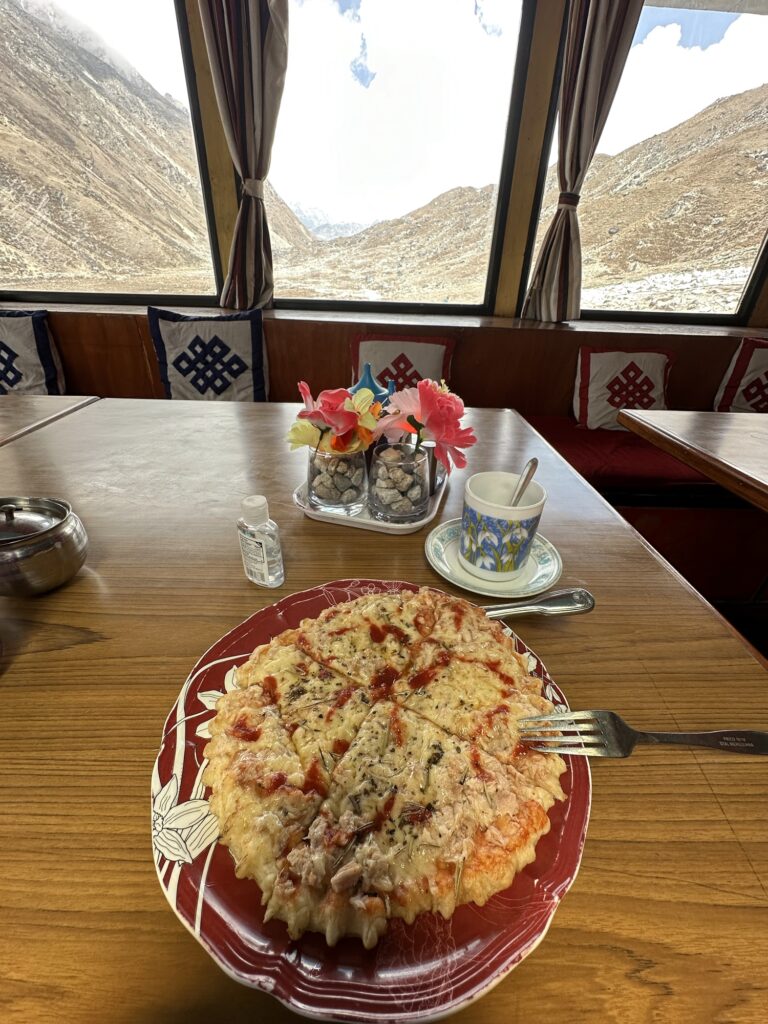
When we got down from Gokyo Ri this morning, I tried to eat lunch. I’ve had good luck with the Pizzas around here… We’re not in NYC but I’ve found that they are pretty easy to get down. Despite going out of my way to specifically say that I only wanted a cheese pizza, this one came with tunafish on it. The timing of this could not have been worse. Did I make fuss? Nope. I ate a few bites and went to bed.
I didn’t puke it up… so I got that going for me.
Ttunafish on a pizza is an abomination in the eyes of god. I’m sure it says that somewhere in Leviticus.
I’ve been warned that the next two nights might not have internet. Hopefully I’lll be back to my normal self for my next post.
Cheers.
6 responses to “Day 10: Gokyo Ri”
-
Looking good Tom! I think if God had wanted us to have tuna on pizza, he would have mentioned it on day 5 in Genesis🐟
-
Tom, have been thinking about you daily as I summit Venice’s Rialto Bridge but only just bingeing on these entertaining texts and exquisite photos!! I’m learning so much and am fascinated by this adventure. It sort of blows my mind that we are inhabiting the same planet earth: while I’m in Venice, mankind’s ultimate urban marvel, you are experiencing raw, powerful, majestic nature on a scale that really puts mankind in its place. I’m so sorry you’re sick, but hopefully, as you say, the worst is past for now. Hang in there!! Love from sea level ❤️
-
It looks so magnificent the views are amazing –
I just talked to Dede to figure out how to write you and she said you had gotten a little sicker – the comment on your blog sounded like you had a cough but now it is different so good luck with that –
It is just so amazing to be sitting at the top of the world like that I can’t imagine the sensation –gorgeous !!
love from sea level
xx -
I have a friend currently at Everest Base camp. She’s done Everest previously and is just acclimatizing while she waits for a Shish permit and then she’ll do that and double back for Lhotse. Her name is Tracee Metcalfe and she’s in the Imagine Nepal tent site. They have round white tents with a pic of binoculars on them and they’re by a row of red square-ish looking tents. I told her to keep an eye out for you in case she’s still there when you arrive. She asked what camp you’ll be in at base camp, but I didn’t know. She’s about 5’6 w/dark hair. Just in case you want someone to play cards with on a rest day. 🙂
-
Tom,
Incredible adventure! I am in awe of your tenacity. Thank goodness for clear fresh (albeit thinning) air. Hard to imagine having to climb Himalayas in acrid, nasty, toxic smoke. As if it weren’t hard enough. Incredible story unfolding. I’m so with you…P.S. The tuna mac and cheese in the Winds (back in the day) was off the charts delicious. On a Pizza? You are a brave sole, cousin. Stay well, be strong, and climb with the force of nature itself.
-
I hope your cold is better by now. Love all the pictures you are sharing. Sending you lots of good vibes. XO Kit
-
-
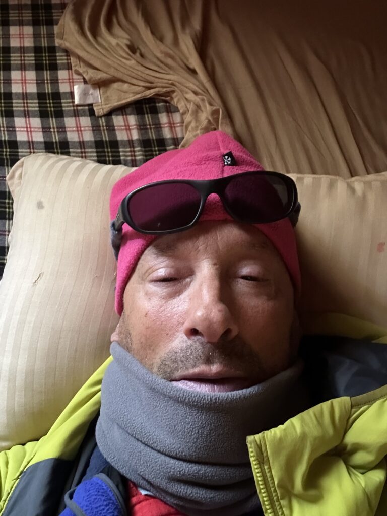
Day 11: Getting really sick
I woke up with the bed spins… like I drank too much (just to clarify, I haven’t had a drop of alcohol since February). Since today was to be pretty short, I thought I could push through it, but a half hour into packing up, Galzn came to my room, and I promptly threw up the water I had drunk that morning. Interestingly enough, my dinner didn’t come up, so it was digested.
I lay back down. It got worse. At some point, I called a doctor in the US. He said that my symptoms resemble positional vertigo and gave me some head exercises to try to relieve it. I did the exercises at least three times. It got worse. No position seemed to provide any relief. The only drugs I took, on the recommendation of the doc, were Zofran and Valium. Next morning, at first light, I knew I was in trouble. I couldn’t functionally move. I was convulsing and dry heaving pretty regularly at this point. I felt like I was dying. I called for a helicopter.
I’m going to guess that the Heli arrived around 8 AM-ish. Galzn packed my stuff up and dressed me and put on my shoes. I was carried to the heliport about 200 feet away. I was dry heaving as the Heli landed about 6 feet from me. I flew down to Lukla with my eyes closed.
Since I’m writing this a week later, I’m going to go off on a tangent here: As a former NY State EMT, and current WFR, we’re regularly trained in the use of supplemental oxygen as a literal lifesaving drug to be administered to the injured. Now, since I was an EMT in college, I couldn’t resist cracking the O2 and taking a hit. I am human, after all. Well, if you’re wondering, taking a hit of oxygen when you’re healthy does nothing at all… you don’t even notice it… And if you think about it, this is perhaps a really, really, really good thing, as it means that when that ambulance arrives, those oxygen bottles will all be full.
Now flashback to January 2011. I’ve just broken my leg skiing out of bounds at the Jacksonhole Mountain Resort. It’s a bad break. I’m know that I’m in shock because my hands are bone white. A ski patroller arrives, one who had a locker right next to mine. He didn’t chat me up. He didn’t ask me what my chief complaint was. He just said “hi Tom, I’m going to put some oxygen on you”. I must have looked like I needed it. When he did, I could feel my level of consciousness rise… almost immediately. After all my first aid training… after all the talk about taking supplemental O2, I got to experience it myself, and it turns out, supplemental O2 works.
When I landed in Lukla, at 9000’ above sea level, 5500’ lower than Gokyo, I could feel my level of consciousness rise. It was the exact same sensation.
I still convulsed heavily on the tarmac when I got out of the helicopter in Kathmandu. And I made quite the entrance at the emergency room at the CIWEC hospital (basically a medical clinic for westerners in Kathmandu). They sent whatever involuntarily came up out of my stomach to the lab, and sent me to get an MRI. I spent the first night in ICU, and then moved to a regular hospital bed. I saw every doc on staff, plus maybe a few more. It was hard to keep track. They all wore masks. They all wore nametags, but not in an alphabet that I can read. Mostly, they all asked me the same questions.
My violent symptoms went away very quickly. I don’t think I dry heaved again after my entrance. The spins and nausea went away quickly. I can’t give you a timeline on that because it’s just too much of a blur, but maybe a couple of hours????? I know that when they took me for the MRI, they tried to seat me in a wheelchair and that didn’t work, so they put me back in a gurney.
An ENT (Ear Nose + Throat) surgeon came by and twisted and threw my head around… nothing. Whatever was triggering my vertigo up in Gokyo had gone away within 24 hours.
Two days later I was released from the hospital. I could have stayed longer, but I wasn’t really sick anymore. I’ve spent the last week at the Yak and Yeti Hotel.
So, how do I feel now? Do I feel healthy? The answer is no. I’m not a pot smoker, but what I feel at this moment – a week later – is comparable to having smoked some pot, and the high is coming down, and you just want to sleep it off. In this case, sleeping doesn’t make it go away. When I walk the streets I feel like I have mild tunnel vision, and I feel slow. And worst of all my appetite hasn’t come back yet. If I have to feel stoned, at least make the pizza taste good. It doesn’t.
Something happened to my brain up there. I don’t know what it is. My symptoms don’t fit any classic altitude illness. With each passing day, it is getting better, but my day to day progress has slowed. I have had some very experienced doctors discuss what I have. There is no consensus. The MRI shows a “micro-haemorrhage in the left centrum semiovale”, which could be a sign of HACE, but I don’t have any of the other classical signs or symptoms of HACE. If it is HACE, it’s a one in a million case. Am I that special?
Let me just say that the diagnosis isn’t over yet. I’ll send the MRI pictures around when I get home. As previously mentioned, I’ve had some of the most experienced high altitude doctors look at my case. Nobody really knows what’s going on.
Can I go back up? If I felt fine, then it’s a fair question. A lot of people come down with HAPE (which is a different altitude illness altogether) and spend a week or two in Kathmandu, and then successfully go back up when all the symptoms have gone away. When it affects the brain, people get more cautious. HACE is much rarer, and has historically been viewed as more serious. Some would say that if I actually had HACE, that I shouldn’t go back to that altitude ever again…. But as I write this I’m hearing doctors yell at the page: “you did not have HACE!!!!” More on that perhaps in a future post. For now, I’m getting ahead of myself. Back to the question at hand…
Can I go back up? If I felt fine…. Perhaps yes. Unfortunately, I don’t feel fine. Something happened inside my noggin. Today I finally accepted the fact that I can’t go back up… not this week. Not this month. I like my brain. I have to let it heal.
Jiban, the owner/operator of the trekking company I’ve been using, was there in the Emergency room when I arrived and I think I made quite the impression on him. He’s not a doctor, but he candidly told me a few days later that it’s time for me to think about things other than Everest. I don’t know if he would fly me back to the Khumbu even if I threw a wad of cash at him. What he saw spooked him. I was sick. I was really sick. Maybe it’s time to go home and count my blessings.
Obviously, there’s a lot more going on inside my thoughts than I’m revealing in this post. Forgive me but I’m not mentally ready to confront the disappointment of it all… not yet at least. So, from Kathmandu, I’m going to sign off for today. Thank you all for supporting me on this all too short of an adventure. Cheers.
23 responses to “Day 11: Getting really sick”
-
Glad you are recovering, Tom.
-
hello dearest tom
so really concerned maybe not more climbing soon !
much much love
mary ann
-
-
Oh Tom. Sending a big hug and lots of love. I am so sorry. XO K
-
Holy smokes Tom, I am glad you are okay. Regardless of what it is, I am glad you are coming home. As you have heard me say before, it’s hard to be smart, but it’s a good idea!
-
Sometimes the odds are not in our favor. I’m glad to hear that you are on the mend. Lots of good years ahead! Take care of yourself, my friend.
-
So glad you are recovering! Be safe. Alex
-
Whoa cousin, that’s a heart stopper of a story. Thank goodness you were able to be flown out, and down. And thank you for returning alive. I can imagine the level of disappointment is excruciating, AND you have SO much to be grateful for. Do I need to say this? No. But there it is. Practice gratitude for the trip, the adventures you had, the vista’s you took in and be grateful you get to come home to Dede, the rest of us who love you, and some damn good pizza!!! Wow.
-
Tom., I am so grateful to hear from you and to know that you’re recovering. We are so sorry this happened. We love you.
-
Bummer on the trip Tom.
Glad things appear(??) to be resolving. Hope that trend continues. Enjoy what you can while you’re there. -
♥️
-
Gee! Frightening stuff, Tom.
Thank goodness you got down fast (well, once you decided to drop altitude), as on the trajectory you were on, who knows how bad it could have been…
A major disappointment to have to bail, but then in mountaineering, the failure to bale when you must is the prelude to the biggest disasters.
Congrats on a wise decision, and all the best to heal up fast. -
Hey Tom sorry you got sick. It’s so hard to avoid along the trail. It’s frustrating I’m sure not to know what actually happened. Either way it Wasn’t fitness or training, so out of your hands. I feel frustrated for you. I know you want to go back up and join back in, but it’s not advisable. Anyway I don’t know what, GDI
-
Been tracking the news via D and sending love your way. TTYs. Oxo
-
What a ride. I’m glad you got good care around you. Such a disappointment too. Best of luck on the ongoing transitions and travel.
-
I am so sorry your adventure has been cut short, but I am so relieved you were able to get down and into a hospital so quickly. Sending you love and best wishes for answers, a speedy recovery, and new adventures to come.
-
Just catching up now and I am so, so sorry it ended this way, but so happy you are OK! Rest, heal, and thank you for sharing your adventure and your amazing photos.
-
I’ve been following your trek on this blog. What an amazing adventure! Beautiful photos. Thanks for letting us share your experience.
There’s no shame in pulling the plug on this project. Unless you make a miraculous recovery, it’s probably time to turn around. That mountain isn’t going anywhere. Your many friends want you to be around.
Full respect for your efforts. Feel better soon!
Tim
-
Hey Bud, give Dr Peter Hackett a call, you may know him. He ran the med clinic on Everest and Denali in the early days. HAPE/HACE expert!
-
Time and love are learnings currency. You have time; you are loved.
-
Glad you’re taking care of yourself.
-
Tom,
Glad you’re doing better. I wonder if you had vestibular dysfunction from a viral infection, as you were sick with a cold prior to getting really sick. Regardless, we’re all happy to hear that you’re improving!Having experienced BPPV (Benign Paroxysmal Positional Vertigo) more than once, and having had to retreat from summiting 2x on Denali (due to other factors), I can relate to what you may be feeling. Disappointment is hard after all the planning and effort.
You made the right call with your symptoms. It’s harder to be smart than stubborn. And all your friends and family are happy you’re smart!
-
I am just glad you decided to come down when you did! Many people, I think, might have tried to wait it out. Good call. So glad you are getting better!
-
Tom: We are just catching up on your adventures and are really sorry to learn what you have been through. We are relieved you are safe and hoping you continue to feel better. We can’t imagine how disappointed you are. One day at a time…
MB & G
-
-
Looking back on Everest…
I’ve been home for three weeks. The cold is finally going away. I still have very mild vertigo when I wake up, or perhaps more precisely: when I sit up from lying on my back. The vertigo lasts about 5 to 10 seconds and is then gone. There’s no nausea and I don’t feel it in the slightest when I’m up, but it does remind me that only a month ago I was as sick as I’ve ever been. I’m now skiing and hiking and soon to go climbing. I’m weak, but I’m on the upswing, and I’m looking forward to summer.
So what happened? There is no easy answer to this. I’ve had a handful of doctor appointments and consultations, including with some very experienced high altitude docs. What I had was probably just a viral cold that migrated into my vestibular system, which somehow triggered what is called “benign positional vertigo” (whoever came up with “benign” has a very dark sense of humor). No, this has never happened to me before. I’ve always been prone to motion sickness, and I’ve traditionally medicated myself when going on a boat, but this was something entirely new.
My symptoms aren’t textbook: nobody has yet answered why the vertigo mostly went away immediately upon descending to a lower altitude, nor does it explain my reduced level of consciousness which again went away immediately upon descent. The docs always ask if I have tinnitus which is commonly associated with vertigo. Of course my ears are ringing, and have been ever since that Who concert back in high school… are there any 61 year olds in America whose ears aren’t ringing?
The good news is that I probably didn’t have HACE. That’s the serious altitude illness that involves swelling of the brain. Apparently, if I had HACE it would have showed up on the MRI, and I’ve now had some of the best doctors in the country look at the MRI, and I’m deemed HACE free. I can also rule out a tumor and a worm in my brain. Phew.
It’s not over yet. I’m going to SLC next week to have a vertigo specialist take a look at me. We’ll see what they say. Unless they can find some pathology (which so far has not been found, beyond the simple sinus cold), the treatment for vertigo is time. So far that seems to be working. I’m feeling better every day. But it’s hard to grasp that only a month ago I wasn’t able to walk on my own 200 yards across level ground to a helipad.
About to be carried to the helipad at Gokyo. Galzn had dressed me up. Can I go back? Can I give it another try? Let me get back to you on that. Let’s see what the vertigo docs say. You know how when you recover from a cold, you pretty much forget how bad the cold was? Well, this isn’t like that. I’m a little shell shocked by how sick I was. The memory is still with me.
15000’ is not that high. I’ve probably been to that altitude at least two dozen times in my lifetime. I’ve always acclimatized well, especially compared to my partners. In this case, I never even had a headache, which is the number one symptom of any altitude illness. Obviously, I should be grateful that this happened at 15,000’ instead of 25,000’, but I would be even more grateful if it never happened in the first place. It’s all so humbling. I was still 4 days away from even reaching Base Camp. I had a long way to go. In Grand Teton perspective, it’s as if I was helicoptered out of the Meadows on my way up to the Lower Saddle. I wasn’t even close to the summit. Whenever I say this out loud, I can only laugh.

Perhaps my mantra going forward. It beats crying about it. With that said, the summit window is starting this week. I won’t deny that it’s still burning inside me…

Yesterday’s Everest summit forecast from Chris Tomer I paid for that forecast. Speaking of money, everybody asks if I’m going to get a refund. Does anybody know a good lawyer in Kathmandu to get my money back? In all seriousness, the money is gone. I don’t begrudge the operator – Shangri-La Treks – in the slightest. They had to set up base camp infrastructure, as well as camps on the upper mountain. The money was already spent. This is my third trip with this company, and they’ve always delivered. And in this case Global Rescue refused to fly me out (insurance companies only make money by saying “NO”), and after arguing with Global Rescue, Jiban just said I’m sending a helicopter now. That’s what I needed, and that’s what I got. Thank you Jiban. If I ever go back, I’ll go with you again. No doubt about it.
If….
2 responses to “Looking back on Everest…”
-
I have enjoyed doing things poorly for a long time – its not that bad. I do, however, surround myself with outstanding company! Glad to have you back and on the mend Tom.
-
So glad you’re doing better and that it wasn’t the more serious diagnosis. You have handled all of this with such grace and good judgement – it’s inspiring. I hope pizza tastes good again!
-
-
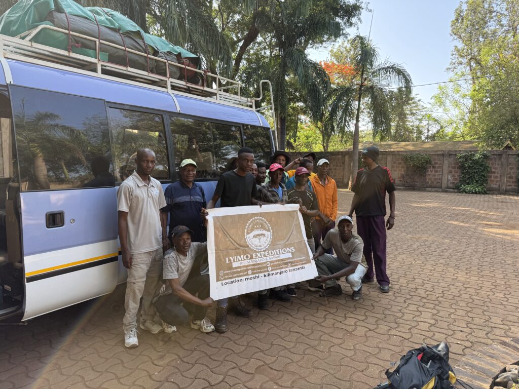
Intro to Africa
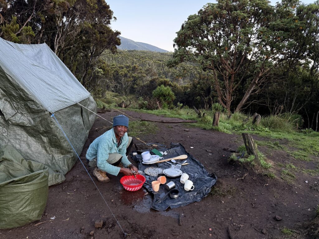
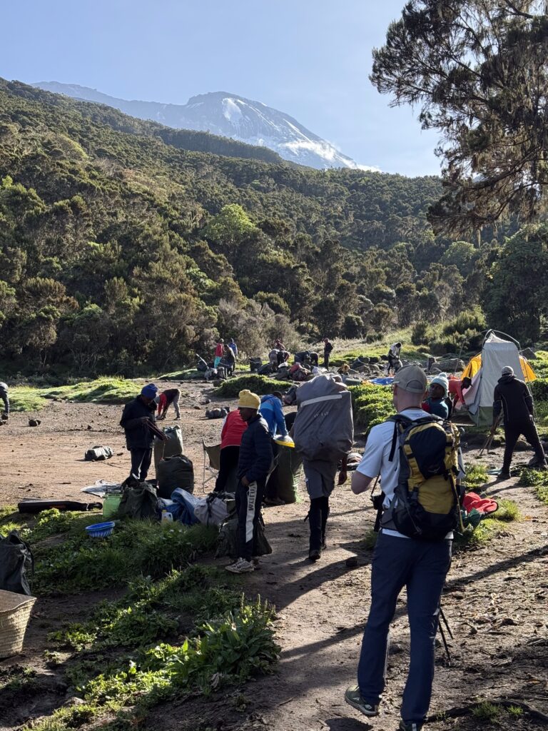
I’m writing this from camp 2. I haven’t had time to write anything up to now. 36 hours of traveling brought us to our hotel in Moshi, Tanzania at 2 AM. The hotel was having plumbing problems so neither of us were able to take a proper shower (Dan I think is still wearing the soap) and at 9 am we were driving to the trailhead. We were hiking at noon and arrived at the Machame camp in pouring rain at 5 pm. Mercifully, our tents were already set up and dinner came promptly. I may have fallen asleep a couple of times during dinner, but I somehow got through it and ultimately had a good nights sleep.
And that was my introduction to Africa. My only other adventure in what they used to call the third world was in Nepal, and thus it’s impossible for me to resist comparing the two, which isn’t really fair. In Nepal you fly to a cultural capital. Here you fly to their version of Idaho falls. And nobody lives on Kilimanjaro, just as nobody lives on the Grand Teton, so there is no cultural element to the hike. The trails are just as crowded, mind you, but there are no villagers on the trail. Rather all the hikers are just tourists like me and their guides and porters.
… of which we have 16… for us 2 westerners. I’m having trouble wrapping my head around that. Sixteen porters and guides! I can only imagine what they must think of us.
The hike itself has been, well, uphill. We started at 6000’ in a hot, humid rain forest. Trees at the start were 150’ tall which was quite lovely and serene. The trail went up an inclined plain for 4000 vertical feet. The serenity never changed which alas is the nature of hiking in a deep rain forest. No views whatsoever. At some point when the conversation stopped and I got tired of counting the sweat drops off my forehead, I put on headphones. And then the rain started and the umbrellas came out and we went from uncomfortably hot to uncomfortably damp and cold. Such is life in the mountains.
In comparing the hike to Nepal, at least the trail isn’t dusty. Muddy yes, but not dusty. My lungs feel a lot more comfortable here, at least so far. The dampness that insinuates itself into absolutely everything is a bit of a shock to the system, but what was I expecting?
2 responses to “Intro to Africa”
-
Hey Tom have a great climb! Glad to see a little snow in the background up higher in those pictures you posted. Dave
-
Ahhhhh…. The Rains of Africa. I was hoping you could avoid them. Love the blog, Tom.
-
-
Day 2 on Kilimangaro
Today we hiked straight up from 10,000 to roughly 12,600’ at the Shira Cave camp. The trail turned into a slippery scramble in places, which honestly made it more interesting. The trees got progressively shorter the higher we got and we started to get views. Overall it was a nice hike. I enjoyed myself. Our camp is near their version of timberline. Hopefully we’ll be able to orient ourselves tomorrow if it dawns clear like this morning. We arrived at camp in thick mists and we ate lunch in our dining tent in pouring rain… our timing was excellent It stopped raining at dinner and as I write this in the dark I can watch the many flashes of lightening in the distance.
Well, despite the easy hike, I’m tired so I’m calling it a day. My Bluetooth keyboard seems to be suffering from the dampness so I’m writing this with my thumb on my phone, which I’m not used to doing so forgive the typos. Internet is very spotty but I discovered last night that at 3 am I could get cell service. Hopefully history repeats itself so maybe in 6 hours I’ll be able to send this.
And it’s raining again.
Cheers.

One response to “Day 2 on Kilimangaro”
-
Love the pics – a lonely mountain arising from the plain.
-
-
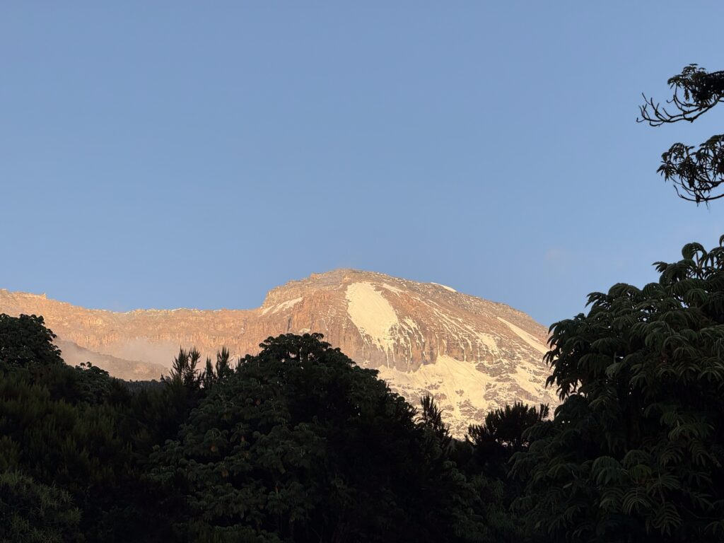
Day 3 on Kilimanjaro
Never a good sign when there are rainbows at breakfast.
Day 3 camp is already set up when we arrive.

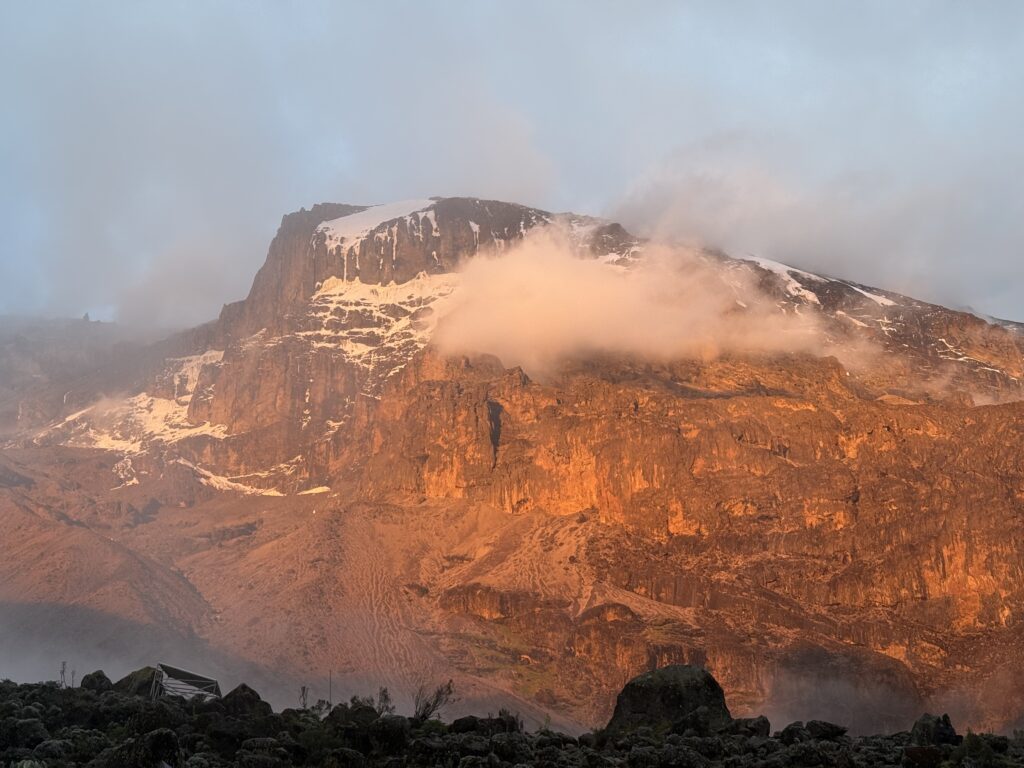
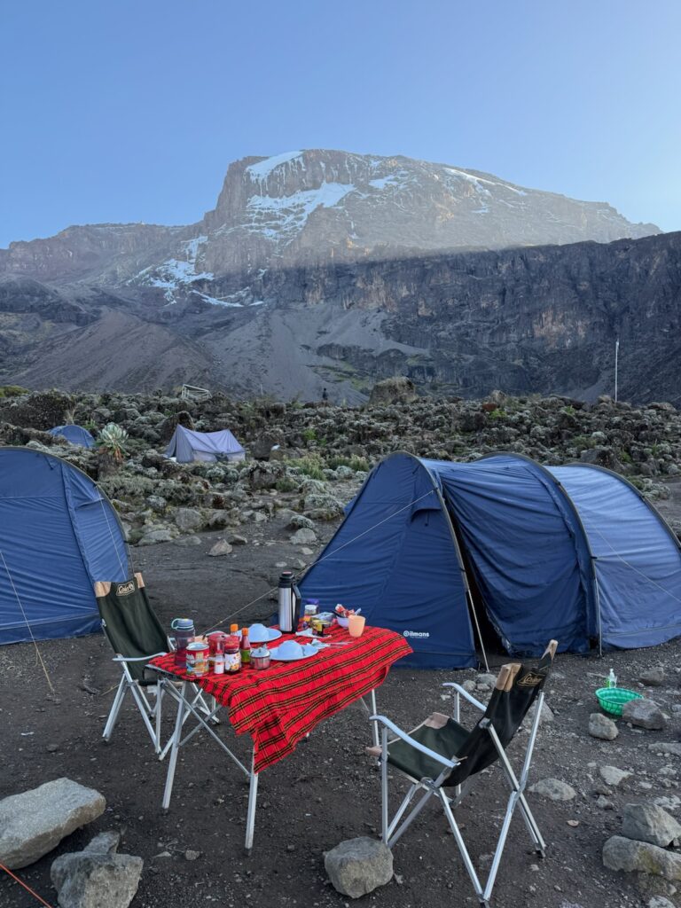
The clouds started breaking up in the evening. That’s the famous icicle in the book The Breach. The first ascent of which was ultimately done by Reinhold Messner.
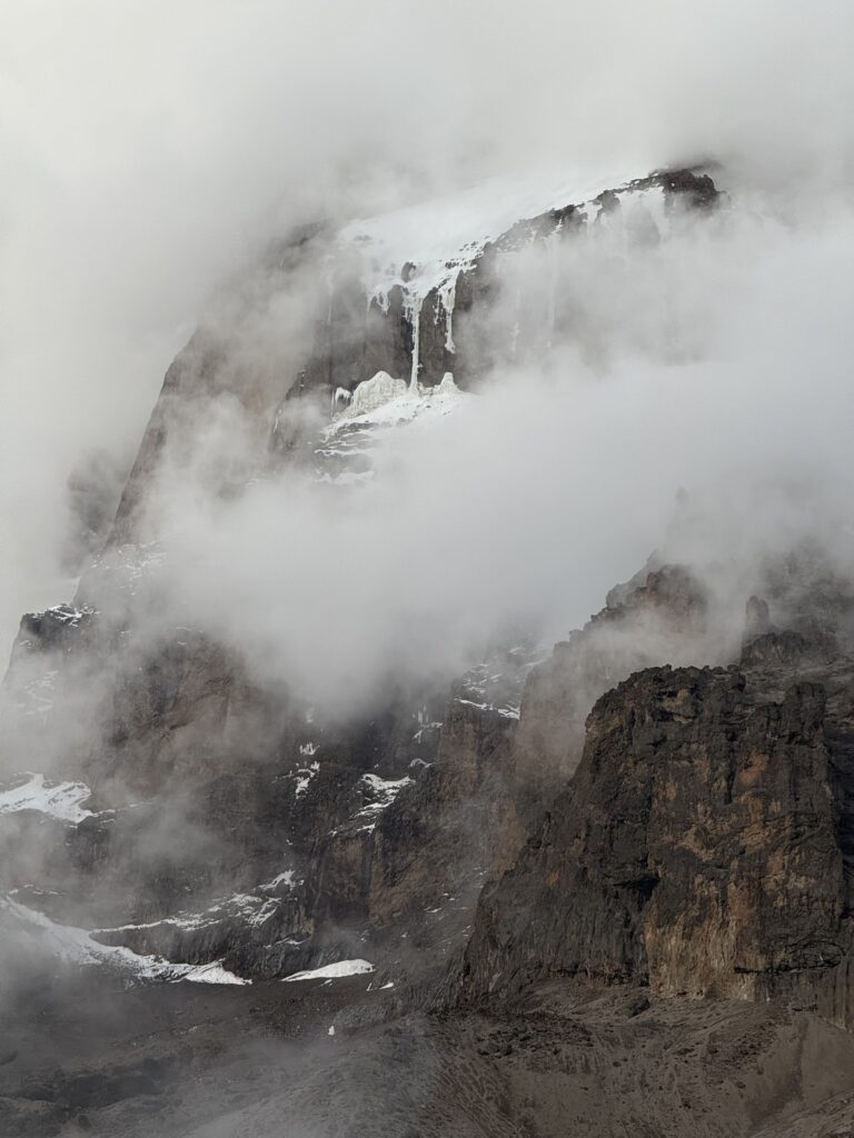
Evening light on the 6000′ Breach wall.
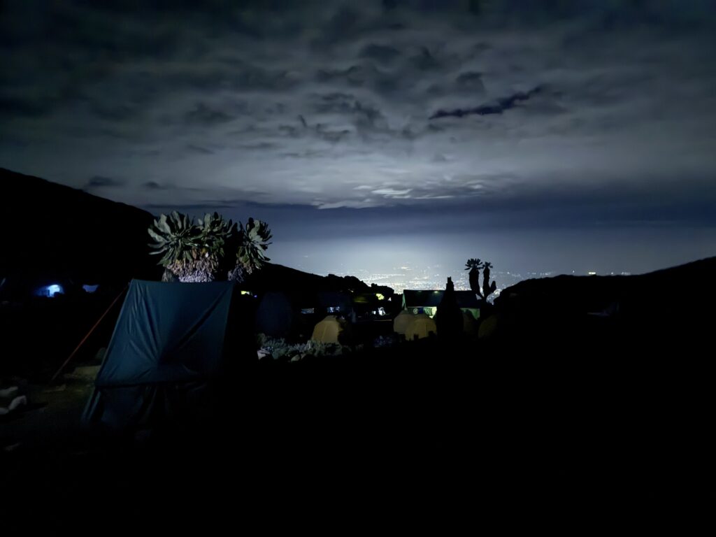
The lights of the town of Moshi, 10,000 vertical feet below.
A rare outdoor breakfast… Beats being inside the damp dining tent.
No direct sunshine yet…
Ahh, finally. Too bad our guides are telling us to pack up and go…
(Here’s day 3 alternate version. Tom has predictably bad cell service so he sent the above via text and the below via email, I’m not sure which I’m supposed to post but they’re both interesting so for now I’m posting both – Alec)
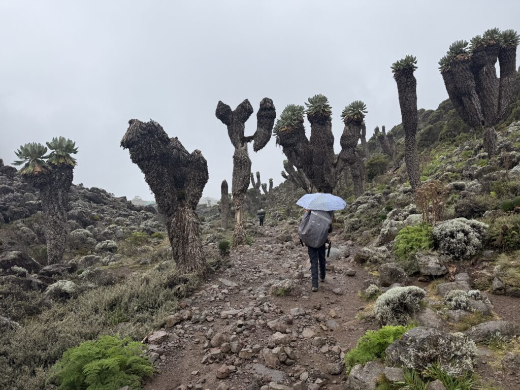
I got up to pee at 4 am and had a fantastic view of the mountain bathed in moonlight… my first view of the mountain from camp. Unfortunately, when I emerged from the tent again at 6:30, we were all back in clouds. It’s too bad because the views would have been amazing this day. From our camp 2 at 12,600”, we hiked up another inclined plane up to a mini saddle at 15,200. We’re now above timberline and the landscape was mostly a volcanic wasteland with occasional meadows that reminded us of the Scottish highlands… well a hypoxic Scottish highland. At various points we would pass bizarre otherworldly vegetation to remind us that we’re still in Africa. Because of the mists, we could rarely see farther than a few hundred yards.
The 5 hour hike ended with an easy descent in light/moderate rain to the Baranco camp at 13,100’. We both felt good and were moving fast which made me fear that we would beat the porters to the camp, but apparently they took a shorter route and our tents and a hot lunch were waiting for us. Hallelujah. Money well spent.
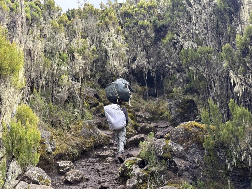
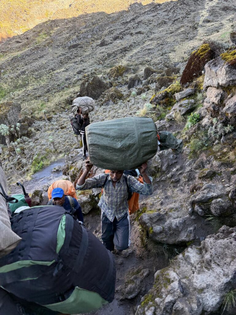
So far, our 16 member support team has been awesome. The food has taken some getting used to, but we’re adapting, and it has always been served with love and enthusiasm. I have to seriously wonder what sort of appetites their previous clients have had, as they give us mountains of food. Even when we beg for smaller portions, we can’t finish it, and when Francis takes our uneaten food back to the kitchen tent, he doesn’t hide his disappointment like some sort of doting parent. With that said, if we ever did eat that mountain of food and then he called us fat pigs, then all would be forgiven. That would be hilarious.
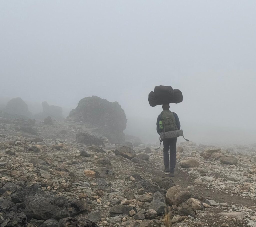
In Nepal, it’s easy to intuit how the porters are so strong, as they are born and raised in the mountains. Here, nobody lives in the mountains. They live on a flat plain that goes on as far as the eye can see at 3000’ above sea level. There’s no geographic advantage here (although through dint of circumstance there might be a lot of competition, and I’ll leave it at that). Some are super strong. I was passed in descent today by a porter running down a loose trail wearing a backpack and balancing another duffel on his head… no hands. I pulled out my camera and started running down the trail to get a picture.
Respect.
The porters here don’t use tumplines (?) like the Sherpas. Rather, they wear a modest backpack and then balance another duffel on their head. Ouch.
That’s all for today.
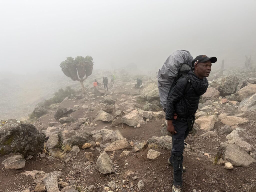
Our guide Romli on day 3:
We’ve learned that these minor breaks in the morning mists usually presage rain. Scottish highlands, day 3.
Lunch!
Our crew singing a song to us before the day’s hike. I don’t think every group gets this treatment, but we’ve seen a couple of others, so it’s not just us.
2 responses to “Day 3 on Kilimanjaro”
-
The singing is so cool. Our guides/porters sang for us as well, especially at certain points in the trip when spirits might have been a bit low…from the rain.
-
Damn – respect indeed for the porters! Too bad about all the rain, but sounds like a great adventure!
-
-
Day 4 on Kilimanjaro
An easy 3 mile day traversing the flanks of the mountain. There were a fair amount of ups and downs, but our new camp – Katanga camp (13,300’) – is only 200 feet higher than last night.
For the second night in a row, it cleared early in the morning and the moonlit views of the mountain were spectacular.
And – surprise surprise – it stayed clear for breakfast.
We even had a some direct sunshine on our faces for at least 20 minutes. If you haven’t yet surmised: everything we own is damp. Not wet, just damp. Tent is damp and has the faint aroma of mildew. Cloths are damp. There hasn’t been a single opportunity to air out the sleeping bags. It’s just one of those trips.
Today’s hike started by going up a steep, west facing slope which at that hour of the morning – 8:30 am – was still in the shade. By the time we topped out and were theoretically back in the sun, the mists had returned and that was that.
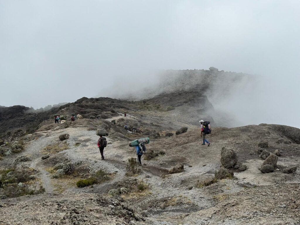
If I had to guestimate the number of people on the trail, I would say – and I’m not joking – an even thousand. Our guide said it was more like 800… big difference. Everybody is starting at the same time, and everybody is going the same direction. If we had started an hour later, we would have been hiking alone, but nobody wants to finish in the rain… and the porters love to be social with each other. As a westerner, we don’t have a choice.
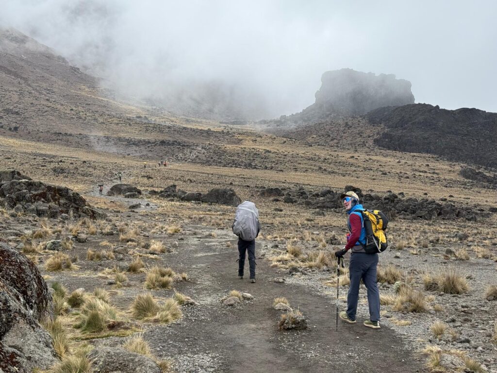
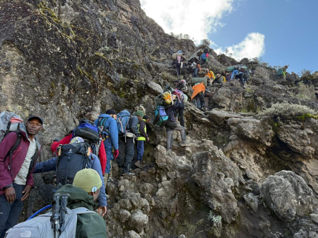
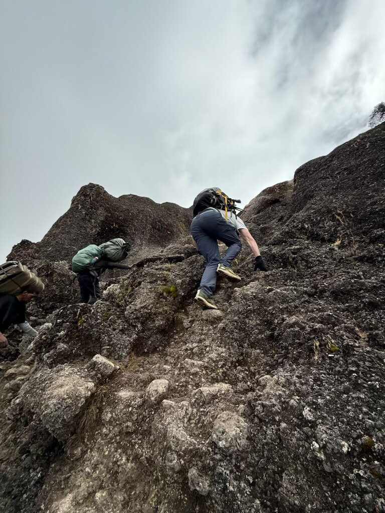
When the trail is easy, it’s pretty comfortable. But the first section was steep uphill scrambling. The etiquette seems to be that westerners don’t pass westerners (unless they allow it) but porters have the right of way. So everybody lets the porters pass. It only takes one slow westerner 500 feet ahead to slow the whole mule train down, and with a porter passing every 30 seconds, it took an hour and a half to climb up 800’. At least it was interesting climbing. Welcome to the 7 summits.
Again, when it’s just a trail, while you’re never alone, the crowds aren’t a big deal. And letting the porters pass means that camp will be set up when we arrive, which is something the porters take pride in. Today the rain is holding off, but the last couple of days it has rained hard starting around noon. Being able to walk into a tent is really nice.
I hope that I’m able to send Alec (my brother who is managing this blog… thank you Alec) some pictures. This cell connection is so weak that it’s not a sure thing. As I write this I’ve been trying and it’s not working, but at 4 AM sometimes the connection is stronger so maybe tonight…). Last night we were under the very impressive 6000’ Breach face, which for climbers is famous. There is a 1970s (?) book called the Breach which I read in middle school before I ever started climbing, and it was really fun to finally see it. I haven’t read the book in 50 years, but my memory is that the first half of the book is a story about an attempted first ascent, and the second half of the book details a fall and a breach of trust between partners, which is notoriously painful to read. It left quite an impression on me. And no, the face was not named after the book.
One last observation before I nap through the afternoon rain: there is hardly any wildlife on the trail. We’ve seen some mice, a few ravens and some small unremarkable birds, and a single dikdik (?)(like a deer) in the distance. Without access to the internet up here, we can’t really read about it. Our speculation is that African wildlife have had millennia to learn that humans are to be avoided, and are thus doing so. And since we’re free to speculate, we’ve also noticed that there are no eagles or predatory birds. We can thus conclude that African swallows wouldn’t need to develop strong wings to evade said predators. After all these years, we now have the final and conclusive answer to one of the great questions of our time: European or African swallow…
Thank you Dan.
Tomorrow is another short hike up to high camp at 15k. The next day is summit day, followed by – gasp – a 13,000’ descent broken up into two days.
Cheers
Crowd scenes on day 4:
Step aside, porting coming through.
Camp
3 responses to “Day 4 on Kilimanjaro”
-
Fascinating. And amazing photos!
-
Ha – Glad you (finally) answered the swallow question! Will the porters clap coconuts as you reach the summit?
-
Great photos of that beautiful mountain.
-
-
Day 5
We made it to high camp! The Barafu camp (“snow” in Swahili). 15,150’. Today was our easiest day of the trip… a mere 3 hours on a mostly smooth trail. Now we have 12 hours to rest before we get up at midnight and go for the summit.
Cell service has been really tough up here, but after midnight I was able to use WhatsApp to send some photos and videos… hopefully those are up on the website. [They are! -Alec] As I write this at lunchtime at high camp, I get one bar occasionally, but it’s just a tease. Nothing ever connects.
For the last 5 days, we have been traversing under the SW side of the mountain aiming towards the SE ridge, which is the easiest route to the summit. While the trail was crowded, we rarely if ever passed people going the opposite direction… everybody is aiming for this same camp as us. Here we have finally joined this easiest route, which also doubles as the descent route. Tomorrow we will go up and then back down the same trail to this camp, and then continue down the SE ridge towards civilization.
I remain amazed as to the size of these camps. There must be 300 tents in each camp – more than in many Himalayan base camps – and every single tent is taken down at 8 AM and carried to the next camp. The manpower is incredible. To add to the hardship endured by the porters, at the last camp the water supply was 300 feet down and a quarter mile distant. At this high camp, the water supply is an astounding 1500’ down and a mile and a half away. Damn. Can I have some more tea please?
Our first camp down in the trees was pretty clean. Yes it was a muddy mess, but there was hardly any garbage and you don’t smell pit toilets (more on that below). With each subsequent camp, there has been more and more garbage, and we finally crossed the line at this high camp: this place is disgusting. No poop, but trash everywhere. I’m glad we’re only spending one night here.
There hasn’t been any poop on the trail… like none. There’s far more poop on the trails in Grand Teton National Park. There is, however, a fair amount of toilet paper… and more when you get higher… oh well (my Vassar education is telling me to shut up and move on…).
And speaking of poop, I’m not sure where the porters do their business. I’ve been looking but I haven’t seen a single one do anything. We privileged clients get to use a porta potty tent reserved just for us, which is clean and comfortable. Every group on the mountain seems to have such a tent. There are pit toilets scattered about, and I assume that the porters are using those, but why don’t they smell? Have you ever been to the top of the tram? In America pit toilets smell. Here they don’t. It’s a mystery.
Well, it’s cold and windy outside so I think I’m going to nap the afternoon away. We are of course socked in clouds…. again. It rained a little this morning when we woke up, but otherwise it’s just been another misty day. At times we could see down into the flatlands, but no views of the upper mountain and of course the dampness from the mists remains omnipresent.
Just as I finished writing this at 1:30 PM, the afternoon rains started. Perfect timing. It’s nap time. Tomorrow is the big day!
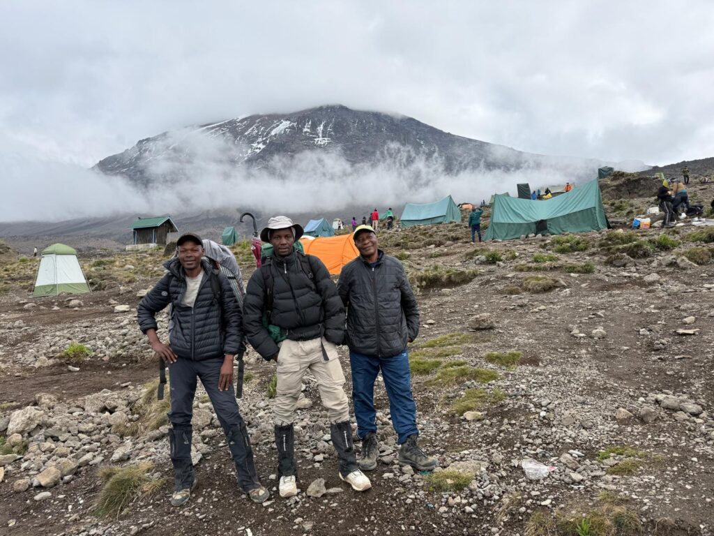
Leaving camp with our 3 guides Romli, David and David’s father Ayumi. David owns the company. Interestingly enough, David says that he grew up as “David” here in Tanzania. 
Leaving camp. All those tents will be packed up in the next 30 minutes. 
If you zoom in, you can see that not a single tent remains (you can identify camp by the physical huts). 
This photo was taken 2/3rds the way to high camp. The red circle is the water supply for high camp. 
And when I turn around after taking that last photo of the water supply, you can see the remaining distance to high camp, which is roughly at the cloud line on the ridge. 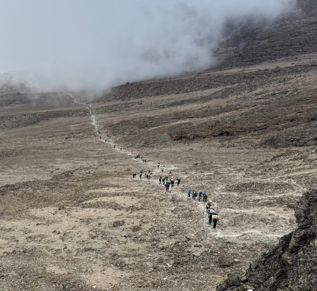
Looking back at everybody heading to high camp. 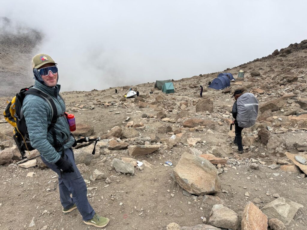
Home sweet home. Our tents are already pitched. 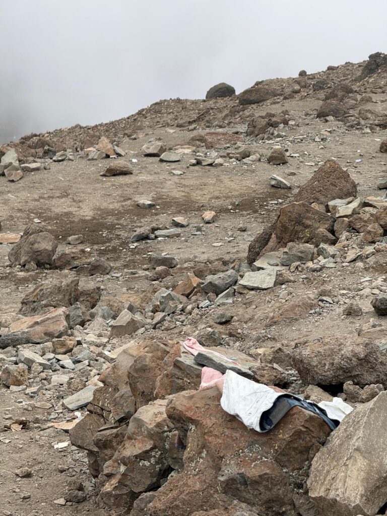
Trash everywhere. 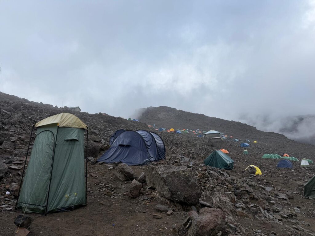
Last photo of the day. That’s our porta potty tent on the left.
-
Day 6 – Summit Day
We were successful. We woke up at 11 PM. Moving at midnight. On top at 5:15 AM. Back at camp at 8 AM. We then packed up and descended another 5000 vertical feet arriving at the Mweka camp (10,000’) in the deep rain forest at noon. The crew then served us lunch. The heavy rains began at 1:30, and I slept until dinner. Somehow Dan managed to stay awake this afternoon… I don’t how he did it… that’s a superpower… a completely pointless and bordering on useless superpower.
Yesterday, we had the pow-wow for the summit day plans. “How long do you think it will take us to get to the summit?” “For you… 5 hours”. What time should we leave? “Midnight”. “Won’t that get us to the summit in the dark?” “Yes”. Can we start later so that we can be on the summit at dawn?” “No”. This went back and forth for a minute or two and brought back memories of Ama Dablam where I had the exact same conversation with my Sherpa, and when the dust settled we had the exact same result: we did it his way and summited really really early.
Here on Kilimanjaro, remember that all parties are guided. Turns out that all guides start at midnight or earlier… we were actually in the late staring group. When I stepped out of my tent at 11 PM, I could see a line of headlights already heading up.
If I look back on my life, I would say that more often than not, the night before a big climb I don’t get much sleep. I toss and turn and think too much. Last night, I slept soundly. The alarm had to wake me up. And then something even better happened: I was able to take a big dump. For those of you who haven’t been in my situation before, to take a big dump before a climb starting at midnight is mana from heaven. It’s going to be a good day.
Oh, and I forgot to mention that there wasn’t a cloud in the sky. Orion shone brightly directly overhead… much higher than we see it in Wyoming, and a bright gibbous moon
was just rising. There was frost on the tent, but it wasn’t that cold. I don’t have a thermometer with me but I would guess high twenties/low thirties.With everything lining up in our favor, we entered the conga line of climbers. The trail started rocky, with some easy scrambling, but then was mostly a steep packed dirt path that was in pretty good shape. If you stepped off the path the ground was very loose, and that made it hard to pass people, but the trail was easy cruising.
We quickly discovered that our plodding pace was faster than most of the other people on the trail. Every single party was book-ended by guides. In our case, Romli set the pace, with Dan and I in the middle, and David bringing up the rear. Not a single guided party stepped aside for us. We could hear Romli talk in Swahili to the other guides, but said talk had no practical result. Rather, when it looked like we could pass, Romli would say “are you ready?” And we would then sprint up a switchback cutoff to get ahead. Something like this would never happen in the US… guides in the US are much too nice. Here, I sort of get it: a lot of the clients we passed were pushing themselves to the redline… we even watched a guy (sounded British) literally fall backwards and tumble down some rocks only 15 feet ahead of us (he claimed to be OK as we passed him). Many clients weren’t wearing packs at all. While Kilimanjaro is the easiest big peak that I’ve ever been on, that lack of difficulty attracts people who couldn’t otherwise climb a big mountain, so I don’t begrudge them being there. And if they stopped for every stronger party that wanted to pass, it would just make their day that much longer, and as it was, their day was going to be much longer than ours.
I don’t know how many people we passed, but it had to be close to a 100. We weren’t going fast. We were just plodding along. We took breaks. It didn’t feel rushed. We put on more and more clothes the higher we got. A wind from the south picked up. At about 3 AM it clouded over (of course). At 4 AM we were back in a cloud again.. this is familiar.
The last half mile or so goes on a scenic ridge from Stella Point at 18,800’ to the true summit
at 19,341’. The wind picked up and our left side started getting rimed up. Again, we’re just following a trail – a dry trail at that. We didn’t have to step on snow the entire way, but with 30 feet of visibility and a strong wind on our left shoulder and getting covered with rime, it actually felt alpine. Cool.At 5:15 AM we stood on the top. It was Dan’s first big mountain. Congratulations Dan. Judging by the lack of footprints in the rime on the ground and the fact that we hadn’t passed anybody coming down, we think we were the first on top this day (what do we win?). Because there was nothing to see, my resentment at summiting in complete darkness was put to rest. Conditions were far too burly to hang out. We took a few pictures and I sent an inreach message to Dede, and after 9 whole minutes on the summit, we started down.
At Stella point, the weather began clearing a bit and those resentments returned, and then it socked in again, and then it started clearing again, and then Dan told me to chill. We were on our way down.
The descent path diverges from the ascent path for more than half the route back to camp. Instead of smooth packed dirt, you go down a soft scree slope which in places feels like descending snow… it’s a lot easier on the knees and quite a bit faster. We took a 10 minute break halfway down and realized that nobody had passed us. This might have been the only 10 minute break of the entire week where we were alone… maybe getting ahead of the pack has its advantages.
We walked back into camp at 8 AM. The porters sang us another song upon our arrival. They seemed genuinely happy for us. Not to be too cynical but I’m guessing our early arrival meant both a better tip and that they could start getting the flock out of there before the rains came.
Within an hour, we were fed, packed up and on the trail. We descended another 5000 vertical feet. This is not the trail we came up, rather, it is the shortest trail from civilization to high camp. Climbers are only allowed to go down it, not up. There were a handful of porters going up bringing food to groups up high, and of course our group of porters were going down, but otherwise the trail was pretty quiet. It was the least crowded trail we’ve been on all trip, and actually had moments of solitude. We got into camp at noon. It was a 12 hour day.
I’m running out of steam. It’s 9 PM and despite sleeping all afternoon, I’m tired and am going to go to bed. No cell service here so I’ll send this out when I get down tomorrow. The porters are in go mode so they are waking us up at 5 AM to be on the trail at 6. It’s 6 miles and 4000 vertical feet to the trailhead and we’ve been told it takes about 3 hours. Will the hotel have any water pressure for showers this time around? Stay tuned.

Starting up at midnight. 
A little higher. The volcano is Mawenzi (16,893′) 
Stella Point (18,800′) 
Looking good Dan. 
On the summit ridge. 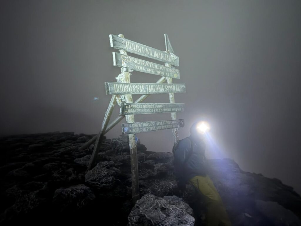
Dan on the summit. 
Back at Stella’s Point. You can see a headlamp close to the summit. 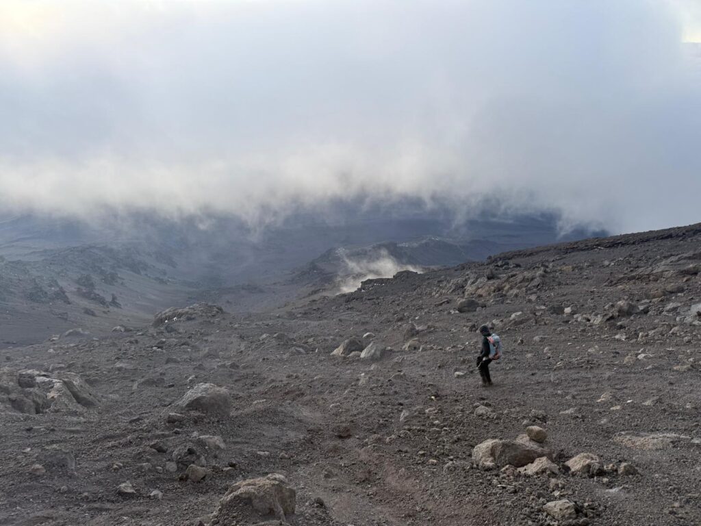
The long scree slop descent 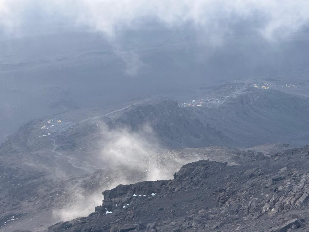
Looking down at high camp… not the tents on the left (which is a higher camp and not used as much), but the far more numerous tents on the right. 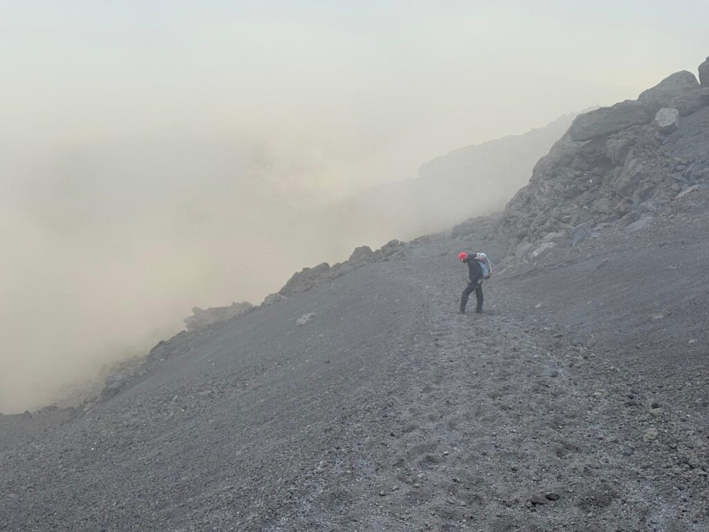
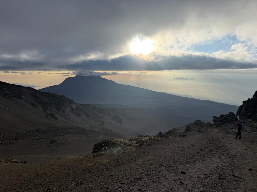
Clearing skies on Mawenzi 
Only another 5000 vertical feet of descent to go. 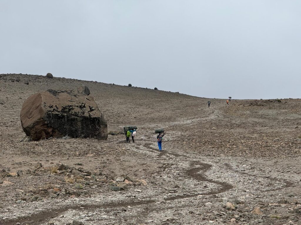
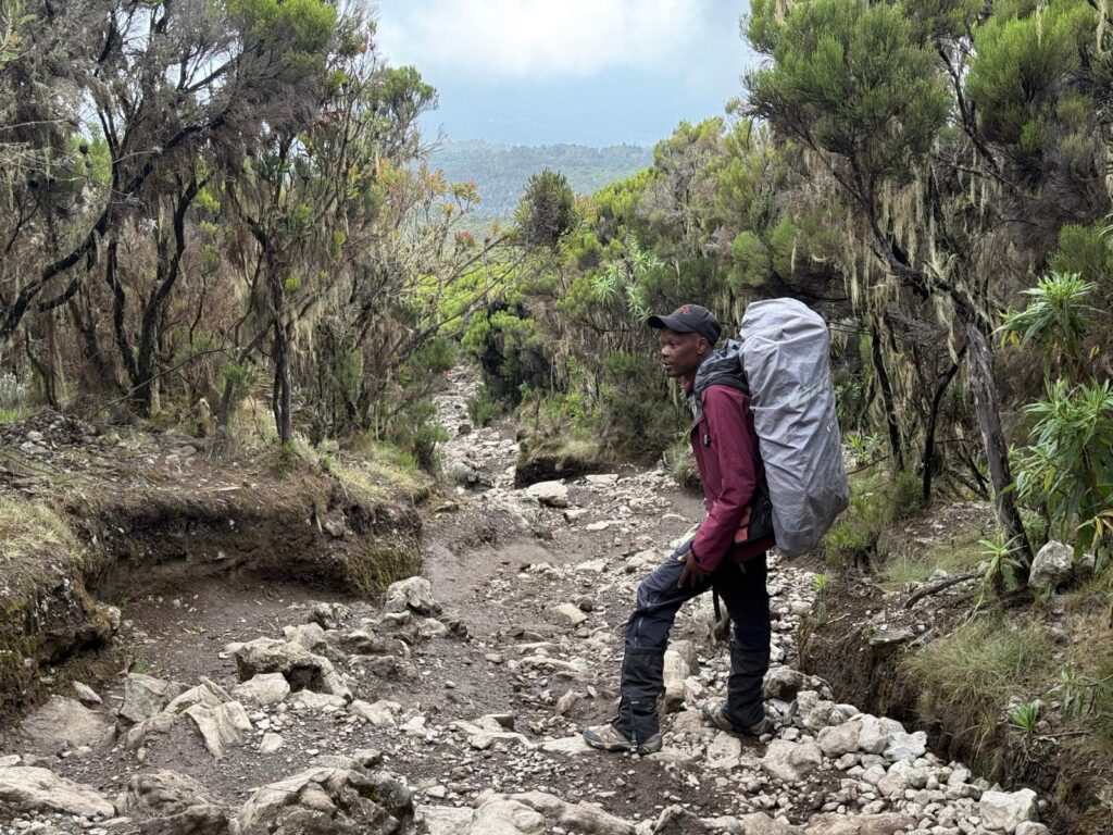
A long rocky path. 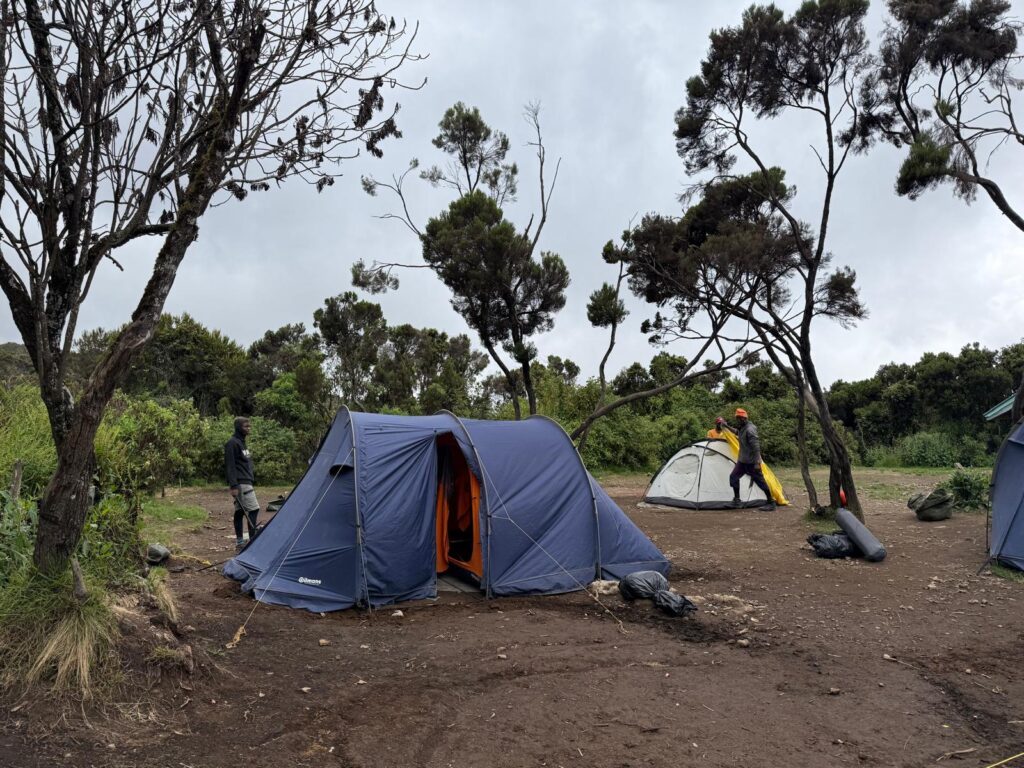
And of course the tents were set up and waiting for us. Thank you. 
Waking up after a long nap in the rain. 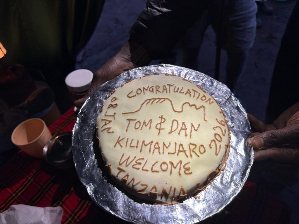
A victory cake. Being welcomed into camp after a successful ascent.
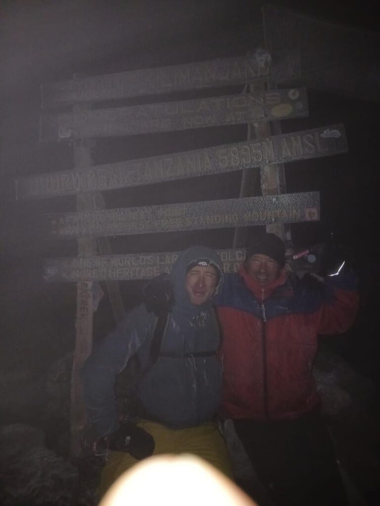
The best summit photo we have. 
The second best. One response to “Day 6 – Summit Day”
-
A proper dump and a victory cake – quite a day – congrats Tom and Dan!!
-
-
Day 7
What goes up, must come down, so today we hiked down an additional 4600 vertical feet to the trailhead, got on a bus and am now at the hotel in Moshi. And guess what? We have water pressure so we could both take showers… well, I ran out of hot water after 5 minutes, but I was mostly done by then.
This place just can’t do it the easy way.
I’m not going to lie, I’m a little tired right now, but in a good way. This adventure isn’t over yet: tomorrow I fly 150 miles north across the Equator to Nairobi, from where I will be driven to Mt Kenya. I get a second night in a hotel and then up I go. Mt Kenya is the second highest mountain in Africa and is a considerably more technical ascent (17,057’). Climbing 5.7 at 17,000’ is no joke. The good news is that I should be well acclimatized after Kilimanjaro, so that should help. In fact, that’s the point.
I will be going alone… just me and another army of porters.
If this blog post is short, well, forgive me I’m tired and I have some packing up to do. Hopefully, I’ll have time to write tomorrow.
Cheers.

An early start. Porters are in go mode. One final song.
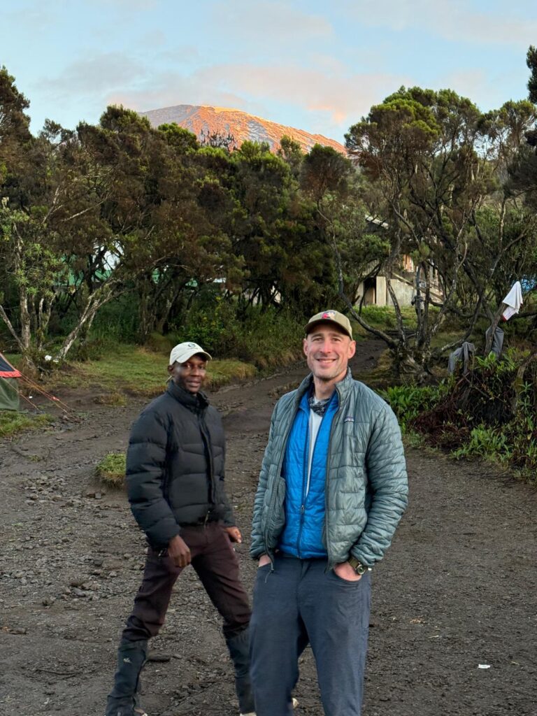
Last peek at the peak 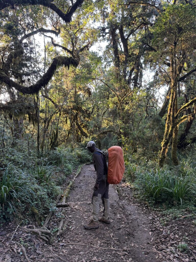
Another long walk in the jungle. 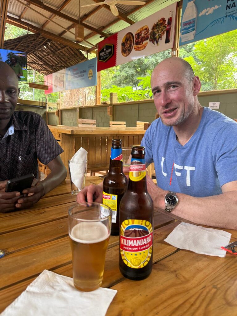
A celebratory beer. 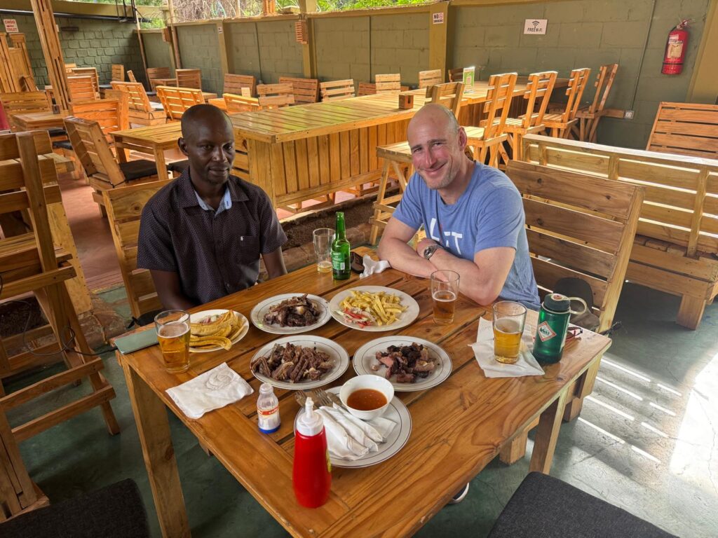
And a mountain of meat.
-
Day 8 – Transfer Day
Today has been a bit of a blur. In my defense, two days ago I stood on top of Kilimanjaro, and my poor knees just walked down 13,900 vertical feet. And I was picked up to go the airport at 3 AM this morning…. Like I said, a blur.
Mt Kenya is about 200 miles north of Kilimanjaro. My previous post was incorrect: I’m still in the southern hemisphere. It’s weird that my Gaia map doesn’t show the Equator, but I think I’m still a few miles south of it. As I write this I’m back in the land of really sketchy cell service and precious oh so precious battery power, so I can’t go online to figure it out. That will be a task for next week.
My flight from Moshi to Nairobi was only 45 minutes, but that doesn’t include the hours in security and passport control (and me foolishly screwing up my visa, which was fixed and didn’t cost me any additional time, but added a bit of stress). Since it’s only a 100 mile drive, I asked the taxi driver why we couldn’t just drive, and he said “too dangerous”. “Drugs”. We then asked what drugs and in what direction were they being trafficked, but didn’t get an answer.
For Mt Kenya, I’m with a completely different trekking company. No relation to David’s company at all. I was met at the airport by my guide Steven, and climbed into the taxi. I was told that it would be a 2.5 hour drive, but I later learned that was just to the first rest stop. Before it was over, it was a 6 hour drive, plus a stop for lunch. We’ve now been dropped off at the trailhead at 10,000’ on Mt Kenya. All the porters and cooks are with us and they are beavering away. I’m typing this in a dinning tent. My personal tent is set up. Tomorrow we will trek up to the Mackinder hut at just under 14,000’. No hiking today.
Question of the day: if two westerners – Dan and myself – had 16 guides and porters for Kilimanjaro. How many guides and porters does a single westerner get? I’ll answer that tomorrow.
I’ll be interested to see how crowded it gets up high. My group is the only one camping here. There are a couple of cars parked, otherwise, it’s quiet. Compared to the festival scene on Kilimanjaro, it’s a welcome respite. Lots of wildlife too: monkeys and a goat like creature whose name I can’t look up right now because I don’t have internet.
Kilimanjaro had no bugs at all, even down to 5400’. While I haven’t seen any yet, I’ve been told that they come out in the evening. We’re too high for the malarial mosquitos, but I’ve been told to put on the deet… makes me wonder what’s waiting for me. I guess I’ll find out. I’ve also been told to keep taking the malaria medicine for when the trip is over. Again, that’s different from Tanzania. Hmmmm.
That’s all for today. From the Naro Moru River Lodge Met Station at 10,000 on the side of Mt Kenya, good night.
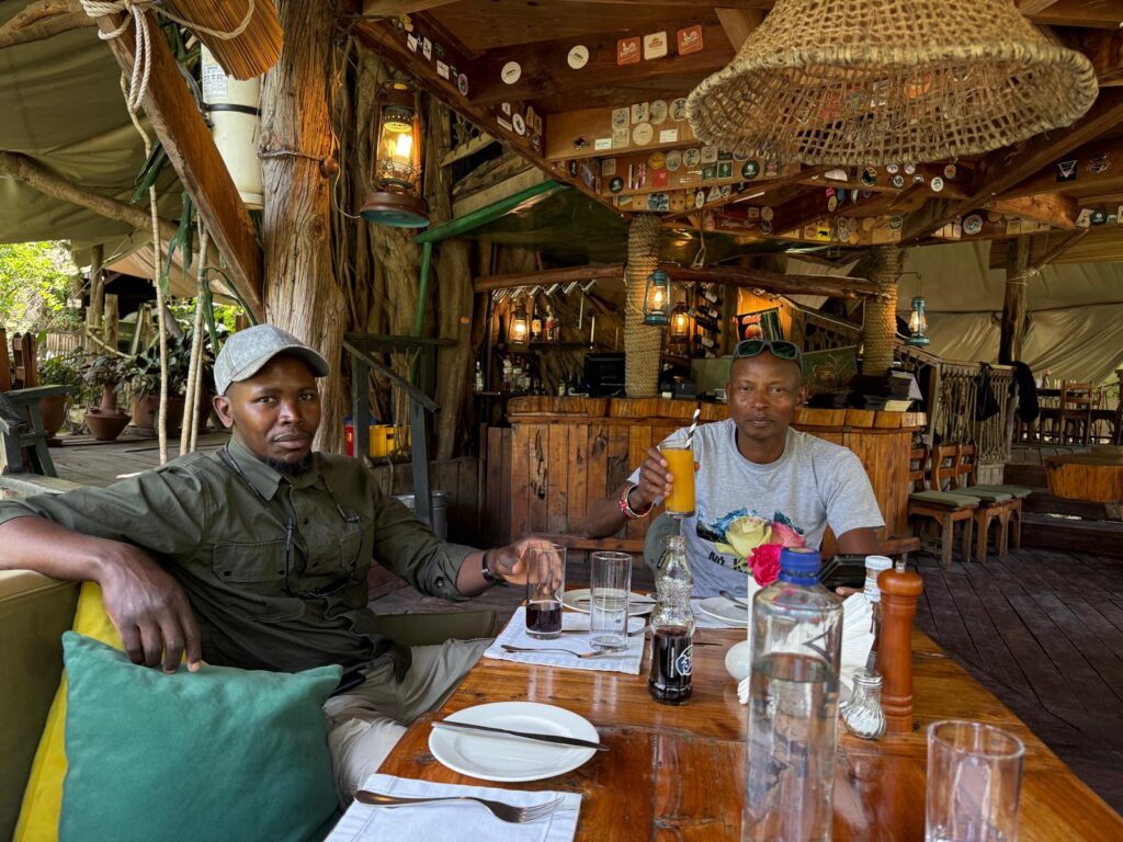
Steven, my trekking guide (but not my climbing guide) on the left and the owner of the company John on the right. 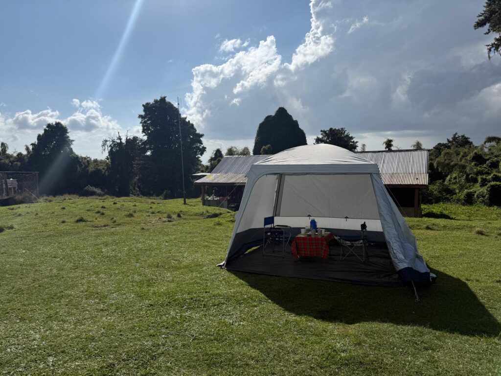
The dining tent is much more comfortable. 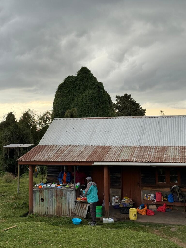
Day 8. The cooks preparing dinner. 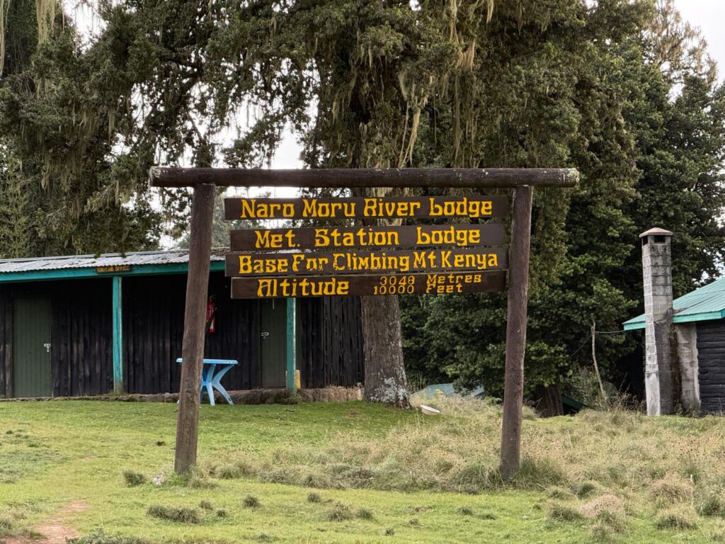
It was nice to be able to drive to 10,000′. On Kilimanjaro, the trailhead to start was at 6000′, and trailhead at the finish was at 5400′. One response to “Day 8 – Transfer Day”
-
Congrats on Killi TB.
Good luck on the next lo
g
-
-
Days 9 and 10 (Mt Kenya days 1 + 2)
As I write this on day 10 (January 12), I’m taking a rest day. It’s my first rest day in Africa. I need it. The flight and then the long drive two days ago wasn’t restful in the slightest, and yesterday was another 5 hour, 4000 vertical foot hike to the Mackinder hut at 14,000’.
And to top it off, I’ve caught a cold. I don’t know where it came from, as we’ve been outside for all of Kilimanjaro, but here it is… so deal with it.
Again, a rest day is welcome. Since I’m at 14k, I’m not losing any acclimatization. This is OK.
My intent for this trip was to acclimatize on Kilimanjaro, and then blitz up Mt Kenya. The Mt Kenya outfitter had other plans, and I should have known that something was up when he ignored my repeated requests for an itinerary. Now that I’m on the mountain, I see that I’m getting the full tour of Mt Kenya, including going 270 degrees around the mountain, visiting multiple lakes, and going over a couple of different summits.
Having met the guy – John Githae – I must admit that he’s very passionate, and while of course there is a financial incentive on his part to extend this trip, he did come off as genuine: I truly believe that he loves this mountain, and wants to show it off.
Here’s an example: my scheduled itinerary ends at a “beautiful trailhead… so beautiful that you should spend the last night there”. What that meant was that the following morning I would do the 6 hour drive to Nairobi, spend 4 hours in a hotel cleaning up, and then catch the red-eye to Japan. Uhhh… no. We’ve now changed that to go to Nairobi on the last day, and then spend a full night in the hotel cleaning up. Sheeshhh.
But that is the only change that I’ve made. Slowing down and seeing the sights is not all that bad. I’ve never been to Africa before, and who knows if I’m ever coming back. And again, with this cold I’m not going to be blitzing anything, so maybe it’s going to all work out.
The Mountain:
Oh yeah, there’s a 17,000’ mountain directly above me. Naturally, it was raining when we arrived in camp yesterday, but at sunset it started to clear. I can see why this mountain is so famous with climbers. 2000’ walls rise directly above us. From memory I could pick out a few famous climbs from an old Chouinard ice climbing book that I used to drool over in high school. No doubt this is a pilgrimage of sorts for me.
(Alas, there is no ice visible today…. such is the new normal on a warming planet. )
This morning dawned clear and cold and it was fun looking at the mountain and reading the guidebook. It misted up around 10 am and I didn’t see the mountain again until sunset, but it never rained….my first day in Africa with zero precip.
Today was a scheduled day hike to a lake a thousand feet up. I’m sure that it’s pretty, but staying in camp was an easy decision. Tomorrow the plan is to go halfway around the mountain to the Shipton Hut. The next day we go up and over 16,355’ Peak Lenana to high camp. There’s a planned rest day at high camp, and then we go for the summit 4 days from now. The egress will then take another two days and finally a hotel in Nairobi on the 18th.
That’s the plan at least.
That’s the plan.
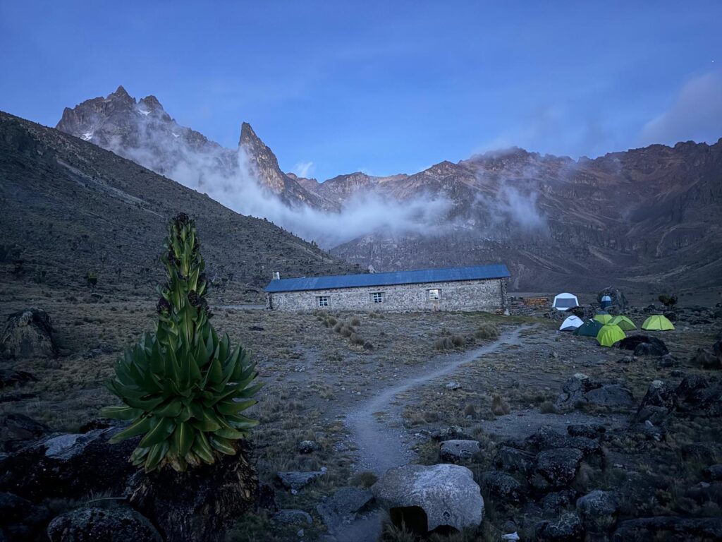
One response to “Days 9 and 10 (Mt Kenya days 1 + 2)”
-
Kenya you post? How’s it going?
-
-
Day 11
Today was the first sunny day – all day – of my trip. The mountains were visible all day. No afternoon mists. No afternoon rain. Am I still in Africa?
We hiked about 180 degrees around the mountain to the Shipton hut. It went up over three small passes, so about 2000 vertical feet up and down. It took about 4 hrs. Tonight’s camp is also at about 14,000.
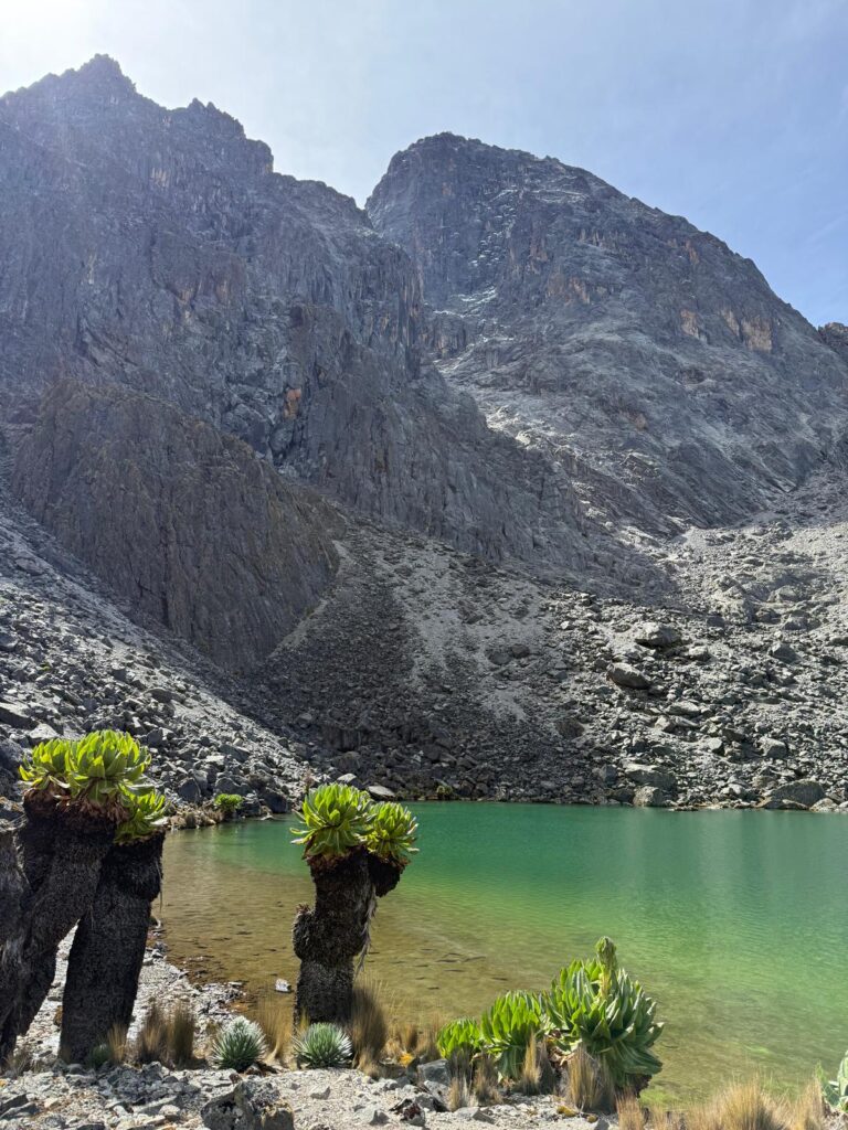
One of a half dozen small lakes we passed on day 11 On the high passes I had my phone on and maybe it sent out yesterday’s blog. It downloaded the headers to my email but I can’t read the body of the emails. Attempts at sending photos also failed. Am I really going to spend a week on Mt Kenya with hardly any internet at all? In this day and age, can I do that?
With these casual days I’ve had more time to focus on the otherworldly flora and fauna. I’ll have to do a big photo dump when this trip is over.
My cold is now a full on cough, and it’s really annoying. This morning I felt downright sick, but after an hour on the trail I felt fine… I just sounded bad. It looks like there are a couple of westerners staying in the hut tonight and I do feel a little pull to go talk to them, but I don’t want to go inside with this cough.
There were three other parties at last night’s hut: one was a trekking group from Hungary. The other two were climbers. Both were attempting the true summit today. Both were going super fast: going from sea level to the Mackinder hut at 14,000’ on day 1, and then going for the 17,000’ summit on day 2. In all my years I have never gone so high so fast. I once hiked up Mt Whitney in a day from Los Angeles, and I remember a vicious headache on the summit. I honestly don’t know how they do it. Is it just drugs? One of them did say that they had a headache at the hut. Because tonight I’m on the other side of the mountain, I’ll likely never know how they did. I’ve been stewing on this all day.
My guide Steve has been opening up to me a bit. He’s never been out of Kenya, but he speaks English pretty well. Being a guide on Mt Kenya is his main job, and I think it pays better than his peers. He seems to like doing it. He’s been eating with me, and says that he never eats like this at home. At dinner tonight he said that he was still full from lunch (me too!). I told him that I don’t eat like this at home either.
Tomorrow is a 7 AM start. We’re going to hike up 16,355’ Peak Lenana, which is the highest trekking peak in the area. If you’ve read No Picnic on Mt Kenya, this is the peak the Italian POWs climbed. Tomorrow should be pretty casual, and then the next day is a planned rest day, and then the big climb. Im not going to lie: I’m a little nervous: I don’t think I can do a big climb in the state I’m in. Well, I still have two days…
Sent from my iPhone
-
Day 12 + 13
This is not an easy post to write. Fear not, I’m OK. The cold virus finally reached a tipping point where I had to end the expedition, but I was able to walk out on my own power and am now comfortably recovering in a hotel in Nairobi.
The plan for the day was an easy hike up and over the 3rd highest peak of Mt Kenya: 16,355’ pt Lenana. For those who aren’t climbers, this is the trekking summit. It has a very short Via Ferrata at the summit (really just 7 or 8 ladder rungs), but it’s a true summit with great views. It’s about 2300 vertical feet above our camp (the Shipton Hut), and only about 700’ above tomorrow night’s camp: the Austrian Hut at 15,700’, which is the high camp for technical ascents of the true summit.
What followed was an eerily familiar discussion: the guide wanted to start hiking at 3:00 AM in order to watch the sunrise from the summit. “What time is sunrise?” “6 AM” “How long do you think it will take me to get to the summit?” “You, 2.5 hours”. “OK then why start at 3 AM”. “Because it’s beautiful”. This time I explained that I really didn’t want to be on the summit at dawn and we settled for a civilized 7 AM start. Apparently, seeing the sunrise from the summit is a thing that the guides like to do. It’s part of their brand. On the way up, we passed about a dozen hikers descending who had done just that.
I’ll give Steve credit, he did accurately predict our timing. It took us 2.5 hours of leisurely hiking to get to the top, where we enjoyed a warm hour in the sun. We were alone the whole time. The weather was so clear that we could see Kilimanjaro 200 miles to the south (a rare event, according to Steve).
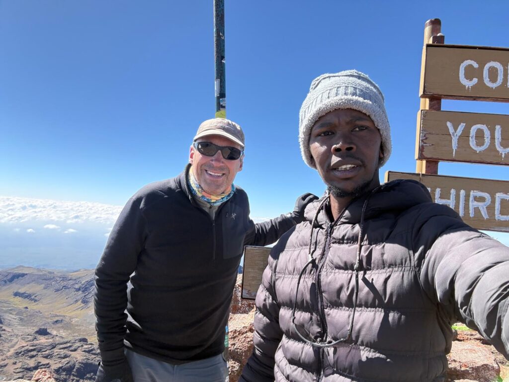
On the top of Pt Lenana We then walked down the easy ridge to the Austrian hut in under an hour, and our hiking day was complete. Now I had, in theory, 36 hours of rest before the climb itself. I crawled into my tent and took a nap.
In the afternoon, both my climbing guide, whom I had not yet met, and the owner of the company, both conveniently named John, woke me up. They had hiked up that morning. I must have presented a memorable visage of health and vigor to them, as I think they decided on the spot that I wasn’t going to the summit. Admittedly, I sounded terrible and couldn’t stop coughing. In a nice diplomatic way, they asked if I wanted to descend immediately. I pulled out my pulse-ox meter and showed them that my O2 saturation was 95%, and that I was not dying of any high altitude illness. However, the ultimate decision was made. Through mutual consent, I was going to Nairobi tomorrow morning. The climb was over. As much as I want to deny it, I knew that I was too sick to do the climb.
So, one more day and night in a flapping tent, and then an 8 mile, 4.5 hour walk down 5700 vertical feet to the trailhead where we started. In the end, I completed the circle route around the peak… woohoo. Once the decision was made to go down, I think my body stopped pretending to be strong. While I felt fit on Pt Lenana only hours ago, I suddenly felt exhausted. And that night I suffered a sleeping injury: I must have coughed while my body was out of alignment as I woke up with a tweaked back. Oh well. I could still walk out. My body just wasn’t going to do it the easy way.
After the hike and then the 5 or 6 hour drive in a taxi whose seats wouldn’t pass muster in the US, I stumbled into the Holiday Inn like a zombie, skipped dinner, and woke up the next morning wondering whether it really is a bad cold, or am I just tired? Two days later I still don’t know the answer. I’m tired, and I’m still coughing, and my ears have yet to equilibrate. Maybe it was a bad cold. That’s two expeditions in a row where I’ve gotten a cold that’s worse than anything I’ve had in Jackson since before Covid. Hmmm.
I don’t have the flu. I don’t have a fever. Mercifully, I don’t have the spins like I had on Everest. It’s just a head and chest cold. I like to think that I recover from colds pretty quickly, but empirical evidence states that’s not the case, at least in the third world. I have no idea how I got it. We were outside for a week on Kilimanjaro. I can’t see how I could have gotten it there. Dan didn’t get sick. Could I have acquired the cold on the plane (which admittedly was a ca-cough-ony)? I wore a mask on the plane, and that was more than a week ago… could the latency be that long? I don’t know. I really don’t know what else I could have done to protect myself. It’s just a bummer.
Well, I have another 2 nights to recover here in Nairobi and then I’m on a plane to Japan. I should be fine. I’ll post a photo essay of Mt Kenya in the next day or two. It really is a lovely place. It’s not empty, but it’s quiet and pretty. To a tourist like myself, the flora and fauna are much more interesting than on Kilimanjaro, and the mountain feels more intimate. There are lovely lakes and tarns scattered about, and the rock walls make me wish I had spent a week here in my 30s just to climb a few routes.
For now, it’s in my rear view mirror. On to the next…
Tom
-
Mt Kenya photo essay, part 1 of 2
Because I wasn’t able to send photos from the mountain, here’s a photo essay from my attempt of Mt Kenya:
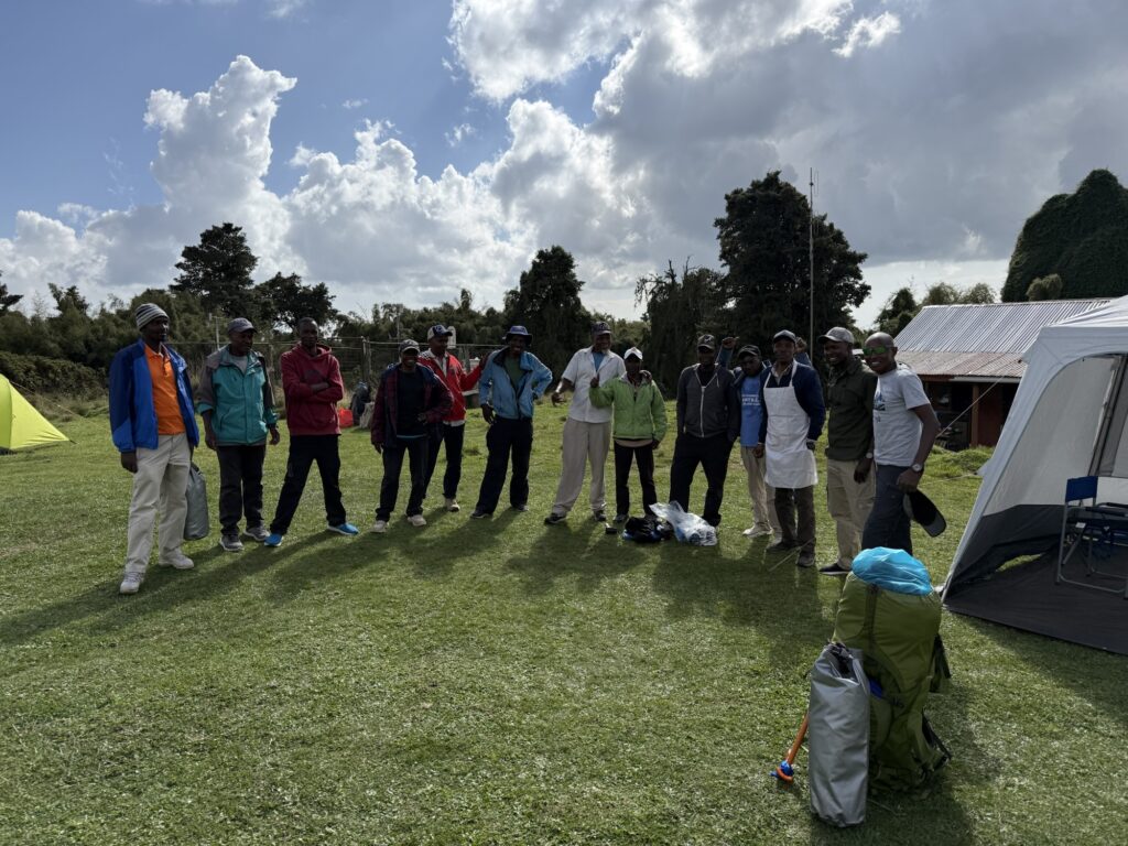
Meeting my 12 porters and guides at the trailhead. The 13th guy on the right is John Githae, the owner of the trekking company. I would see him at high camp, but he wouldn’t be joining us for the trek. 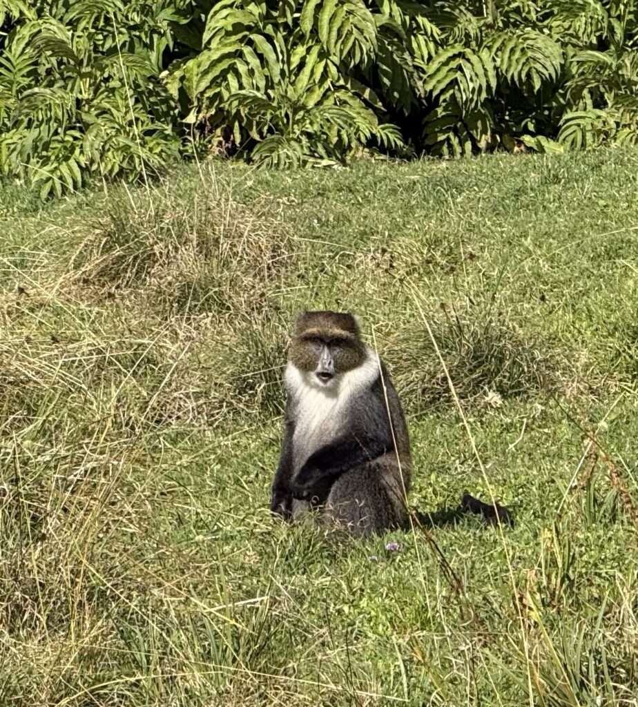
A blue monkey at the trailhead. Their niche here seemed to be that of camp robber. To leave your tent door unzipped would be to invite them to steal whatever they could grab. 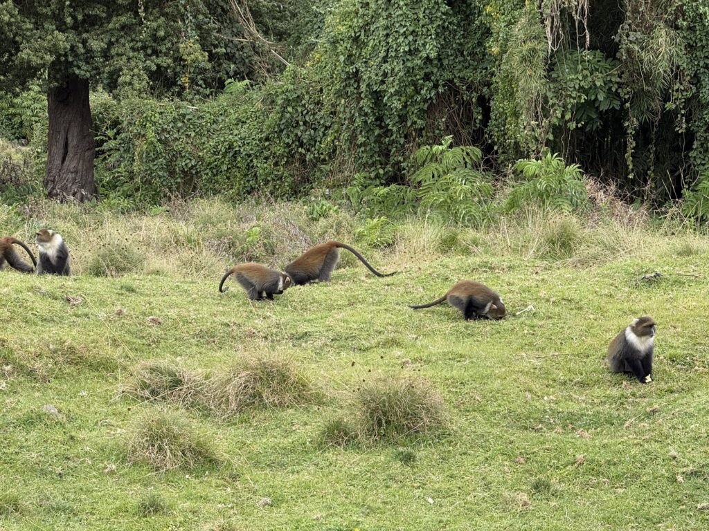
There were a lot of them. 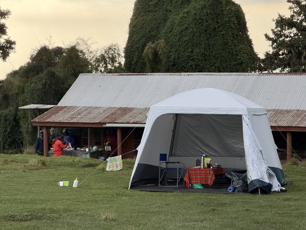
My personal dinning tent… far more comfortable than the one we had on Kili. The porters always slept and cooked in the various huts. While the huts were never full and thus they never had to do this, but their plan B for sleeping was to sleep – all 12 of them – in the dinning tent. 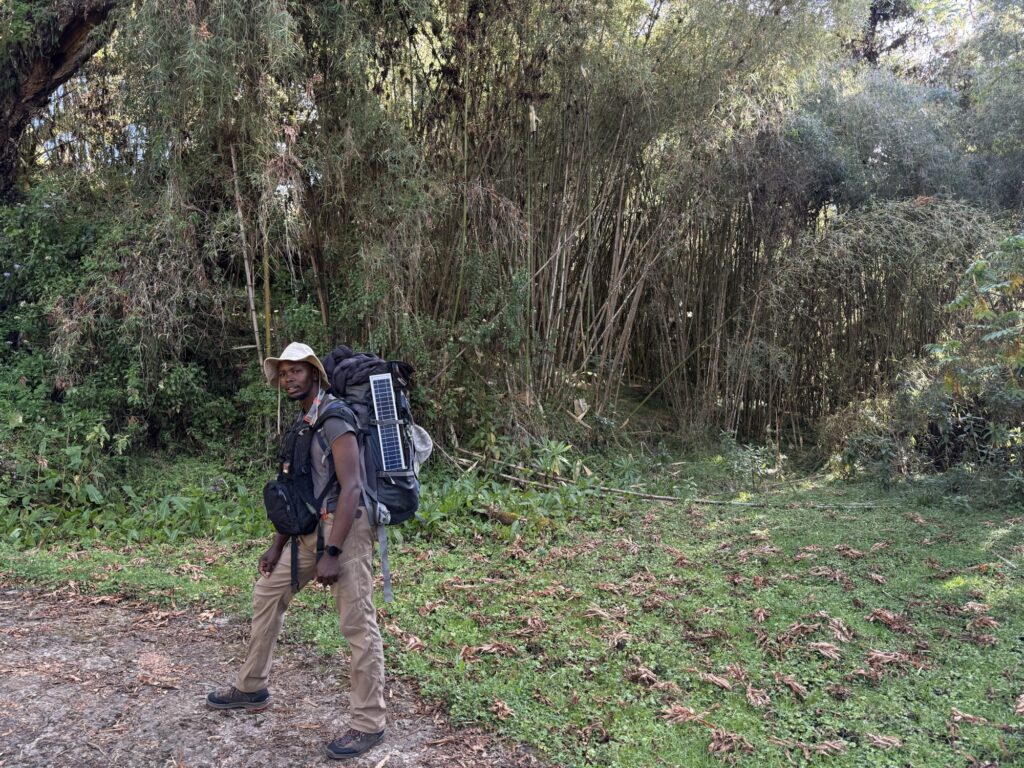
Starting up in a bamboo forest. That’s my guide Steven. 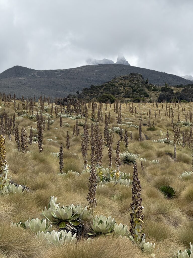
One little incomplete glimpse of the mountain on the hike up. 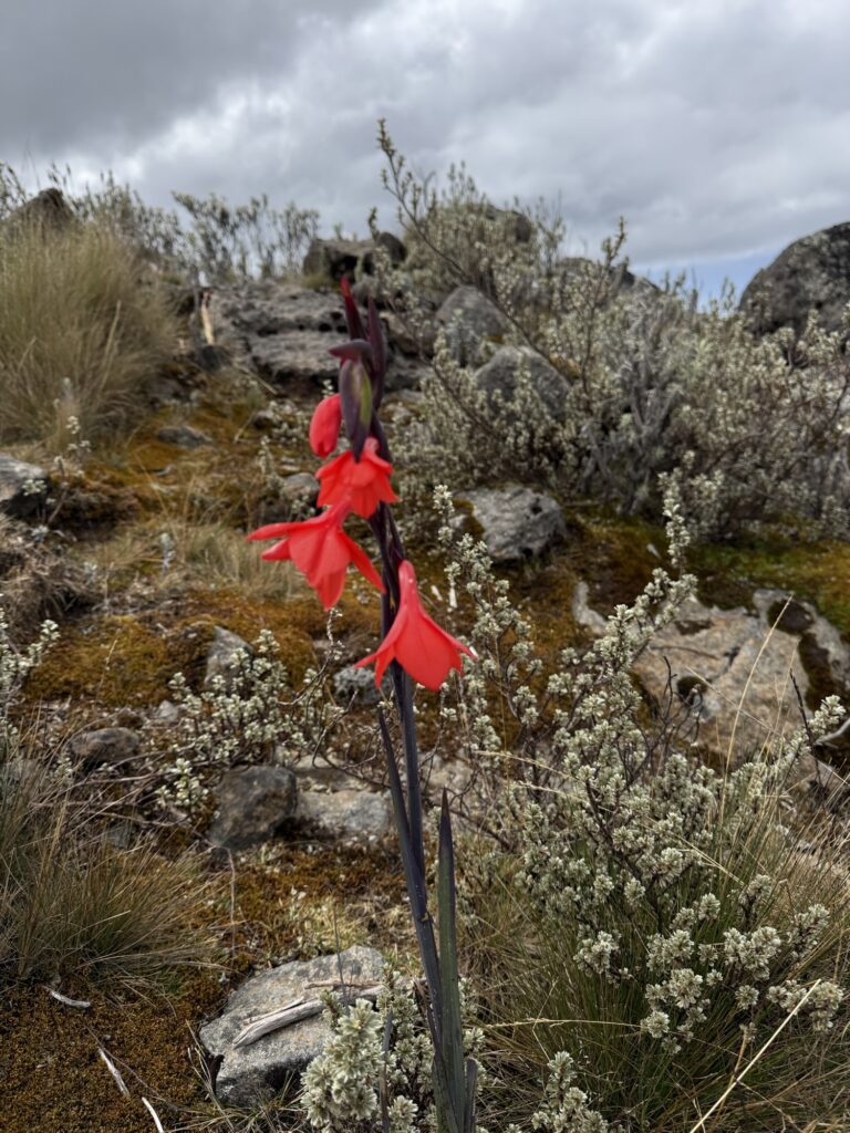
I don’t recall seeing flowers like this on Kilimanjaro. 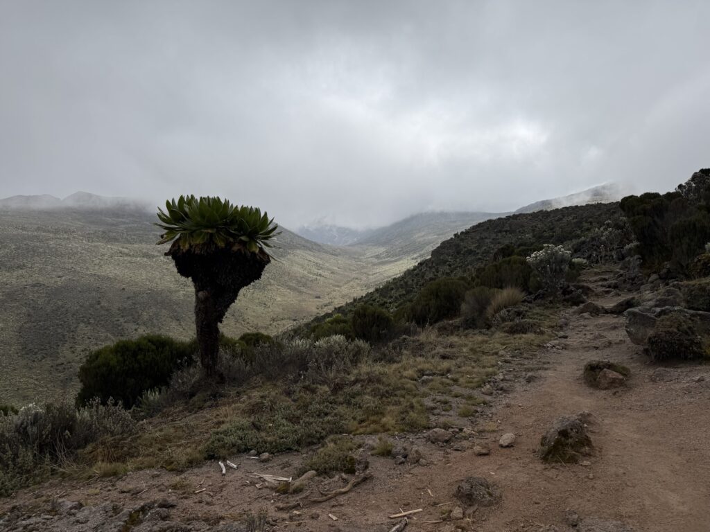
Our first night’s camp, the Mackinder hut (13,800’) is at the head of the valley. The mountain is in the clouds above. 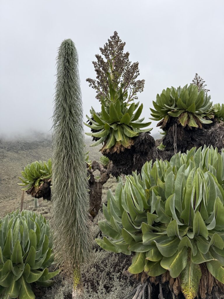
Bizarre vegetation. The tall plant is locally called Ostrich Feathers. 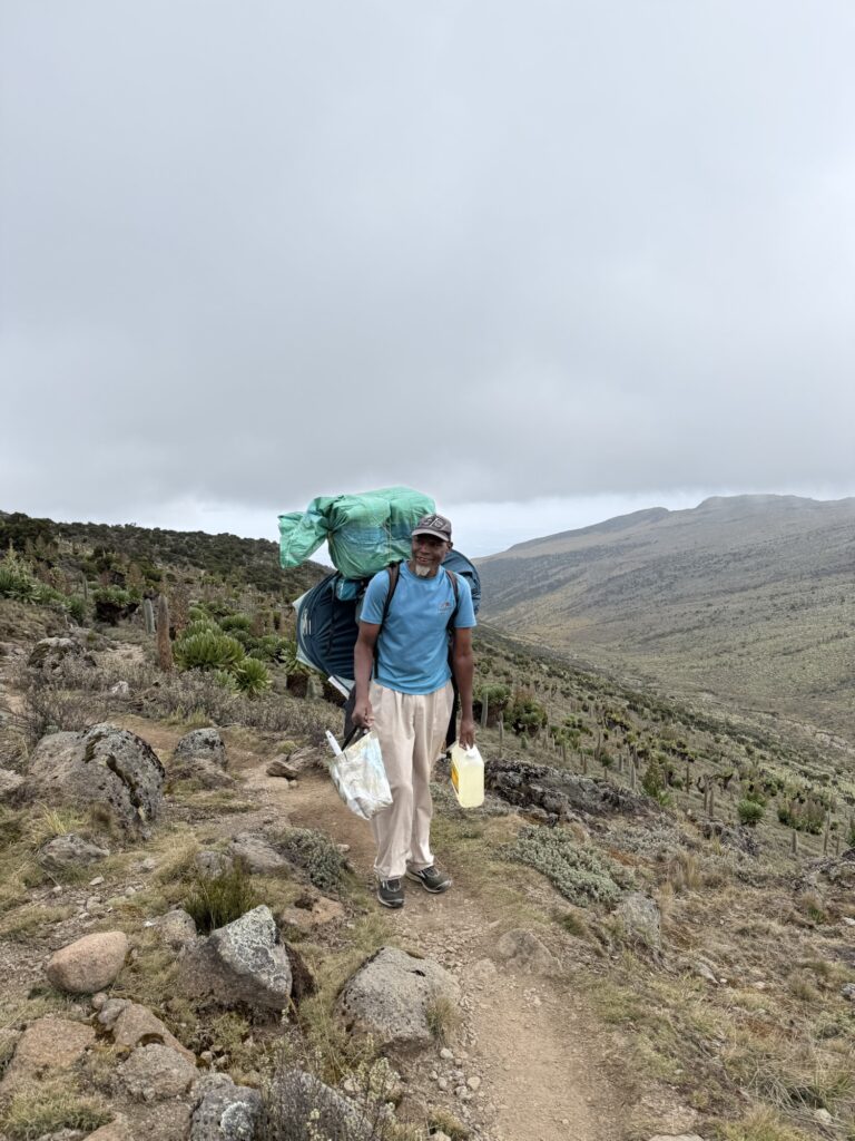
One of my porters catching up to us. My first impression was damn, those guys were loaded up. I later learned that one of the porters pulled a hamstring low down and had to turn around and thus the other porters split up his load. My 12 was thus reduced to 11. The porters were very strong, and regularly passed me on the trail. I would have kept up with them if not for my oh-so-burdensome 15 pound daypack. With that said, a second porter tweaked something or other on the last day, prompting us to wait a couple of hours for him at the trailhead before driving to Nairobi. They were strong, but they weren’t invincible. 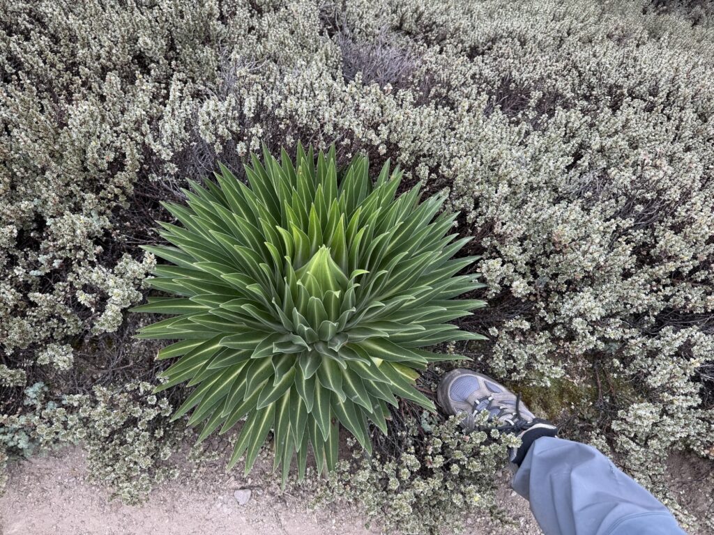
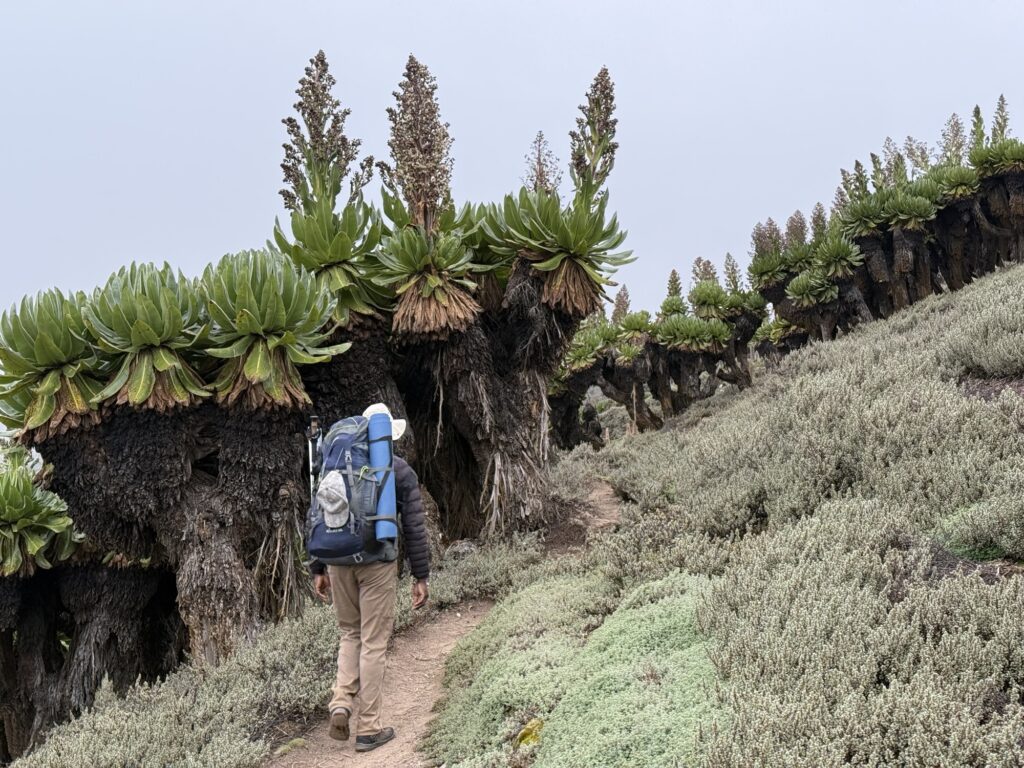
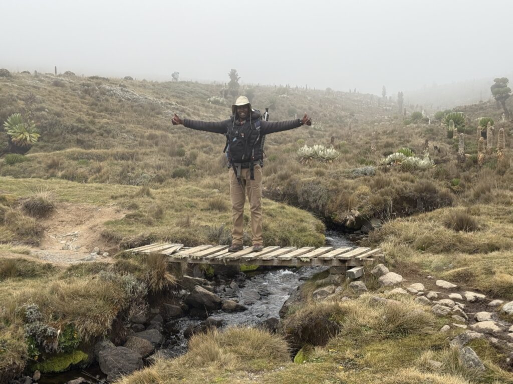
It’s not raining yet, but it will be real soon. 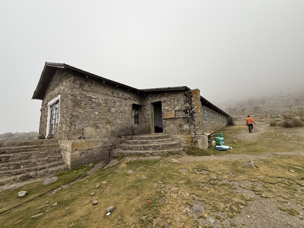
Arriving at the Mackinder hut 13,800’ 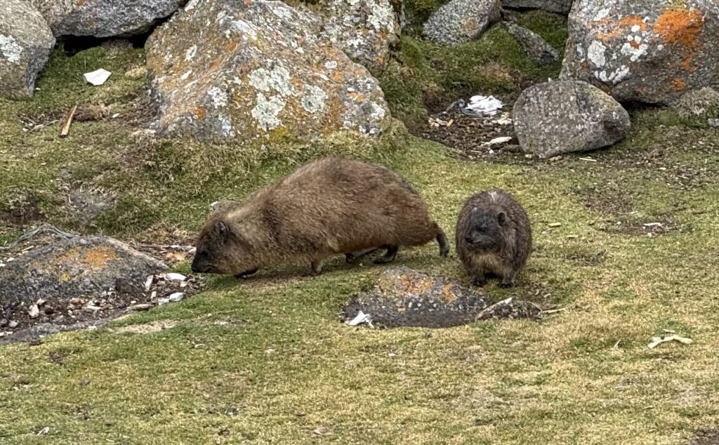
Rock Hyrax. These critters are about the same size and coloration as North American Marmots, and seem to occupy the same niche, but they are improbably related to elephants. 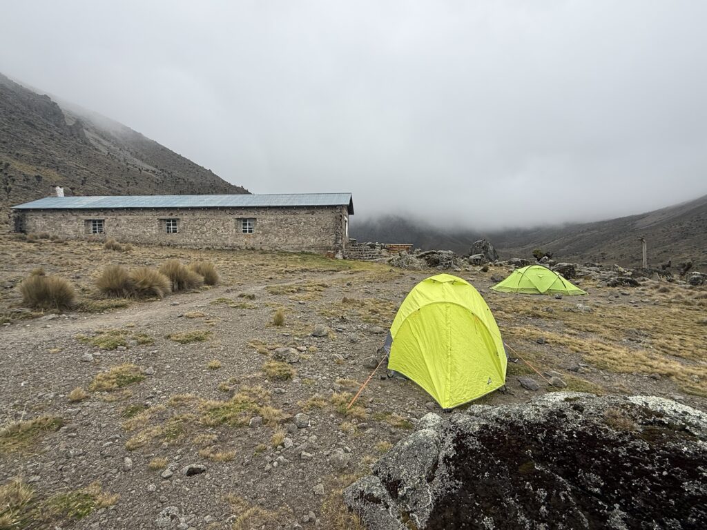
My personal tent (close) and that of some European climbers behind it. The hut itself was dark and damp. I wouldn’t choose to sleep in it although I know that some westerners did. 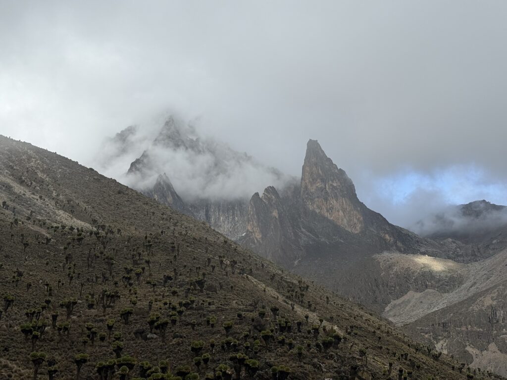
My first view of the mountain as the clouds broke up in the evening. 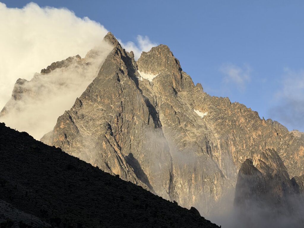
The left hand summit is the true summit (Batian 17,057’). The right hand summit is Nelion (17,021’). My climb would go up the face behind the right hand skyline, over the top of Nelion, down into the col between the two, called the Gate of Mists, and up to Batian. Descent involves reversing the route. Thus, while not technically too hard, it’s a long and complex route. The couloir coming down from the Gate of Mists is the famous Diamond Couloir… Alas, there’s no ice in it these days. 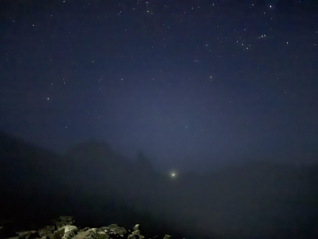
Headlamps coming down to our hut after a very long ascent. 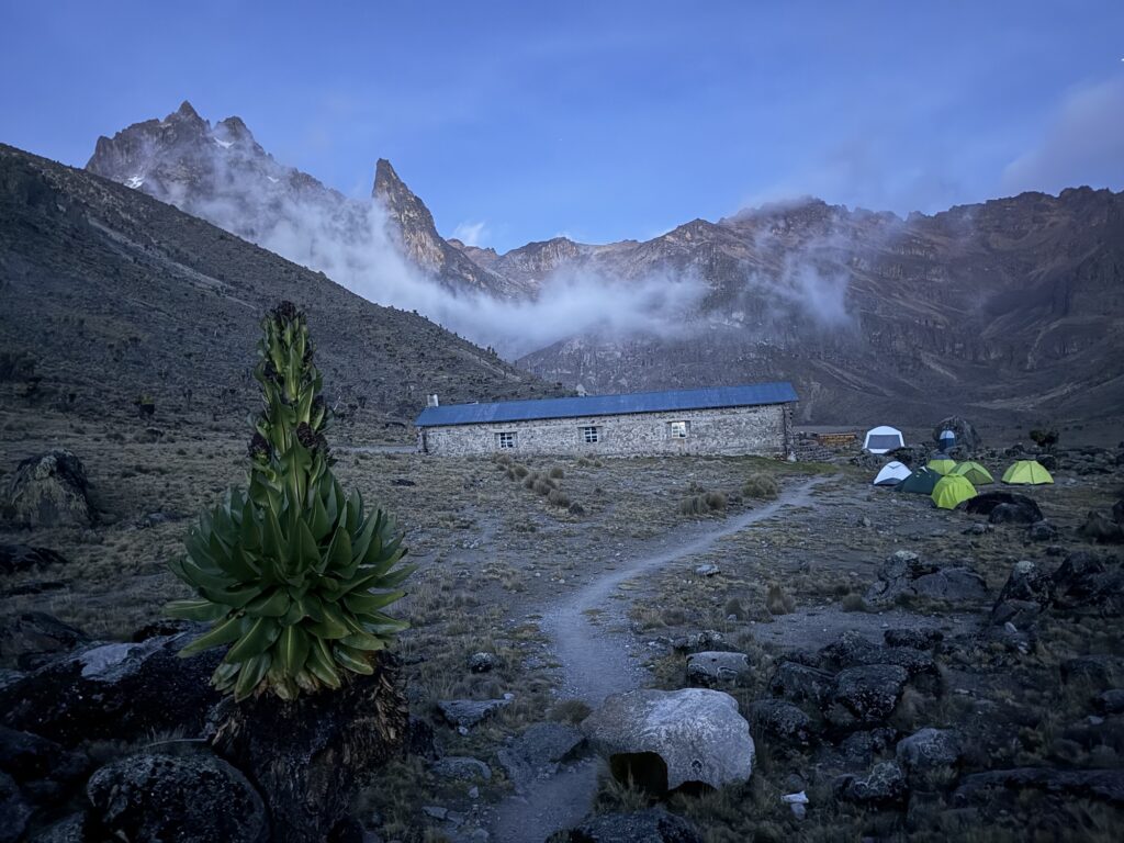
-
Mt Kenya photo essay, part 2
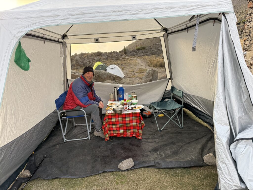
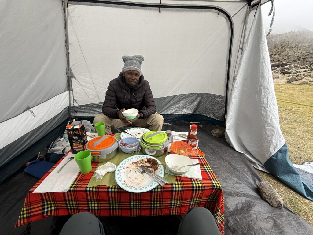
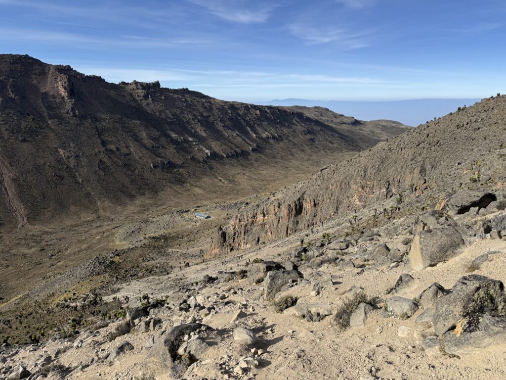
On the 3rd day of our Mt Kenya adventure, we moved from the Mackinder hut to the Shipton hut. This is looking back at the Mackinder hut. 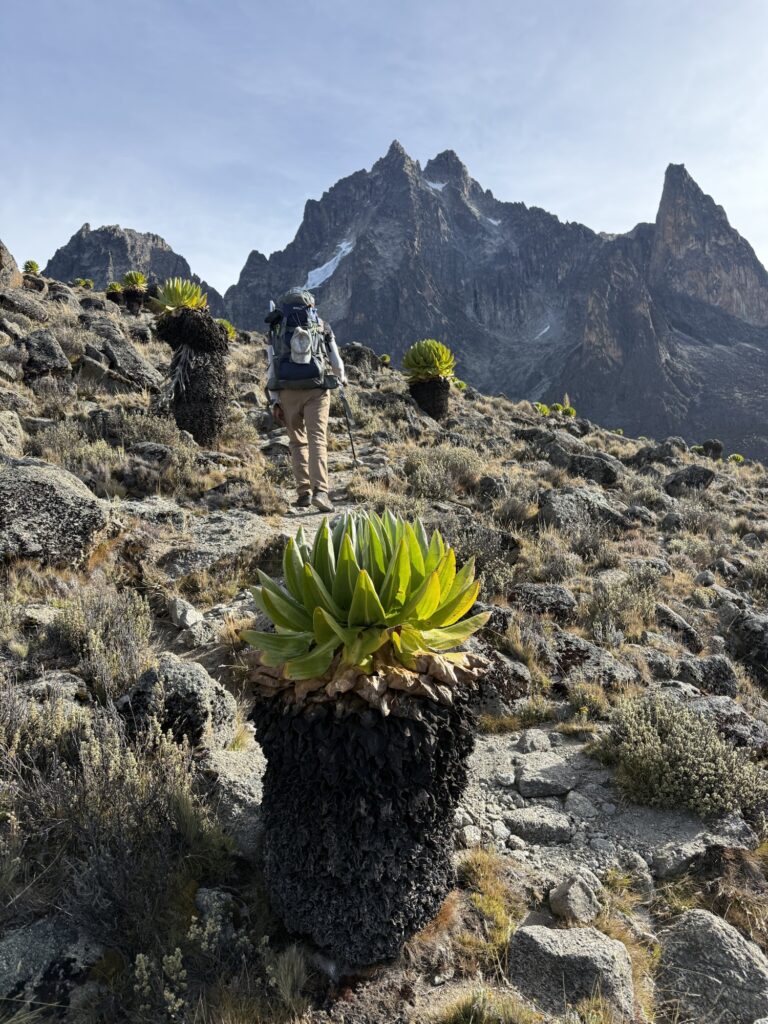
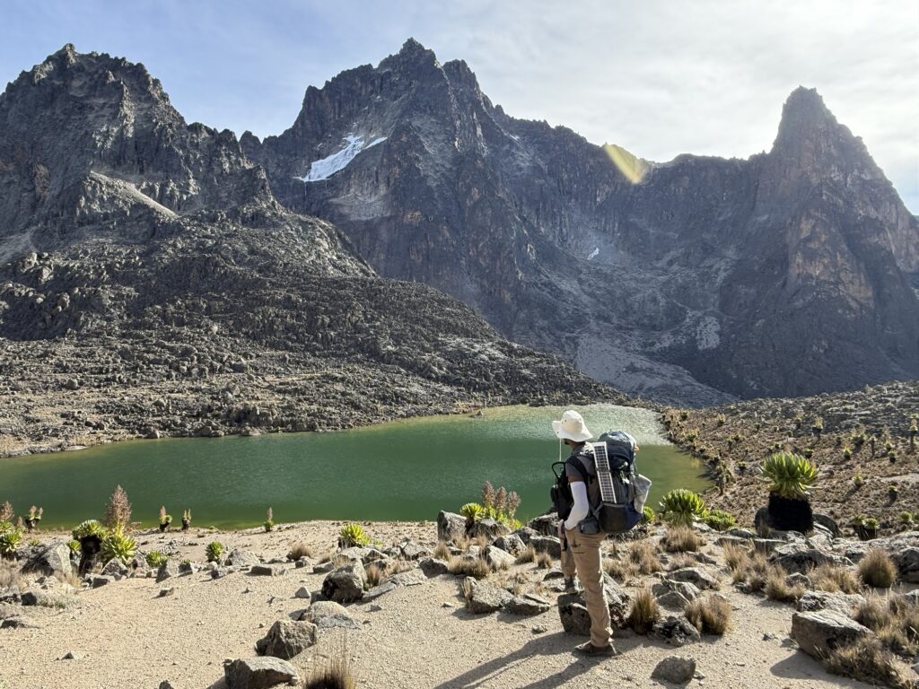
We passed a half dozen lakes on this hike and they were quite lovely. Here I got a glimpse of how a native Kenyan feels about this place. Steven was in awe of how clear the water was and said that it was the cleanest lake he has ever seen. He was euphoric about it and it was wonderful to see this spiritual side of him. It made me appreciate my privileged life, To put this in perspective: while the water here on Mt Kenya was mostly clear, if we were in, say, the Wind River Mountains of Wyoming and saw the exact same water, we might move on looking for a cleaner lake. Sometimes it takes somebody else’s perspective to see how good we have it. 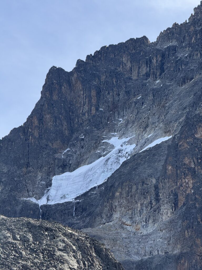
I think this is the largest glacier remaining on Mt Kenya. Oddly, it’s on the west face. In North America, the largest glaciers tend to be on the shady north faces. South of the Equator, the largest glaciers tend to be on the southern faces. Here on the Equator (well, 14 miles south of the Equator to be exact), the shadiest side of the mountains are the west faces, as a typical day dawns clear and then clouds up in the afternoon, so the face that gets the least amount of sunlight are the west faces that are shaded by afternoon clouds. 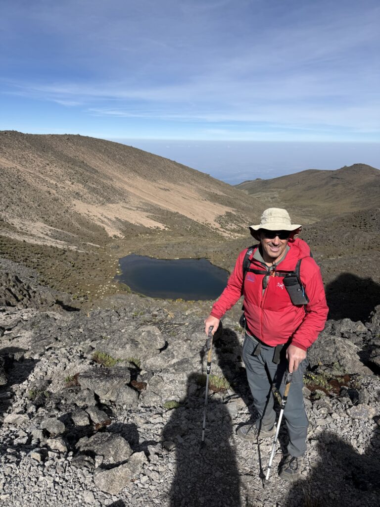
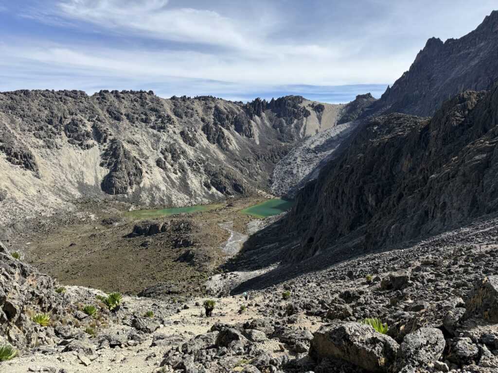
Down to the lakes, and up the scree slope on the right. 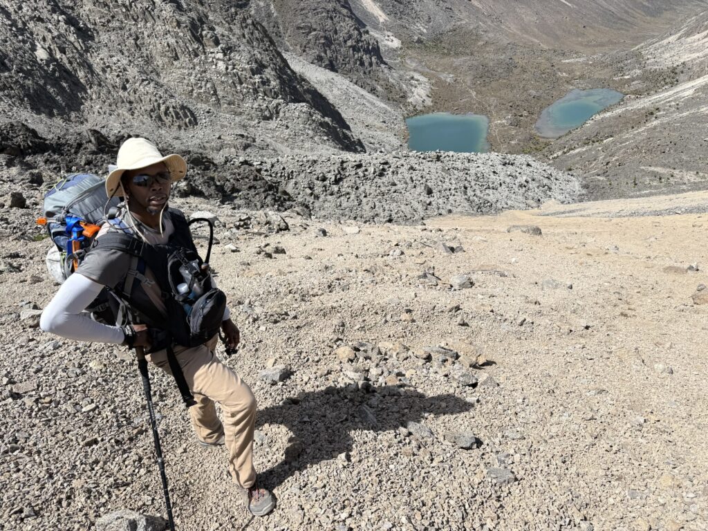
High on the screen slope from that last picture 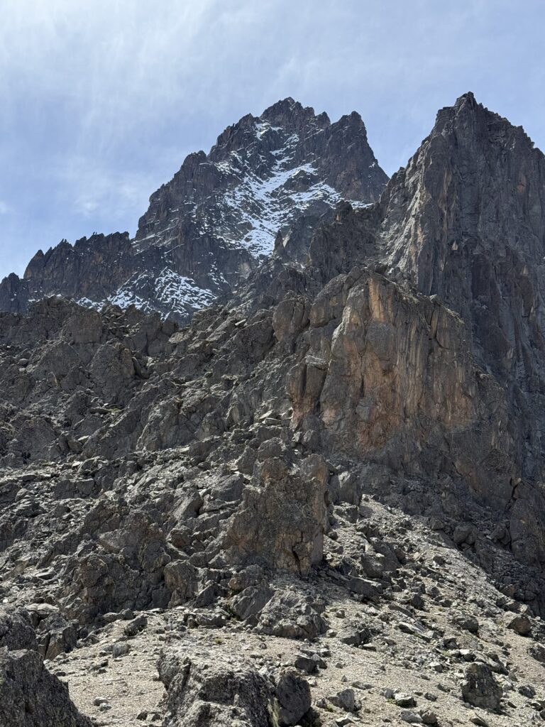
Fresh snow on the north face of the mountain. During the northern hemisphere’s winter, the mountains on the equator tilt 23 degrees away from the Sun, leaving one side sunnier, and the other side shadier. In January, the north faces are shadier than the south faces, thus, the snow from the afternoon storms linger. In July and August, it’s the south faces that are shadier. There is a relatively modest route that goes up that north face to the summit, but it’s mostly climbed in August and September when the Sun melts the snow on the north side of the mountain. My intended route, which is also the easiest route on the mountain, is on the south face and is thus mostly snow free in January. 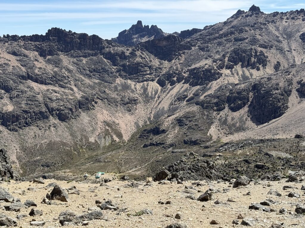
Heading down to the Shipton Hut at 14,000’ 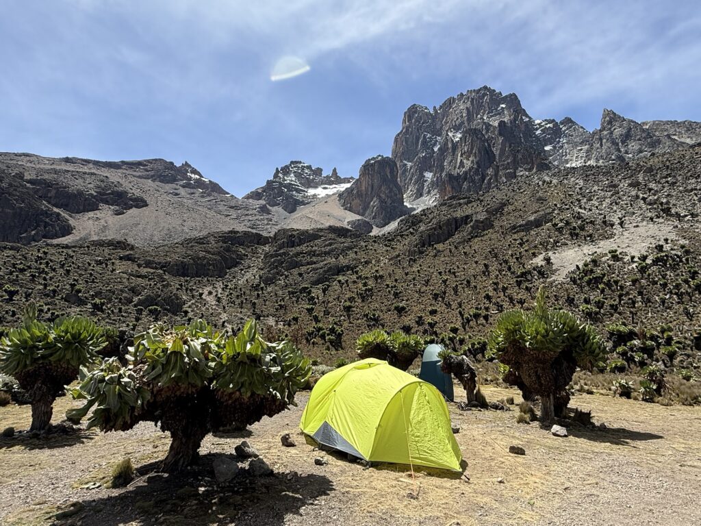
Tent was all set up and waiting for me 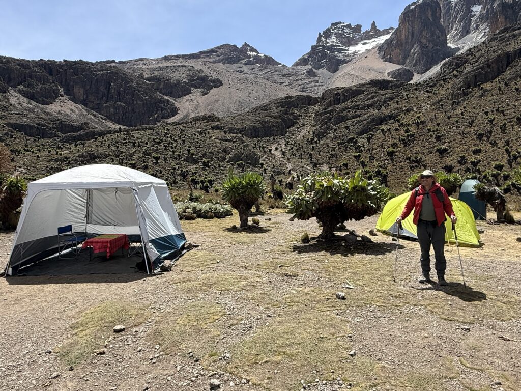
That is Pt Lenana in the center of the photo. That’s what we’ll go up tomorrow. 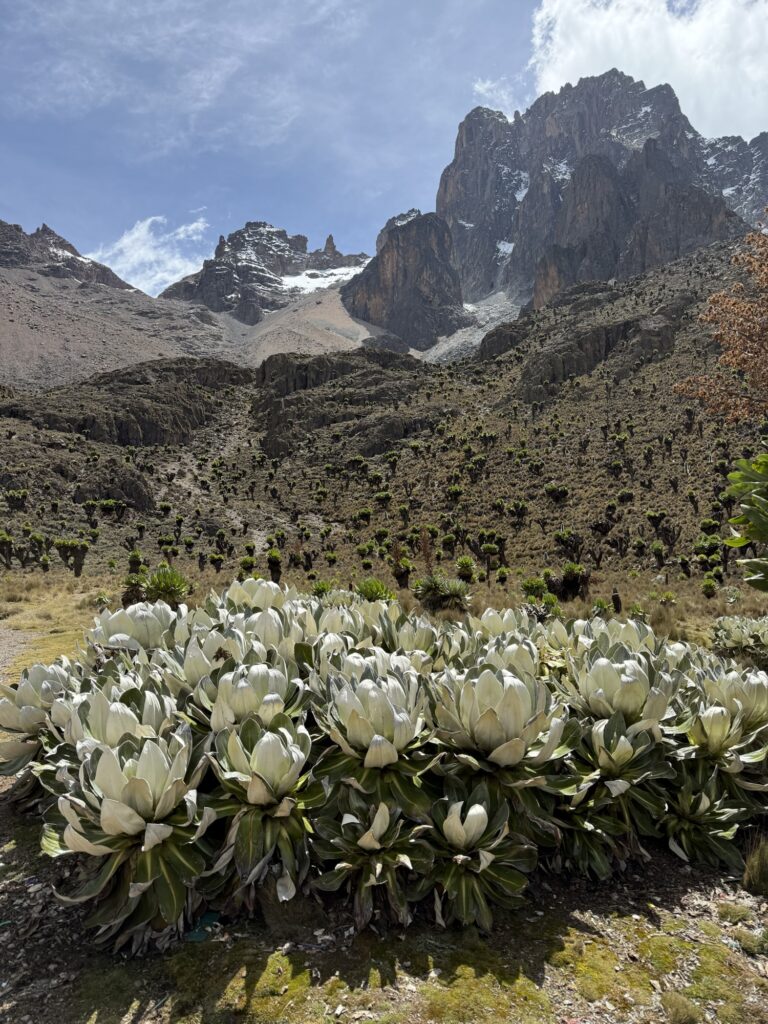
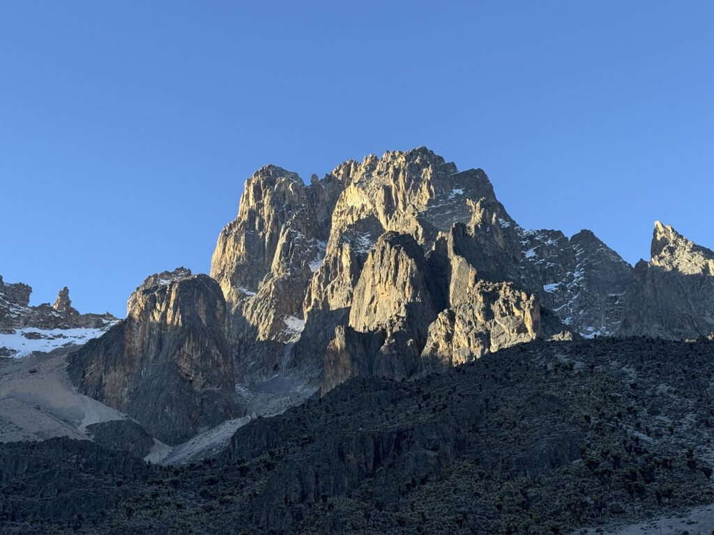
There is a 5.8 route that goes directly to the summit on that wall somewhere. I think it’s 20 to 25 pitches long. I wasn’t able to pick the route out using the guidebook that I had. 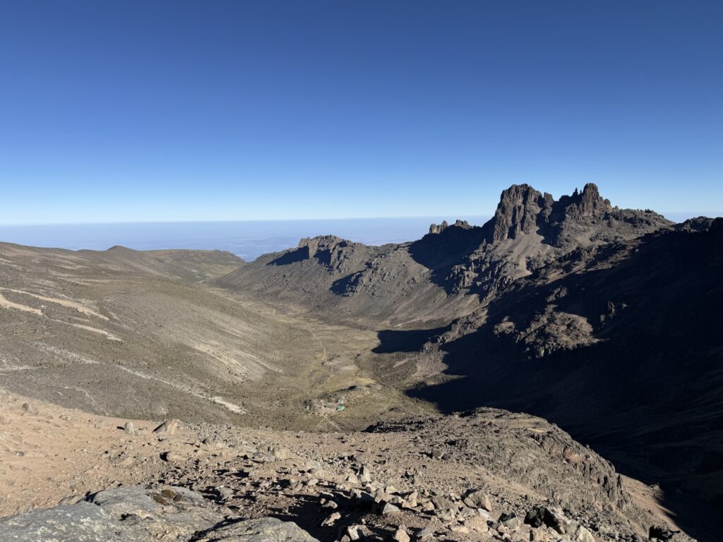
Heading up Pt Lenana the following day. 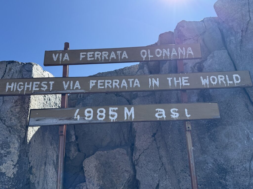
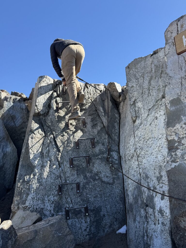
That’s pretty much the entire Via Ferrata right there. 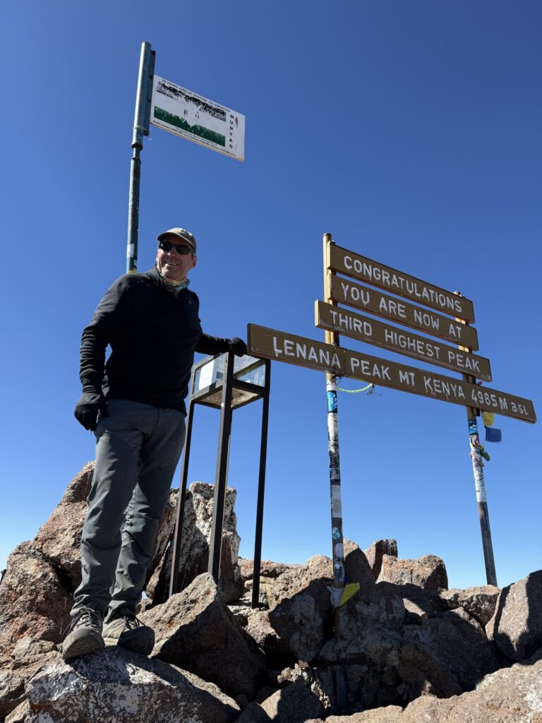
16,355’ 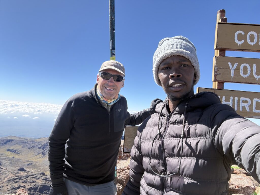
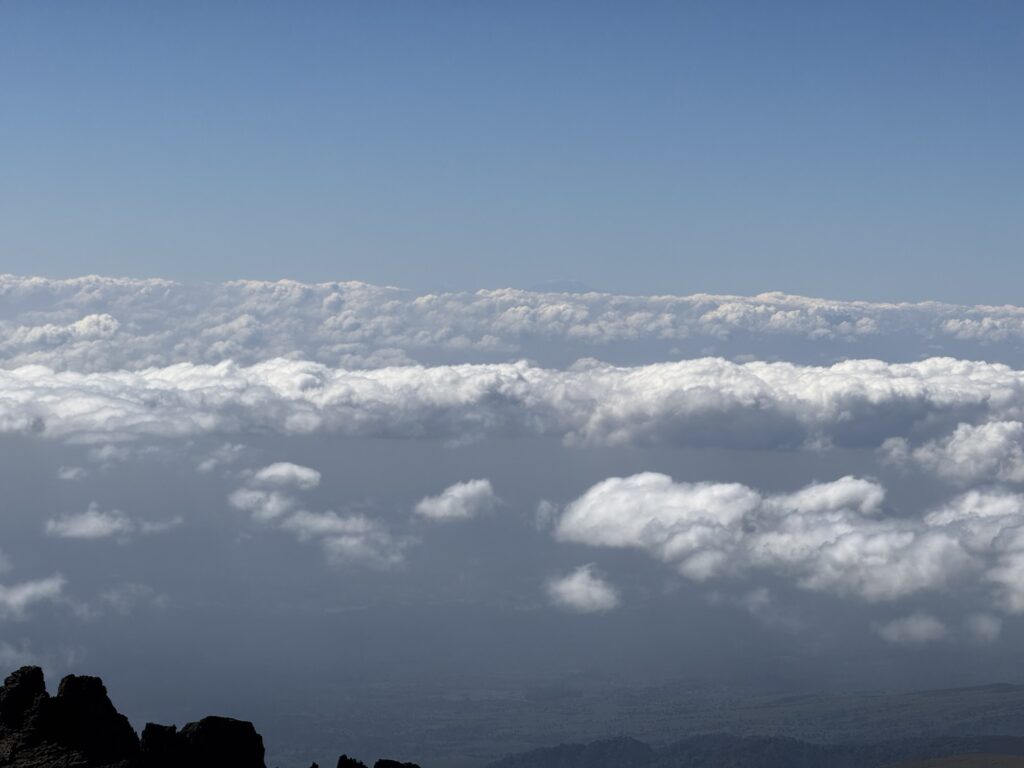
Yup. That’s Kilimanjaro 200 miles to the south. 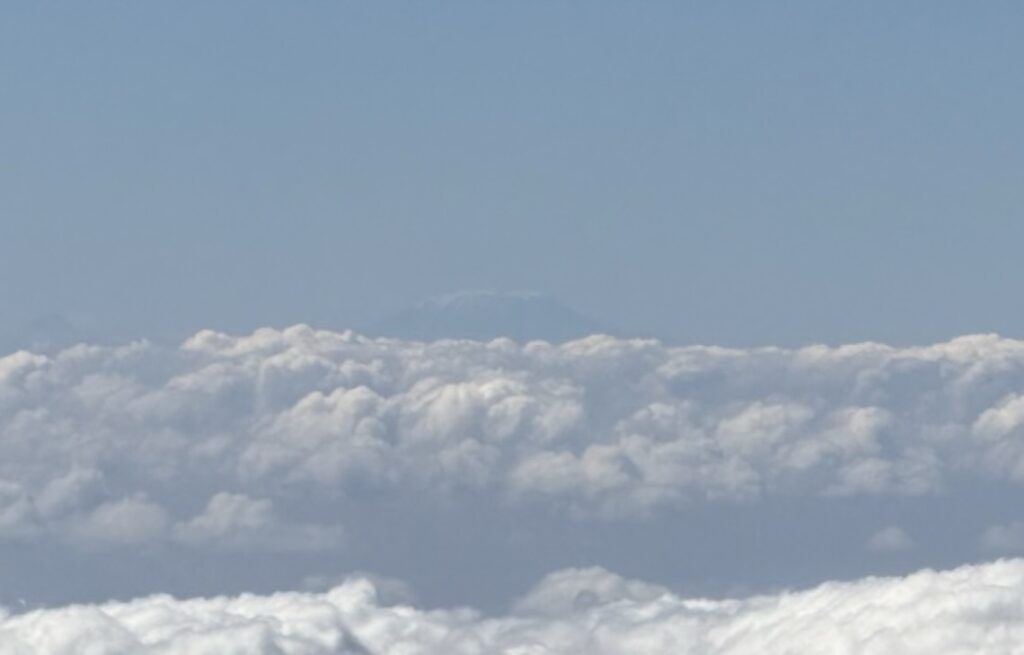
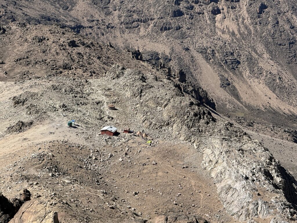
Looking down at the Austrian Hut, aka high camp (15,700’), from the summit of Pt Lenana. 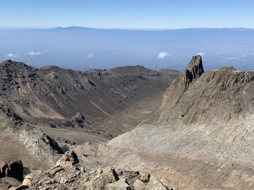
The Mackinder Hut just right of the center of the photo. The next day we’ll hike out past it down to the trailhead in the rainforest. 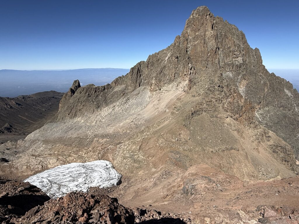
The real mountain with a small remnant glacier. Only a decade or two ago the ice connected to this glacier went all the up to where I’m standing taking this photo. 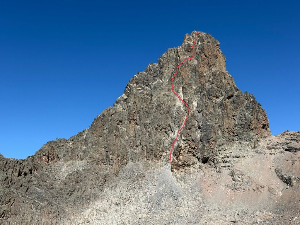
The route up Nelion. This doesn’t show the traverse to the true summit Batian which is hidden behind. 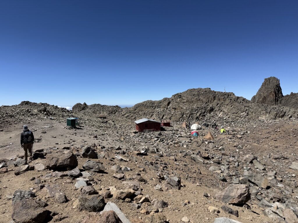
Arriving at the Austrian Hut 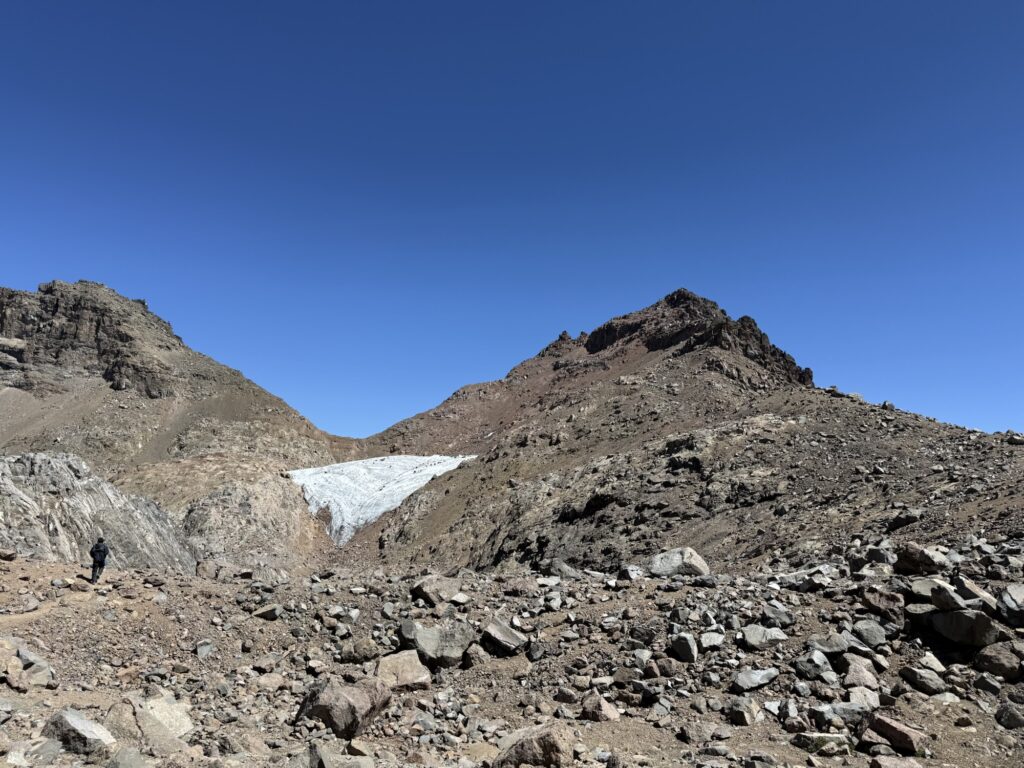
Looking back at Pt Lenana 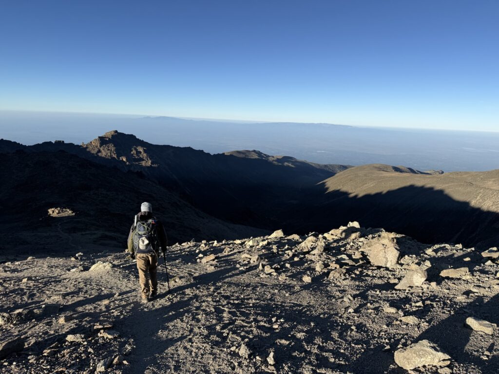
Too sick to climb, so we’re heading to the car with an early start the next morning. 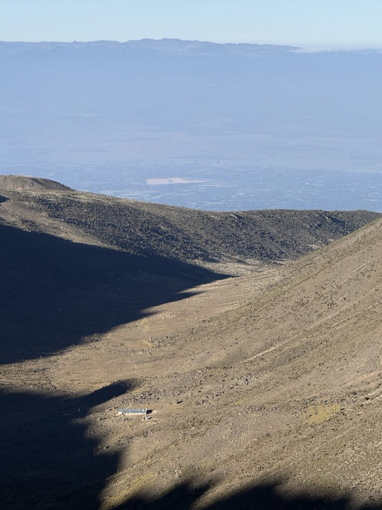
The Mackinder Hut. 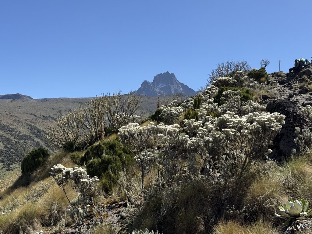
One last look at the mountain 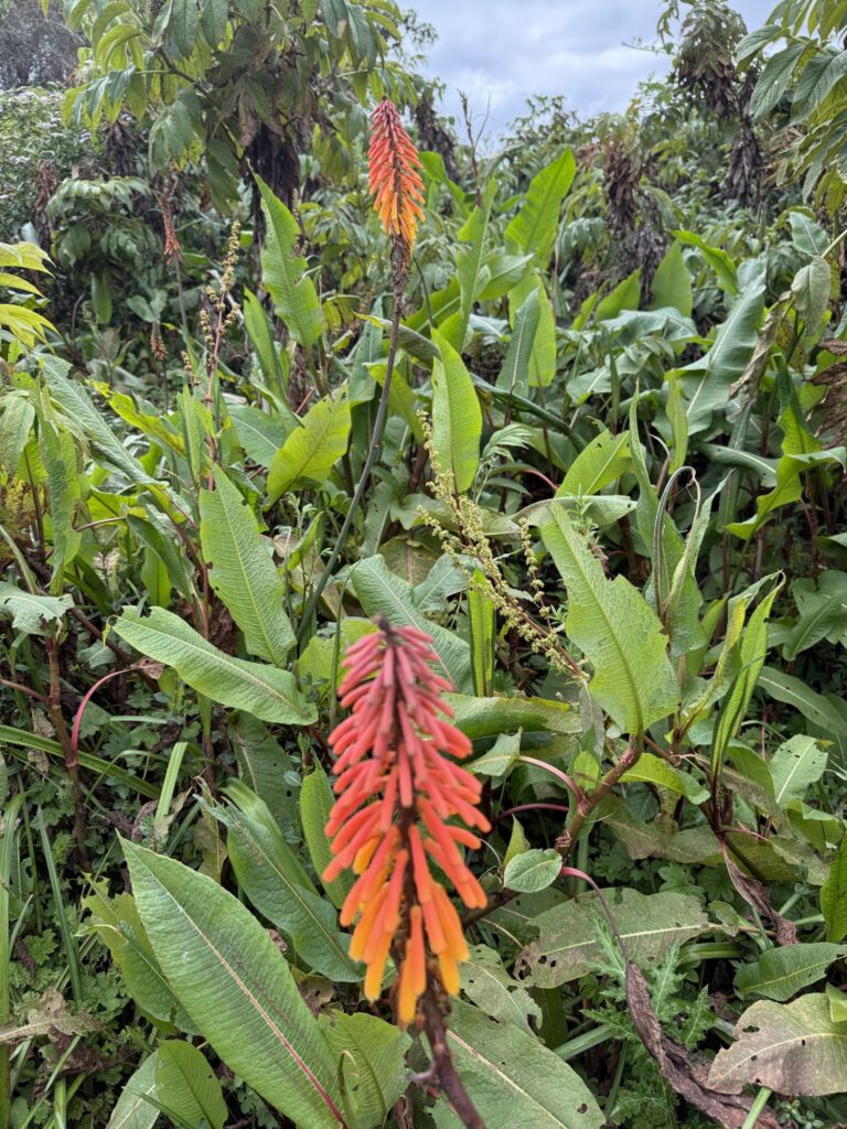
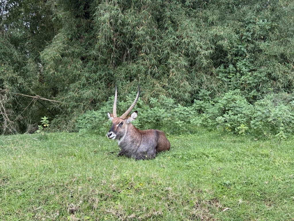
A male Bushbuck 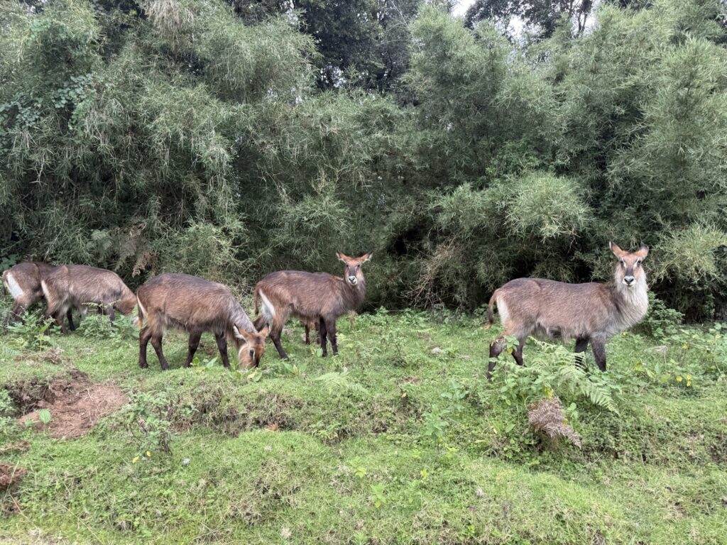
Female Bushbucks 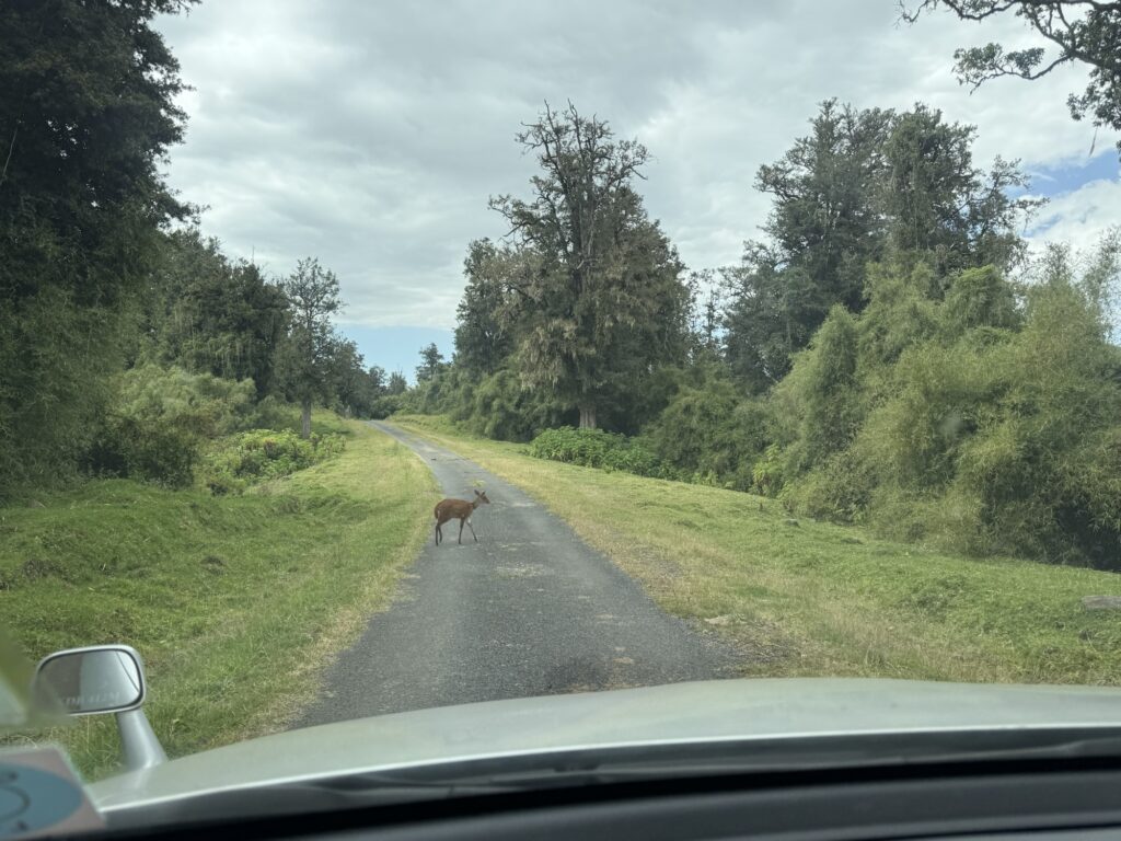
A common duiker 
The blue facade claims to be the Rafiki Hotel. I wonder if they have any vacancies?
-
Final thoughts on both Kilimanjaro and Mt Kenya
Before I leave Africa, I’m going to write down some final thoughts on the two mountains.
When I think back on Kilimanjaro, the first thing that pops into my head is that I was surprised as to how crowded the mountain was. I’ve never seen anything like it. Each camp was as busy as a Himalayan base camp in high season, but the difference is that on Kili, the entire base camp moves with you up the mountain, only to be replaced by another base camp coming up behind you, and of course, you’re replacing the base camp that has moved on ahead of you.
According to the guides, Christmas is the busiest week. Our guides liked January. They said that was a great time to climb the mountain… maybe even the best time. However, they admitted that the weather is better June through September, and that sometimes the crowds perhaps potentially maybe might possibly be dispersed a bit… on certain subjects they were sometimes reluctant to give hard opinions, so I don’t really know. Since I’ve now been on the mountain in January, if I were to return to climb Kilimanjaro and Kilimanjaro only, I would aim for June – September, if only to see something different.
I chose January because that reportedly is the best time to climb Mt Kenya, and from what I saw, that proved accurate. I would have had good weather and good conditions on the mountain.
The second thing that pops into my head when I think of our ascent of Kilimanjaro is how much trash was at high camp and on the summit day trail. It might have been the dirtiest trail I’ve ever been on. I’ve had a week to stew on this and I can’t think of anything that even comes close. It would be so easy to clean it all up. They’ve already figured out the poop situation at the camps. They merely need to issue everybody a trash bag… one that is sanitary enough to hold toilet paper. Just like in Nepal and Grand Teton National Park, everybody should be issued a wag bag for pooping on the trail and on summit day. The only way this works is if the guides buy into this, but that’s an attainable goal. Remember that guides are mandatory by law for all trekking on both Kilimanjaro and Mt Kenya. The mechanism is there to clean the place up. It’s cheap and easy. All that’s required is the will to do so.
Third thing is the food. My guidebook states that “a food gourmand will likely be disappointed” and that’s an accurate statement. When I came back from Nepal the first time, within a few days I was cooking Dal Baht at home. Not all Nepalese food is that great, but some of it has become a staple in my life ever since. There is no such analog here in East Africa. The native food is very bland. I was expecting hot sauce and spices, but that was not the case. It was very interesting eating my meals with a native Kenyan on Mt Kenya, as we discussed what he normally eats, and I reciprocated, of course. Protein is a small part of their diet. They eat a lot of carbs.
And I still don’t understand the quantities that they serve. They don’t eat like that themselves. This is something that maybe they think we westerners want? I don’t know, but it seems to be ubiquitous.
The fruit was amazing. Especially early in each expedition. Maybe I was hungry but those were the best mangos I’ve ever had. The passion fruit and the tree tomatoes were amazing. The only thing I didn’t eat were the apples because I loaned my knife out and never got it back.
Neither of us had any intestinal issues. Their handwashing and food handling seemed to be excellent. Thank you.
I was never bitten by any insects. That one surprised me. I didn’t take malaria pills in Tanzania, but I did take them in Kenya. Again, nothing bit me. I only wore deet at the first campsite on Kenya. I didn’t bring shorts because I was nervous about the bugs, but I may have been the only westerner on the mountain without them.
The altitude:
Neither Dan nor I had any problems with the altitude. Going up too fast can make your days feel pretty miserable and I was wondering if 7 days was long enough to actually enjoy being up there. To my surprise, I was fine. When I was younger, I never took any altitude drugs… ever. I was too much of a purist back then. I’m older and wiser now: for this trip, I started on Diamox (Acetazolamide) on day 2. I woke up gasping a couple of times on night 3 (13,000’), which is normal for me, but that was it. After night 3, I slept relatively well and the altitude just wasn’t an issue for the rest of the trip. I should also mention that for the first time in my life I took Dexamethazone for summit day. Dex is a steroid that has long been known to help suppress some of the body’s negative responses to altitude. I’ve carried it in my first aid kit since my Denali days back in the 80s, but it was always kept in reserve for an emergency. I had never taken it. Nowadays, people regularly take Dex as a PED for summit days. It’s become the normal thing to do. We did, and both of us felt great. Would we have felt great without it? Well, life isn’t a controlled experiment so we’ll never know.
Before I move on to Mt Kenya, I want to say that despite the negatives outlined above, I enjoyed our ascent of Kilimanjaro. The mountain is big enough to demand one’s attention. Interesting enough that each day brought something new, and yet the climb was short enough not to overstay its welcome. It was a fun adventure that I would do again.
Mt Kenya:
I wish I had come here in my 30s with a good partner and week of supplies. Like many great mountains, it’s far more than just a summit. This is a climbing area. There are spectacular routes to explore. Now that might be easy for me to say since I haven’t yet climbed anything on the mountain, but from what I saw, the climbing looked good… maybe not as good as climbing on granite, but way better than limestone.
The crowds may have biased this appraisal, but I found Mt Kenya to be much prettier than Kili. It was certainly more quiet and intimate. After the approach day, we were always in side canyons with the mountain rising above us. Small lakes were common… something completely lacking on Kili. It felt natural and peaceful.
Mt Kenya is only 200 miles north of Kili, but those 200 miles make a difference. The vegetation was significantly different. They are building – and I’m not making this up – a 450 kilometer solar powered electric fence around the entire mountain at roughly the 7500’ elevation level. The intent is to keep the wildlife inside the park. That’s awesome. The land below appears to be all inhabited. Just like in America, there’s no place for the wildlife to go.
Another nice thing about Mt Kenya is that the trailheads are at 10,000’ as opposed to between 5 and 6 thousand feet on Kili. That means one less day of approach in both directions. Yes, you miss a bit of the rain forest, which is special, but I had plenty of that on Kili.
As opposed to Kili, where we hardly saw any signs of wildlife at all beyond camp robbers, this place is thriving. Down low there were even some dangerous animals in our neighborhood like African Buffalo (which we never saw but their fresh scat was everywhere). In my photo essay I’ll post what pictures I have.
The plan:
Bewarned: There is a bit of “live and learn” in the following paragraph. I’m writing this while still in Africa and while I’m trying to be diplomatic, I’m still a little emotional about it. I do wonder what my opinion will be 6 months from now. However, here are my current thoughts:
In theory, acclimatizing on Kilimanjaro and then blitzing Mt Kenya is a good one. Would this illness have sabotaged the plan no matter what? We’ll never know. As it was, I’m a little disappointed in how it was planned and felt that I was given some false information. My itinerary didn’t allow me time to recover from Kili. This was mentioned in the planning stages but I was told that I had to go up on the mountain as quickly as possible in order to have a chance at making the summit. Specifically, the choice was presented as: do you want to rest? or do you want to get to the summit? There isn’t time to do both. That turns out not to be true. I was also told that I would have two nights in hotels during the transition before going up on the mountain which also wasn’t true (I only had one night in Moshi). As I wrote in the blog, it was suspicious that the Mt Kenya outfitter ignored my multiple requests for an itinerary. I only found out at the trailhead on day 1 that he had planned this grand 9 day tour of the mountain. Remember that Kilimanjaro was only 7 days. I neither needed nor asked for a grand 9 day tour. What I wanted to do was climb the mountain. I stated that very clearly right from the start. Had I stayed healthy and pulled off the whole enchilada, I’m sure it would have been memorable, but it’s pretty obvious in hindsight that the itinerary wasn’t realistic for a 62 year old climber. The outfitter did get a lot of money from me… Mt Kenya was far more expensive than Kilimanjaro. That, no doubt, is the ultimate answer. Live and learn.
I had set aside 20 days to climb both mountains. Now that I know the approaches, I’m confident that’s plenty of time to do both: Climb Kili first. Rest up for 3 or 4 nights in hotels as you move from Moshi in Tanzania to Nairobi, Kenya, and then blitz the mountain in 4 days: 2 day approach, 1 day climb, and 1 day egress. Add another day or two for weather and putzing around, and we’re still easily within the 20 day window. A grand 9 day tour of Mt Kenya is likely prettier and more interesting that Kilimanjaro, so if you didn’t go to Kili first, then such a long tour makes sense, but after spending 7 days on Kili, enough with the walking… let’s go climbing!
- Tom Bennett 1/18/26
One response to “Arrived in Kathmandu”
Way to go cousin, Tom. Incredible images. You got this👍🏼
Onward and upward!